Big Lake Trail
Total Miles
7.7
Technical Rating
Best Time
Summer
Trail Type
Full-Width Road
Accessible By
Trail Overview
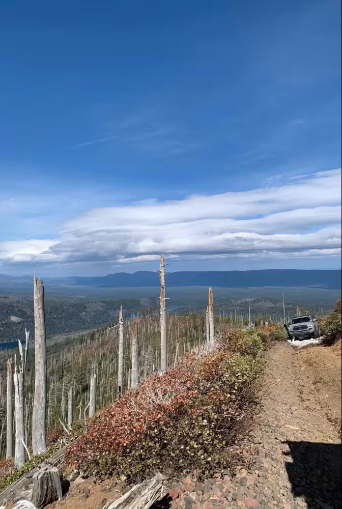
This route originates near a segment of the Pacific Crest Trail (PCT) at an approximate elevation of 4,700 feet. From the trailhead, it follows around Big Lake West Campground before continuing toward Potato Hill Snow Park near Lost Lake. The route traverses predominantly forested terrain with limited exposure and intermittent mountain views. It also offers beautiful views of the forest, as it gets denser as you get closer to the Mount Hood area. The surface consists primarily of compacted dirt, gravel, and seasonal snow, depending on conditions. It provides connectivity to several recreation points, including Big Lake, the Santiam Pass OHV Jeep Trail, and Lost Lake. The route is generally low-traffic and remote, with minimal services and limited signage in some segments. The route is typically suitable for high-clearance vehicles or OHV use. It is located approximately 25 miles northwest of Sisters, Oregon.
Photos of Big Lake Trail
Difficulty
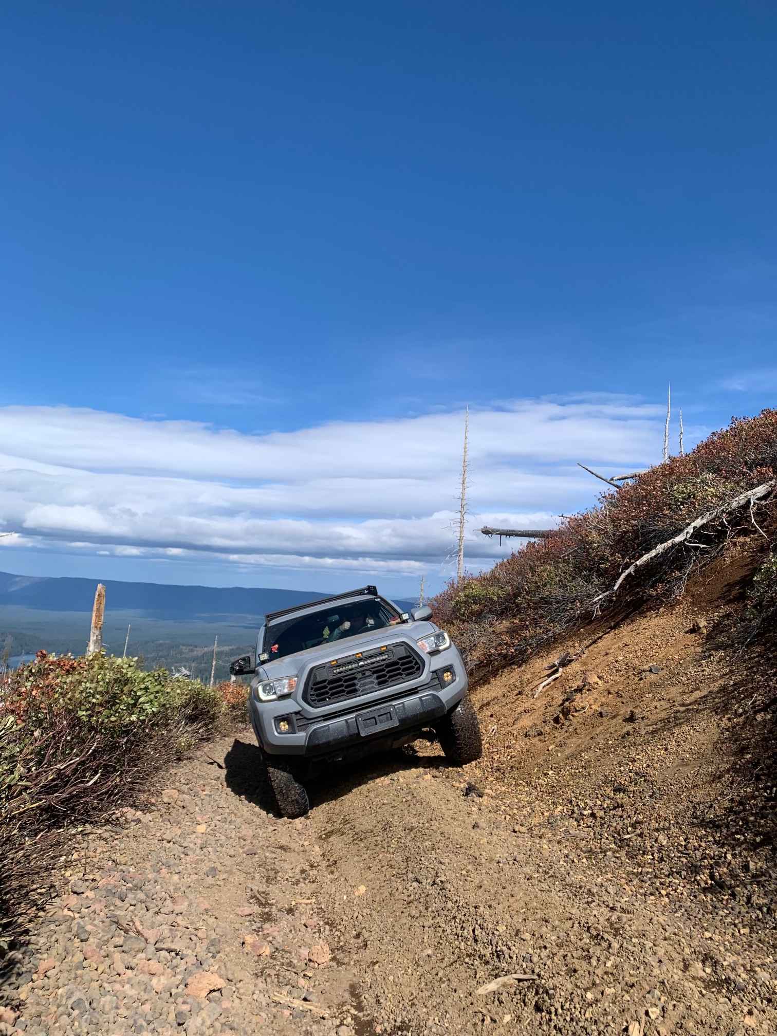
Early in the route, drivers can expect more open sections composed of silt and gravel, allowing for steady travel before the trail transitions into tighter, more technical terrain as it moves deeper into the forest. The route narrows considerably in these sections, with dense vegetation encroaching on the trail and making pin striping likely. Throughout the route, there is consistent rutting and occasional washouts. Near Big Lake, the trail features two water crossings that are typically between six and twelve inches deep, though they can become deeper and more forceful during early spring due to creek overflow. The approaches to these crossings are often soft and muddy. In addition to the water crossings, multiple sections of mud and sand require 4WD. Most of the trail can be managed in 4H, but several segments are better navigated in 4LO to maintain control and torque. The trail also includes several pronounced off-camber sections. Scattered throughout the route are loose rocks, embedded stones, and occasional small boulders that add to the technical nature of the drive and may require careful maneuvering to avoid undercarriage contact. A high-clearance 4x4 vehicle is strongly recommended for this trail. In summer and fall, the trail remains technical but is generally more manageable as water levels drop. In contrast, winter conditions bring heavy snow accumulation that makes this trail completely impassable without snowmobiles.
Status Reports
Big Lake Trail can be accessed by the following ride types:
- High-Clearance 4x4
- SUV
- SxS (60")
- ATV (50")
- Dirt Bike
Big Lake Trail Map
Popular Trails

Gunner Lake Mainline
Coffeepot Crater Road

The onX Offroad Difference
onX Offroad combines trail photos, descriptions, difficulty ratings, width restrictions, seasonality, and more in a user-friendly interface. Available on all devices, with offline access and full compatibility with CarPlay and Android Auto. Discover what you’re missing today!