200
Total Miles
3.4
Technical Rating
Best Time
Summer, Spring, Fall
Trail Type
60" Trail
Accessible By
Trail Overview
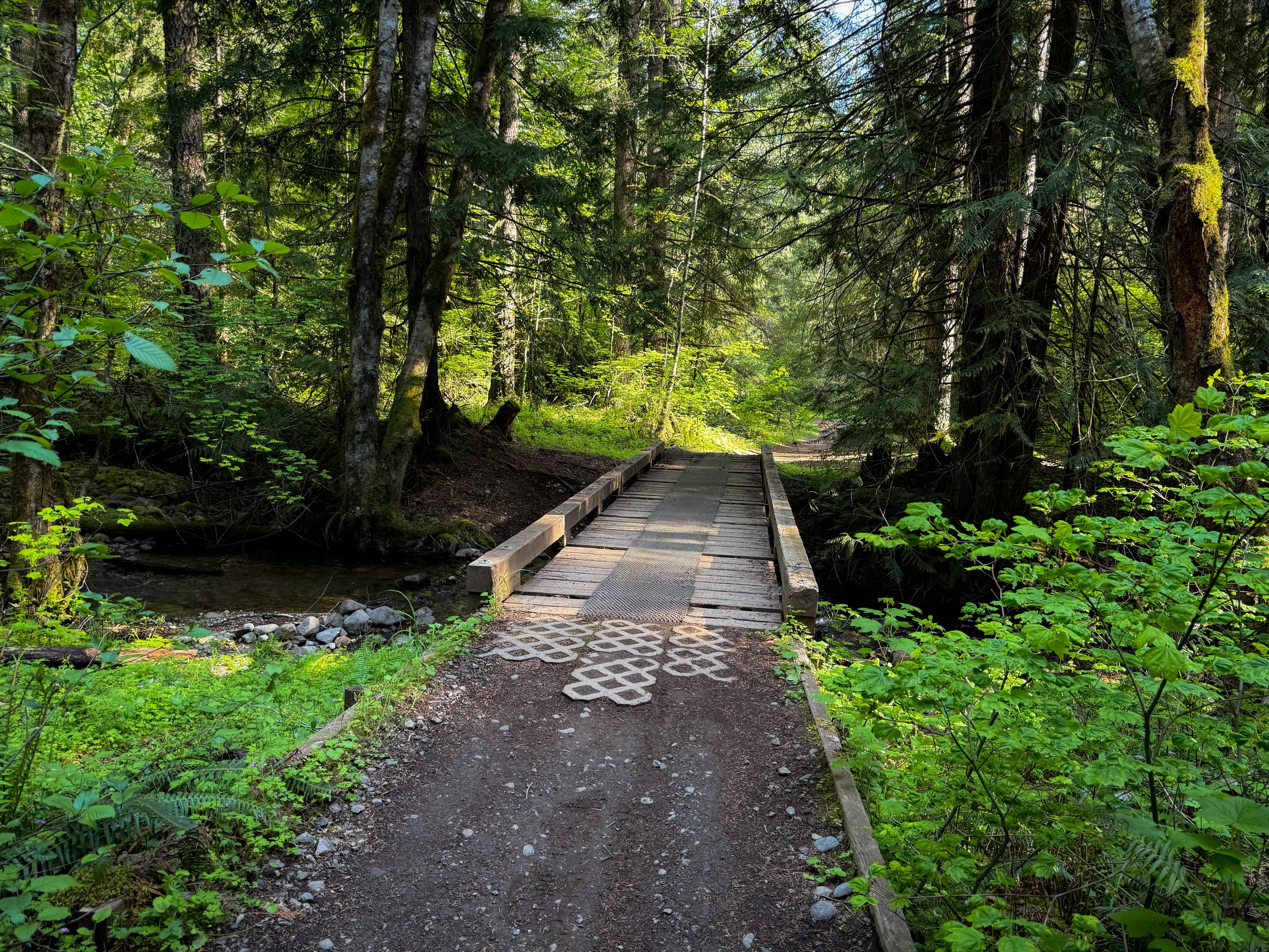
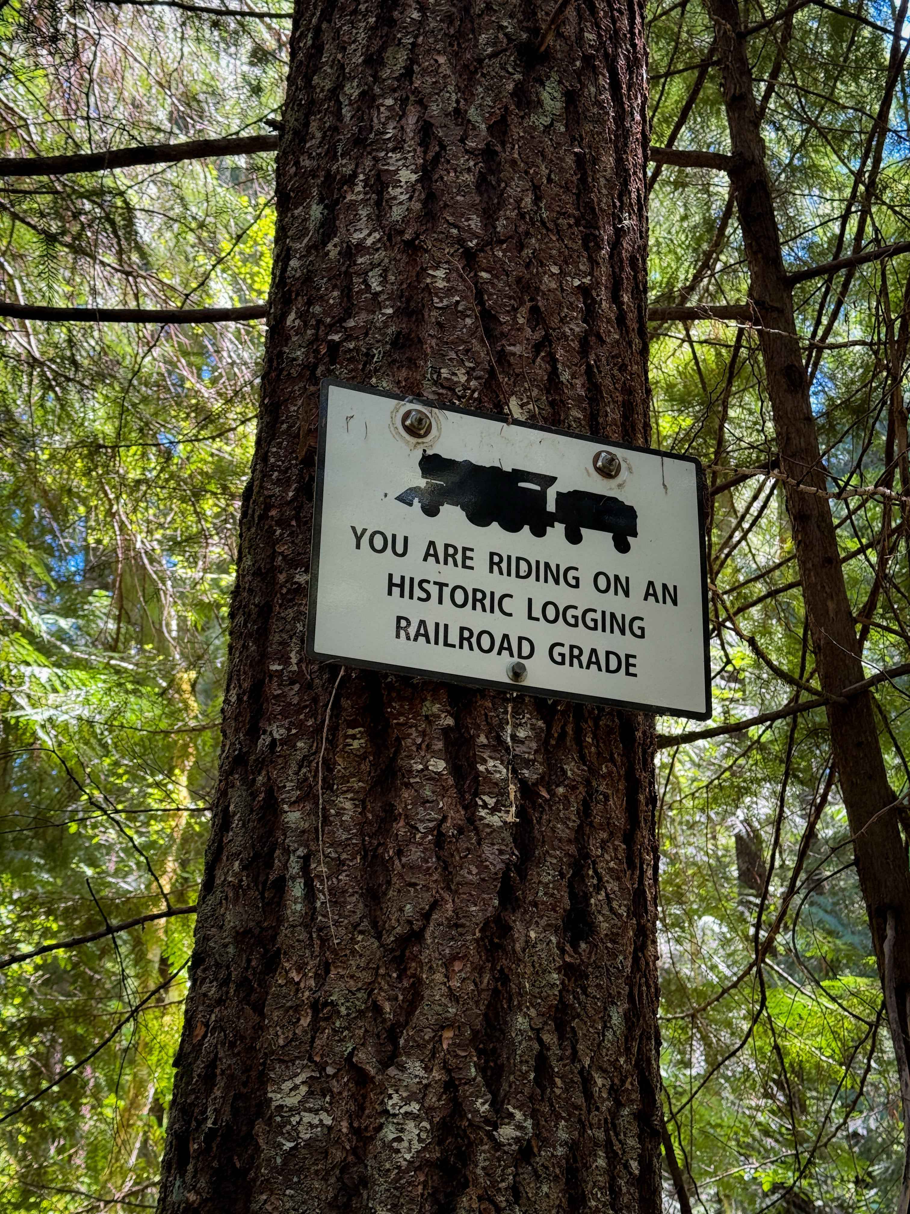
Trail 200 is an easy SxS trail through a lush forest of Douglas firs that is mostly flat with little elevation change. The trail is directional north to south. There are lots of mud puddles and ruts, especially in spring, with some of the mud puddles spanning the entire width of the trail. Part of this trail is a historic logging railroad grade, and there are several small bridges over small streams and creeks. It starts on the northwest end of FS Road 1928702 (or you can come in from a different spur from the staging area). The majority of the route is wide and flowy, but watch out for some sharper curves that come up quickly, and some sections have a little bit of loose rock or roots. The SxS portion of Trail 200 ends at the intersection with 201, which can be taken south over Fifth Creek Bridge. Trail 200 continues west over Huckleberry Creek Bridge; however, the bridge is too narrow for 65" vehicles, so this last portion of Trail 200 is only open to ATVs or dirt bikes. SxS vehicles should continue south on 201 instead. There isn't much warning about this, and it isn't signed super well, but it is noted on the official trail map.
Photos of 200
Difficulty
This is an easy SXS trail as it only has minor technical elements, such as deep muddy ruts and tight turns. It is mostly gradual or flat, and is very wide, making it ideal for less experienced drivers.
Status Reports
200 can be accessed by the following ride types:
- SxS (60")
- ATV (50")
- Dirt Bike
200 Map
Popular Trails


Diamond Craters Auto Tour Route
Hole in the Ground Loop - FS 3130
The onX Offroad Difference
onX Offroad combines trail photos, descriptions, difficulty ratings, width restrictions, seasonality, and more in a user-friendly interface. Available on all devices, with offline access and full compatibility with CarPlay and Android Auto. Discover what you’re missing today!