West Mesa Loop
Total Miles
4.7
Technical Rating
Best Time
Spring, Summer, Fall, Winter
Trail Type
Full-Width Road
Accessible By
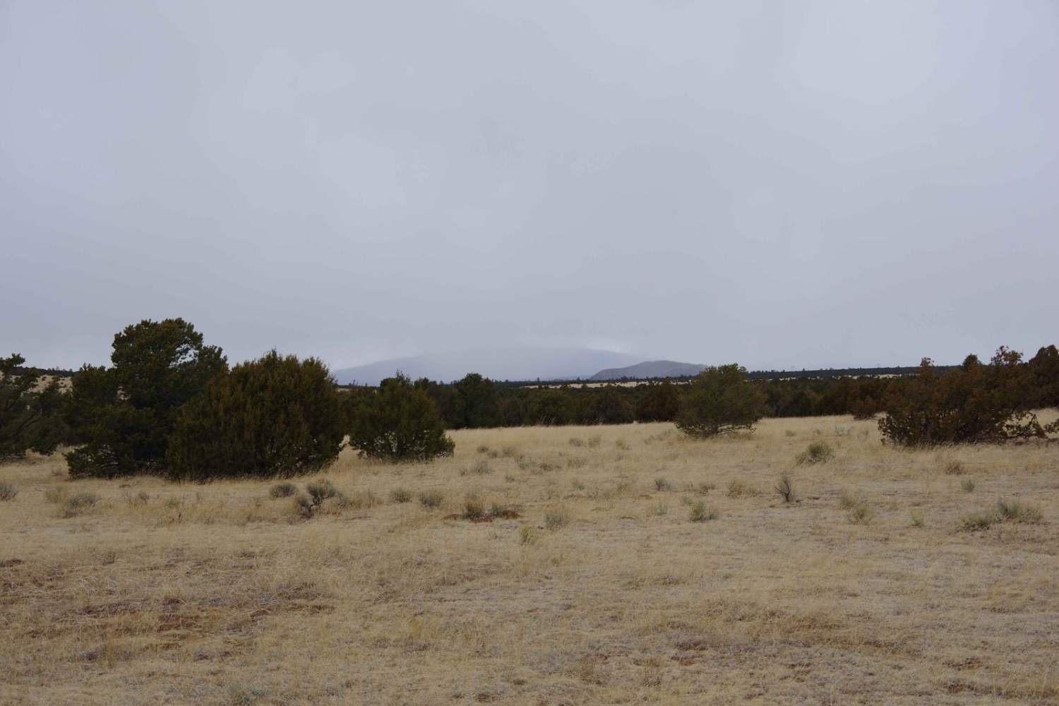
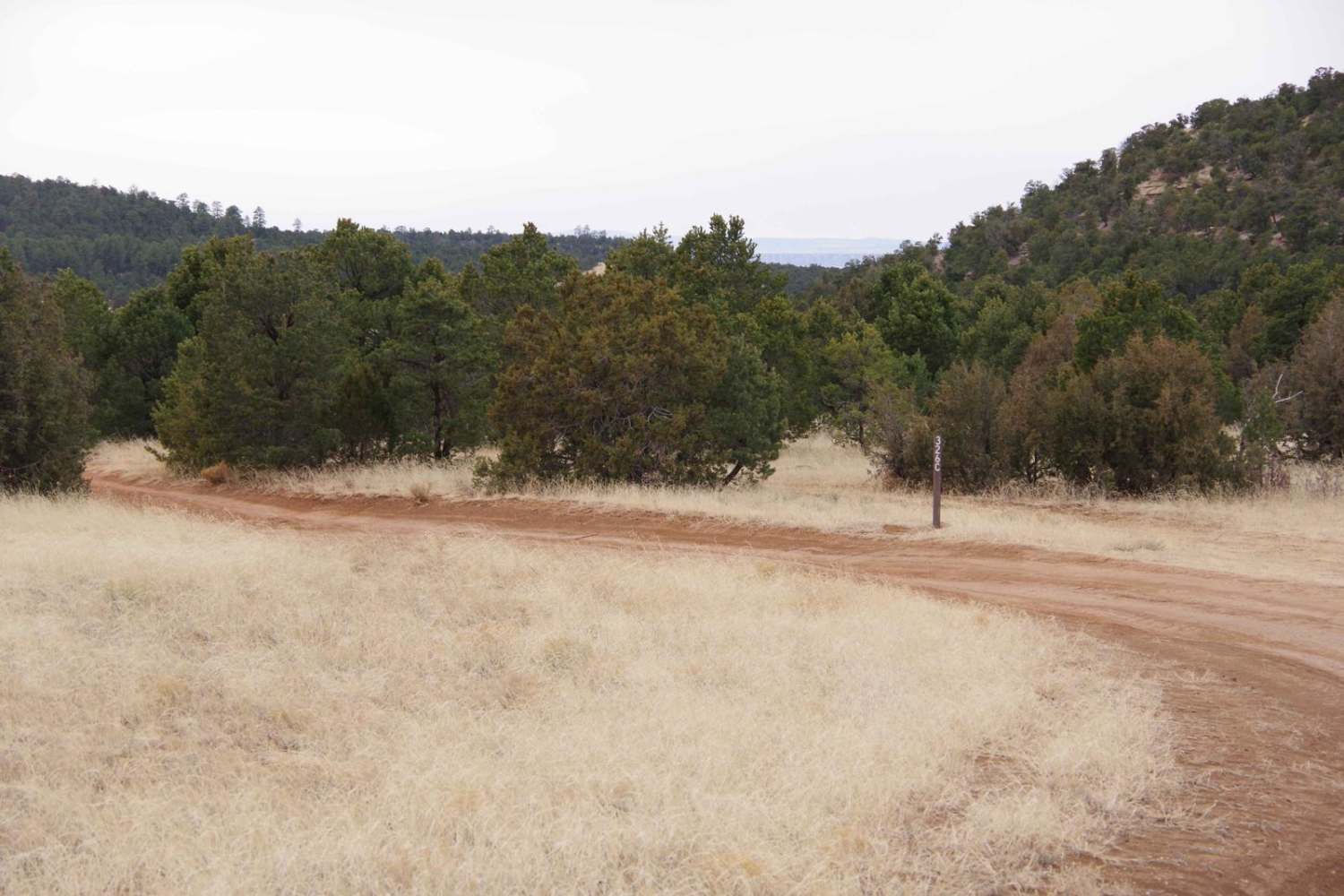
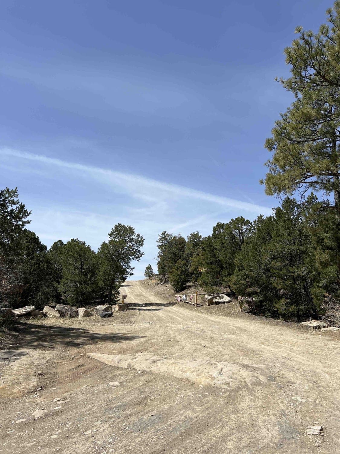
Trail Overview
This primarily dirt two-track partially loops through the northwest section of the Glorieta Mesa area. It features some deeper ruts and off-camber sections and has the potential to become very slick mud after rain or snow. Most of the trail is wide enough for two vehicles and provides enough room to pass traffic if needed. Shortly after the first .75 miles, the trail becomes slightly tricky due to grass overgrowth and does not become easily visible again until after the first 2.5 miles once past the Corner Tank. Overall, it's a straightforward trail that most high clearance 2WD vehicles can complete, with the most significant obstacles being rutting up to 12 inches in depth and small rocky sections with rocks smaller than 10 inches. However, entering the area with anything other than an AWD or 4WD vehicle is not advised after wet weather. Cell service throughout the track frequently changes from strong to weak depending on the relative elevation, but overall, it is decent. Wildlife, such as coyotes and various birds, are abundant here, but the land is also used for cattle that frequent the actual trail. Views can be plentiful and vast in certain spots along the trail, with a few glimpses of the mountains to the north and south during clear skies.
Photos of West Mesa Loop
Difficulty
Drivers will encounter some sections of deeper rutting, smaller sections of rocks under 10" in size and some brush overgrowth that makes the trail difficult to see. Drivers should be aware that this area can become extremely muddy after wet weather.
Status Reports
West Mesa Loop can be accessed by the following ride types:
- High-Clearance 4x4
- SUV
- SxS (60")
- ATV (50")
- Dirt Bike
West Mesa Loop Map
Popular Trails

Bull Creek 86

BLM-SFNF Connector & Camping
Hidden Trail
The onX Offroad Difference
onX Offroad combines trail photos, descriptions, difficulty ratings, width restrictions, seasonality, and more in a user-friendly interface. Available on all devices, with offline access and full compatibility with CarPlay and Android Auto. Discover what you’re missing today!