Alamitos Loop
Total Miles
4.6
Technical Rating
Best Time
Spring, Winter, Fall
Trail Type
Single Track
Accessible By
Trail Overview
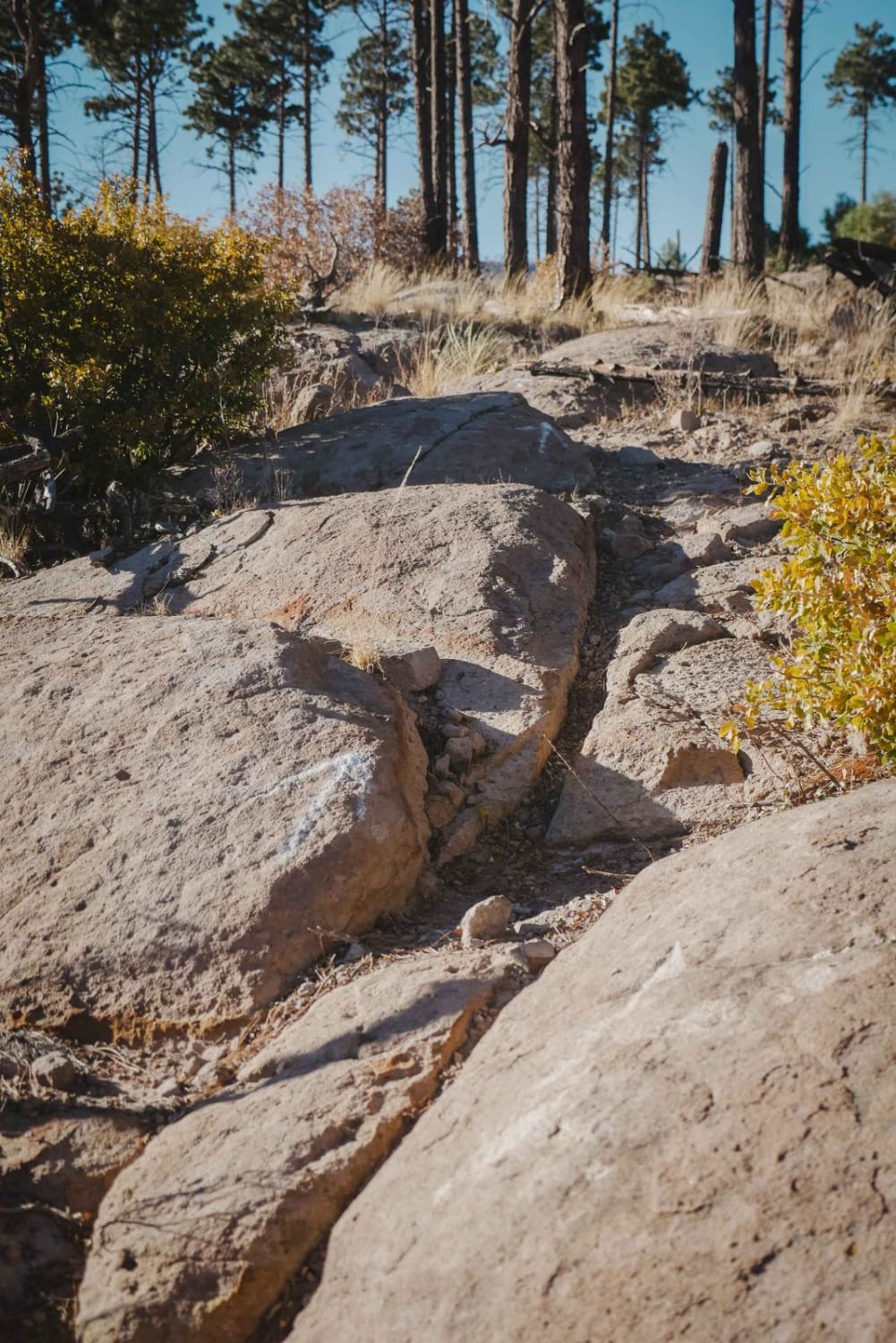
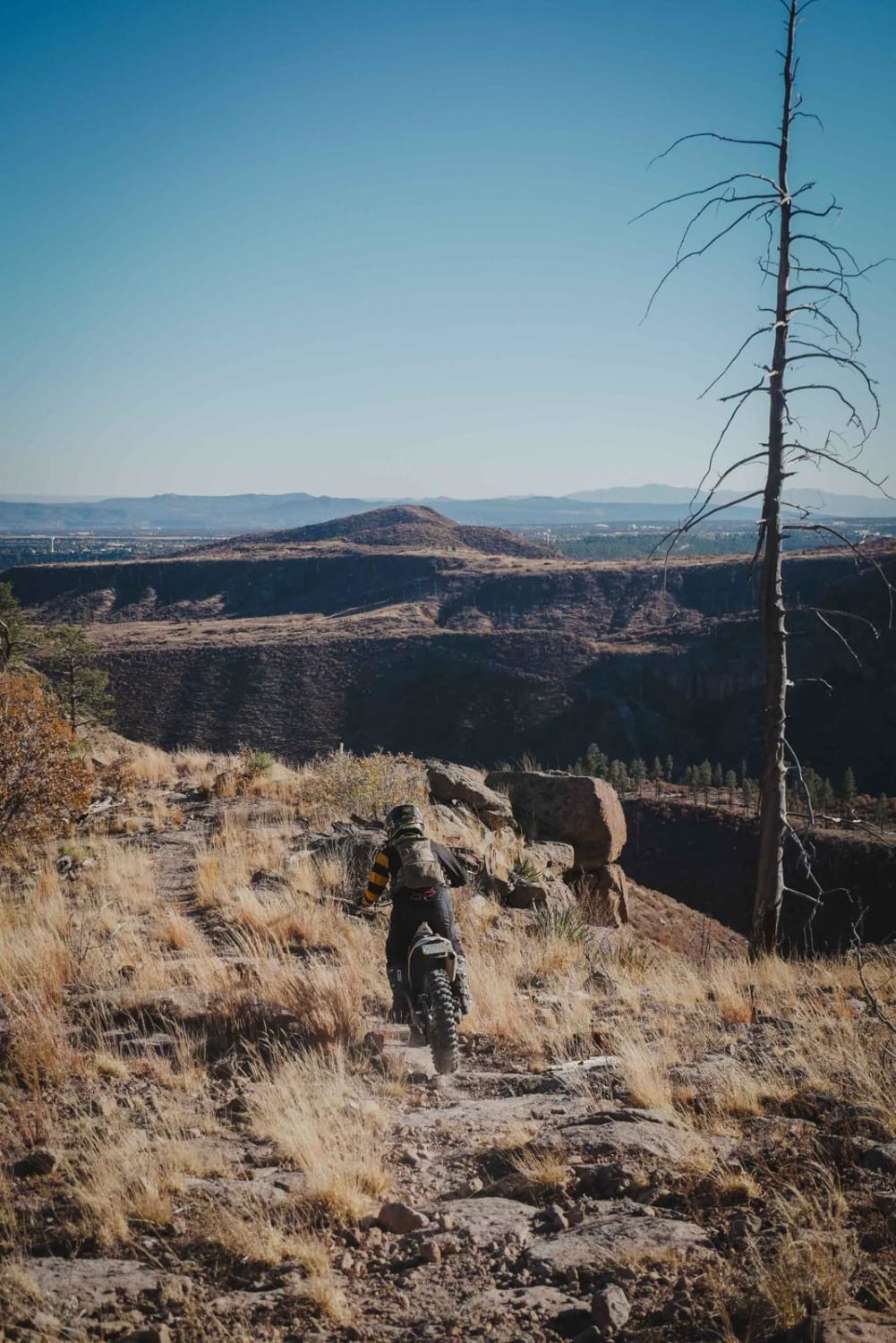
The Alamitos Loop is a fun and challenging trail in the OHV area north of the town of Los Alamos that will require some significant route finding in spots. The north end starts off of the Pine Spring single track and the trail rides along the top of a mesa, through a burn area with several big downed logs. It's easy to get off track right away because there are lots of cow trails that look just like the single track, and it is overgrown with grass. There isn't anything hard in this segment, but it requires a bit of route finding, and a GPS is helpful to make sure you stay on track. The trail dumps onto a road and passes the intersection with the west end of Pine Spring. The next 0.5-mile segment is the most complicated section because the trail has become overgrown in the bushes. It pretty much requires straight bush-whacking up the next hillside to meet up with an old jeep road. There are no trail markings and it needs help to get beat in more. If you make it to this point, you should be on an old dirt road with tons of downfall, and the trail picks back up on the south side of the road. It's hard to find where the trail picks back up, but you can tell that the next section of the trail actually gets ridden and is beaten more since it has a couple of arrows on the rocks to help you follow it. It continues as a narrow rim trail along the edge of a canyon with red slab rock and boulder faces like downhill ramps. Sometimes it rides within 5 feet of the edge of the canyon and has a really nice view. It continues as a rim trail for 2 miles and then crosses 446F. It goes directly across the road and goes along the rim of another scenic canyon. It doubles back on the opposite side of the canyon. It goes within 5-10 feet from the edge with more rock slabs and embedded boulders. It is not too hard but does get close to the edge at one point. The very east end of the trail drops down to a road. There is a stack of red rocks marking this entrance, but it could be easily missed. Since there is that middle section of the trail that gets really confusing and overgrown, it appears that people probably ride this trail east to west as an out-and-back for 3 miles, and ride the section that loops with Pine Spring separately.
Photos of Alamitos Loop
Difficulty
This is an intermediate trail with lots of rock slab drop-offs and exposure on the side of a canyon. Riding this trail in its entirety will require significant route finding in the middle of the trail.
Status Reports
Alamitos Loop can be accessed by the following ride types:
- Dirt Bike
Alamitos Loop Map
Popular Trails
Godzilla

Cedro Peak

Crouch Mesa
The onX Offroad Difference
onX Offroad combines trail photos, descriptions, difficulty ratings, width restrictions, seasonality, and more in a user-friendly interface. Available on all devices, with offline access and full compatibility with CarPlay and Android Auto. Discover what you’re missing today!