Hudson Pass
Total Miles
8.5
Technical Rating
Best Time
Summer, Fall
Trail Type
Full-Width Road
Accessible By
Trail Overview
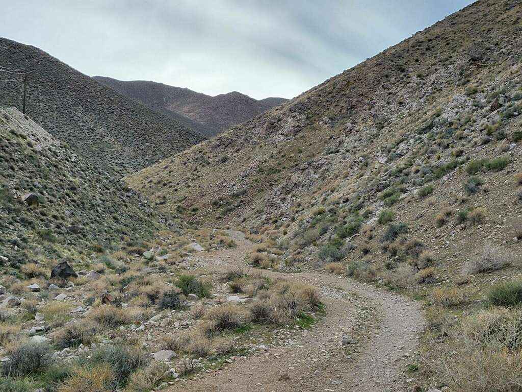
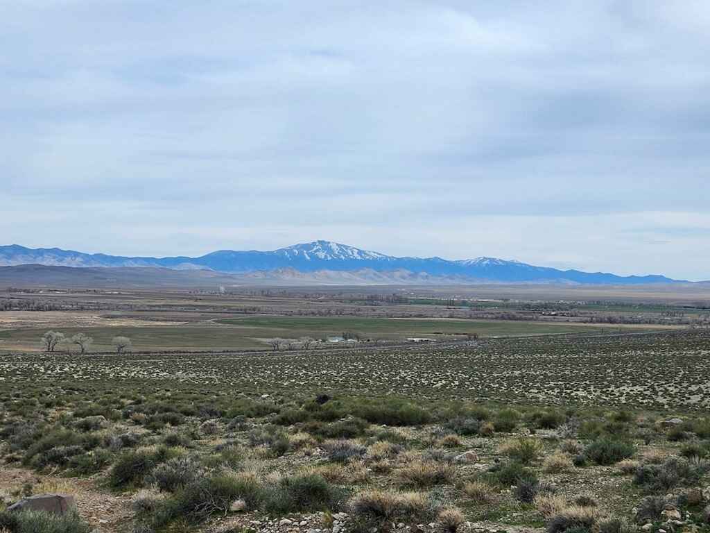
This trail is only 8.5 miles long, but the terrain is rough, making it feel like an accomplishment in a stock or lightly-modified vehicle. The trail can be driven in either direction, but it is probably more difficult going from the west to the east. The west side of the trail is mostly flat on a rough, narrow dirt and sand road. In the rain, this section of the trail becomes more challenging mud. Once out of the valley, there is a short hill climb in loose rock to get to the summit of Hudson Pass. Travelling the west-to-east direction, this hill is where the difficulty starts to increase to probably about a four. The summit of Hudson Pass provides excellent views of Smith Valley to the Sierra Nevada Mountains, and Mason Valley is visible through the canyon looking to the east. Once on the summit, there is an optional obstacle on the ridgeline that is approximately 150 yards north of the trail, and it is probably a good six-rated obstacle. This is a steep hill of loose rock that has a s-turn in the middle of it. The s-turn has a rock step on both ends of it, and since it is all loose rock, the vehicles will bounce as they hunt for traction. The trail leads up the ridgeline, so going off the side of the trail may mean sliding off the edge. There is a way to drive around this obstacle and drive up the north side, and the north side is steep but not a bad road compared to the south approach. A failed attempt at this hill may require a vehicle with a winch, driving around to the north side to get to the top, to be in position to set up a winch line. Once continuing on eastward from the summit, there is a descent into the canyon, which consists of driving on loose rock, some about the size of footballs, in a narrow canyon with a couple of tight turns and some off-camber spots. Some of it must be taken slowly because the vehicles can slide on the rocks and go off the trail. This section requires good ground clearance, and it will test tire durability; a longer vehicle may have some difficulty. This canyon is also subject to flash-flooding, so be cautious of heavy rain. Once out of the canyon, it's a short, rough road to a staging area that's about 200 yards from the highway.
Photos of Hudson Pass
Difficulty
This trail has some steep sections of loose rock, and there are some narrow, off-camber areas. There are a couple of short stretches where the trail is football-sized rocks. After rain, the west side of the trail can have significant mud, and the canyon can have standing or flowing water.
Status Reports
Hudson Pass can be accessed by the following ride types:
- High-Clearance 4x4
- SUV
- SxS (60")
- ATV (50")
- Dirt Bike
Hudson Pass Map
Popular Trails

Dry Valley Rim

Adams McGill Reservoir Loop Part 2
Winters Ranch - BLM SSR18
The onX Offroad Difference
onX Offroad combines trail photos, descriptions, difficulty ratings, width restrictions, seasonality, and more in a user-friendly interface. Available on all devices, with offline access and full compatibility with CarPlay and Android Auto. Discover what you’re missing today!