Dicks Road
Total Miles
6.9
Technical Rating
Best Time
Spring, Summer, Fall
Trail Type
Full-Width Road
Accessible By
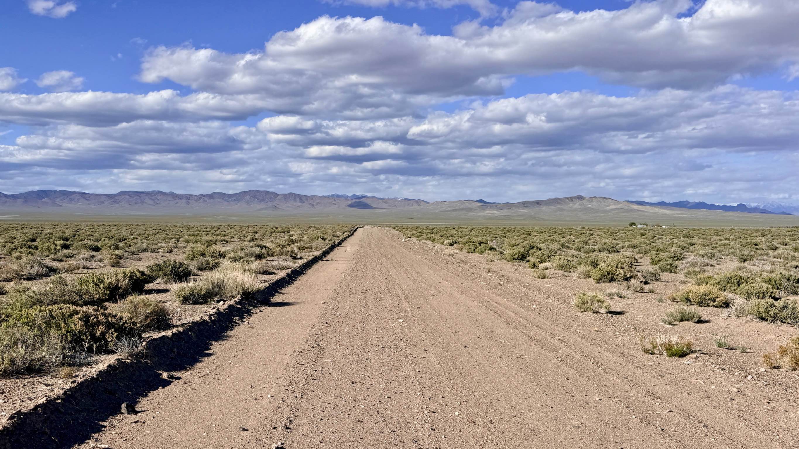
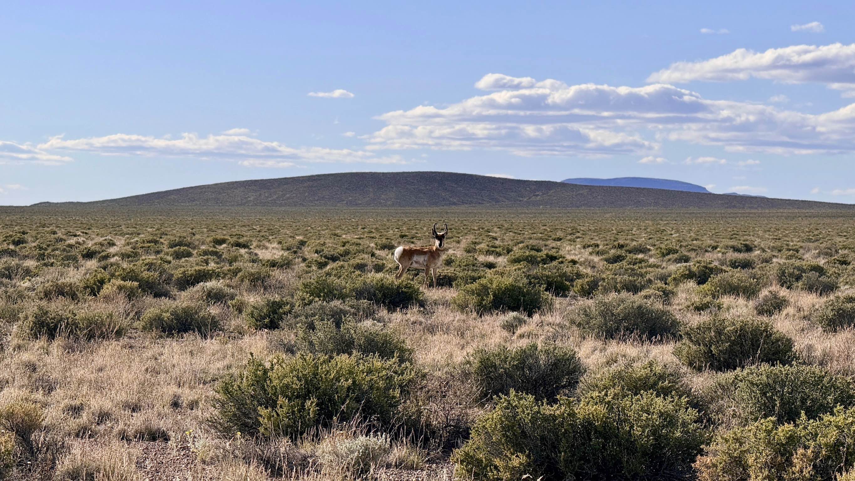
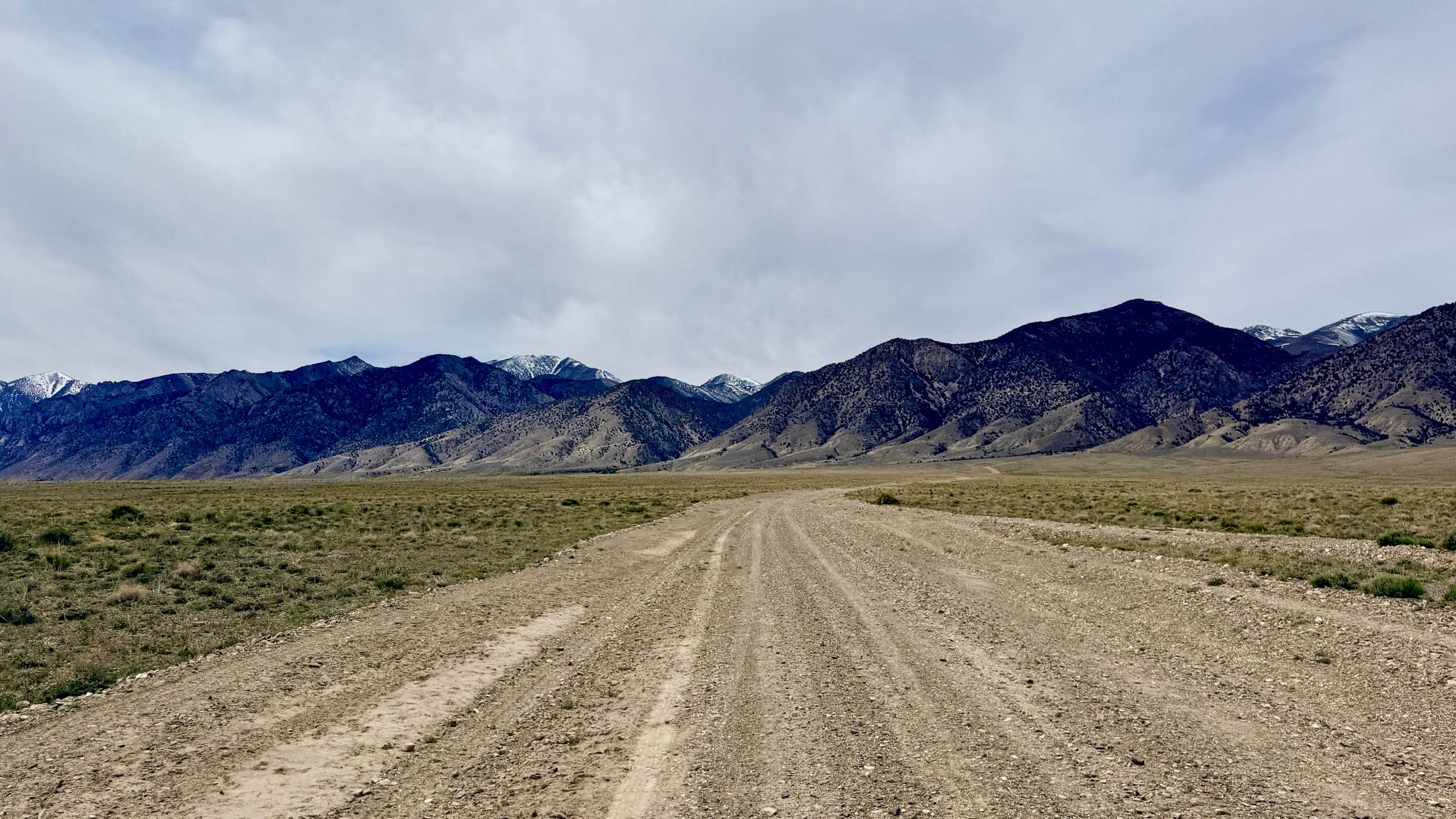
Trail Overview
Dicks Road is a surprisingly well-maintained and "well-grained" single-track trail that provides a delightful shortcut across the expansive valley floor. Connecting the Cloverdale-Peavine corridor to the Gabbs Pole Line Road, this route offers a smooth and efficient way to navigate the basin. The driving experience is characterized by a steady, comfortable pace through the silver sagebrush, with the towering peaks of the Toiyabe and San Antonio ranges serving as your constant companions on the horizon. A unique charm of this trail is its passage through active ranching country. As you traverse the route, you will pass by a small, working farmhouse. Please maintain a respectful, slow speed as you approach the residence. You are likely to see the friendly local farmers out and about, and a polite wave goes a long way in these remote communities. The area is also a hotspot for impressive livestock; keep a sharp eye out for massive Longhorn bulls grazing near the track. If you are lucky, you may even catch a group of Pronghorn Antelope running parallel to your vehicle as you cruise down this easy and exceptionally scenic high-desert corridor. You may see one or two bars of LTE service in the open flats, but it remains unreliable for heavy data use. Download offline maps before leaving the Tonopah or Gabbs area.
Photos of Dicks Road
Difficulty
While the surface is smooth and well-graded, it is a narrow single track. Be prepared to pull off onto the shoulder or use a natural clearing to allow oncoming traffic to pass safely. There is no winter maintenance on this route. While the well-grained surface is reliable, drifting snow can obscure the single track during the winter months.
Status Reports
Dicks Road can be accessed by the following ride types:
- High-Clearance 4x4
- SUV
- SxS (60")
- ATV (50")
- Dirt Bike
Dicks Road Map
Popular Trails
Summit Creek - FS 44091
Stewart's Point
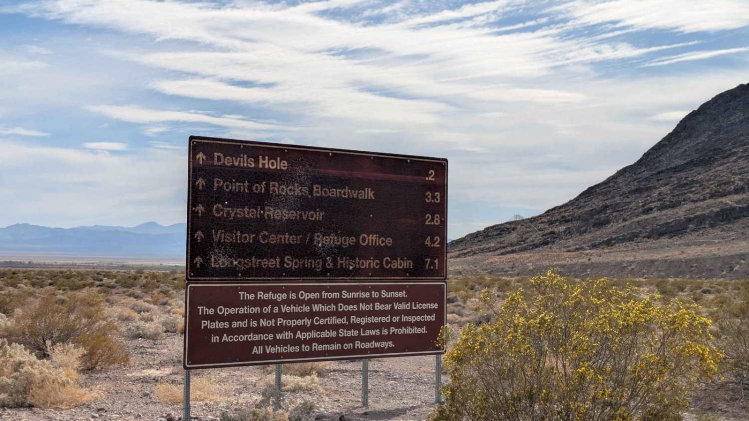
Devil's Hole Road
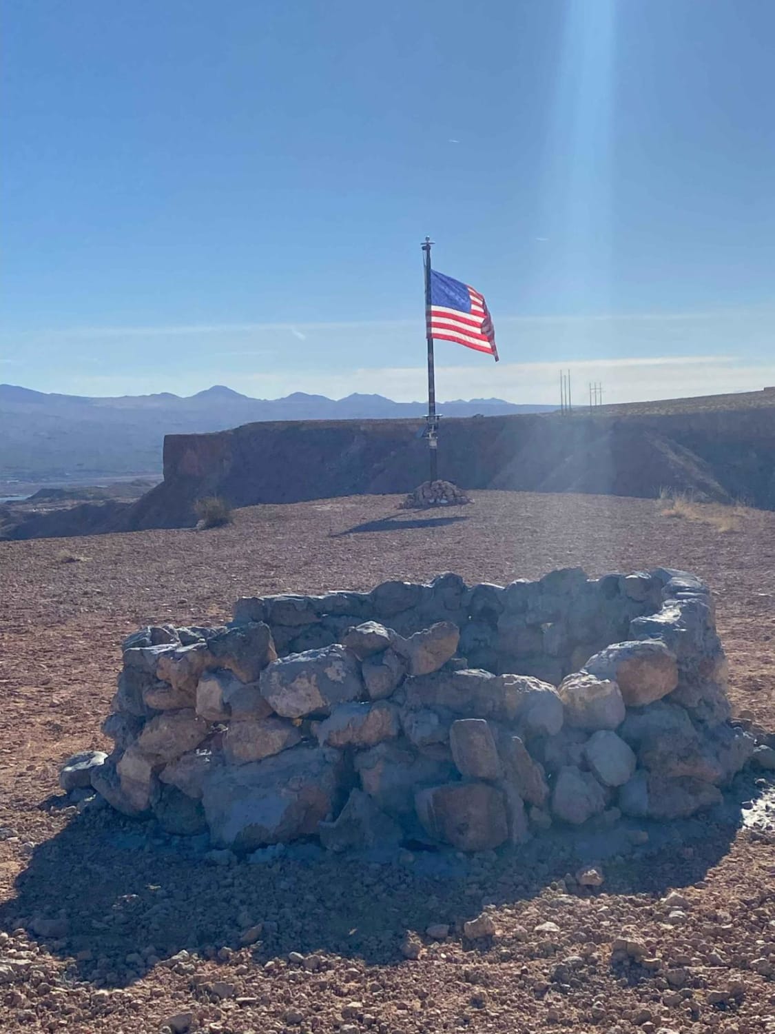
Mesquite American Flag Overlook
The onX Offroad Difference
onX Offroad combines trail photos, descriptions, difficulty ratings, width restrictions, seasonality, and more in a user-friendly interface. Available on all devices, with offline access and full compatibility with CarPlay and Android Auto. Discover what you’re missing today!