Blakely Canyon
Total Miles
1.6
Technical Rating
Best Time
Spring, Summer, Fall
Trail Type
Full-Width Road
Accessible By
Trail Overview
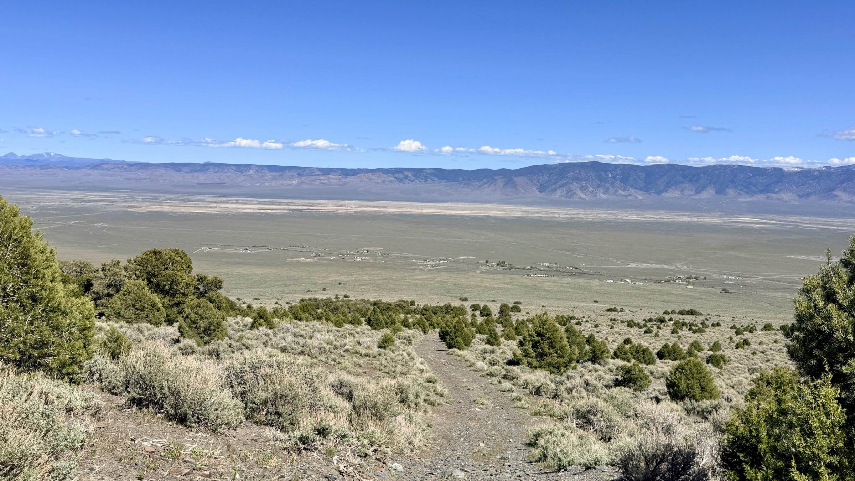
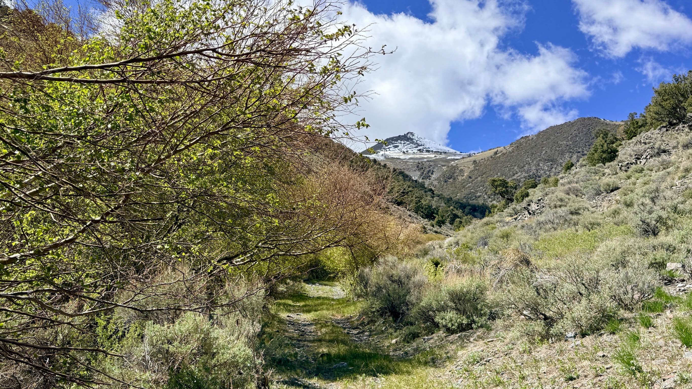
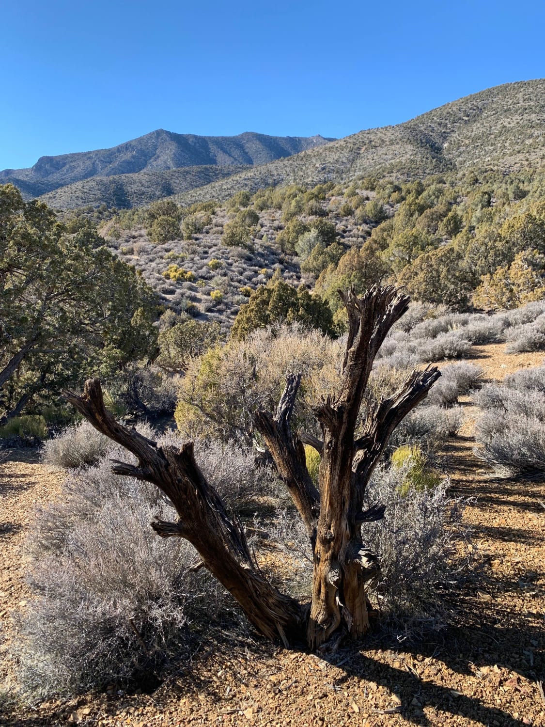
Blakely Canyon offers a steep and spirited rocky ascent. The trail is characterized by its dramatic verticality, consisting of long, sustained hill climbs over loose volcanic gravel and "scree" that will test both your traction and your low-range gearing. As you work your way up, you are rewarded with magnificent panoramic views of the valley below and the looming mountains to the east, with the jagged silhouette of Wildcat Peak dominating the horizon. As the trail enters the canyon itself, the environment shifts into a lush riparian zone fueled by a small, spring-fed creek that trickles down the mountain. The canyon is filled with thick vegetation and trees, providing a rare and beautiful green corridor in the high desert. Be aware that at the time of recording, the upper reaches of the canyon have become heavily overgrown; the track narrows significantly to the point where only motorcycles or small ATVs can continue without significant manual trail clearing. This route can be easily linked with the Kingston Blakely (FS43217) trail to create a spectacular loop overlooking the town. One or two small, scenic dispersed campsites were noted along the climb, offering incredible vistas for those with smaller, self-contained setups. There is no cell service in Blakely Canyon. The steep canyon walls block all signals. Download offline maps before leaving the Kingston area.
Photos of Blakely Canyon
Difficulty
Rated a 4 due to the combination of steep, loose rocky hill climbs, significant washouts, and sustained off-camber sections. Full-size vehicles should be prepared to turn around once the vegetation becomes too dense to avoid heavy paint damage. Low-range is a must for both the ascent and the controlled descent back toward Kingston.
History
Blakely Canyon is part of the historic Reese River Mining District. While Austin was the center of the silver boom, the Kingston area was vital because of its reliable water flow, which powered the massive stamp mills that crushed ore from the surrounding mountains.
Status Reports
Blakely Canyon can be accessed by the following ride types:
- High-Clearance 4x4
- SUV
- SxS (60")
- ATV (50")
- Dirt Bike
Blakely Canyon Map
Popular Trails

South Twin River - FS 44080
Valley View Trail
Hemlock Road
The onX Offroad Difference
onX Offroad combines trail photos, descriptions, difficulty ratings, width restrictions, seasonality, and more in a user-friendly interface. Available on all devices, with offline access and full compatibility with CarPlay and Android Auto. Discover what you’re missing today!