Antelope Creek - FS 44430
Total Miles
2.6
Technical Rating
Best Time
Spring, Summer, Fall
Trail Type
Full-Width Road
Accessible By
Trail Overview
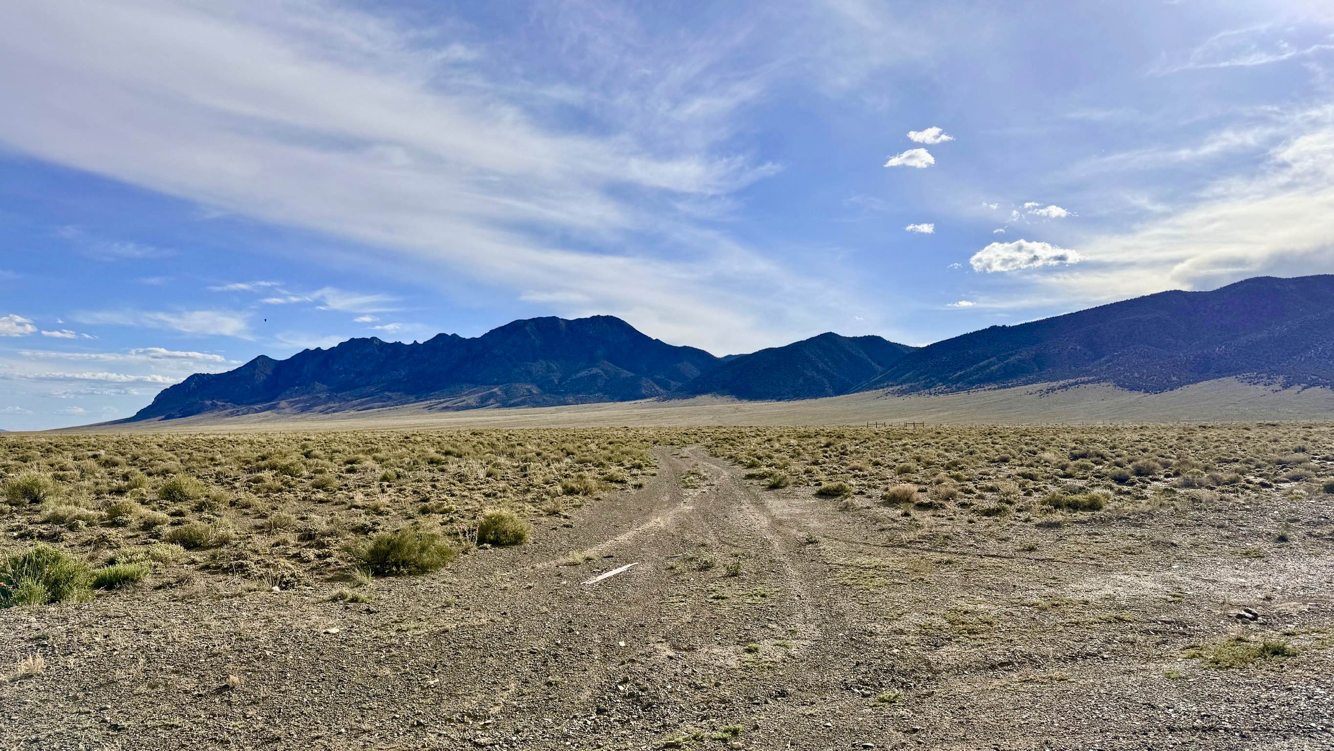
Antelope Creek is a pleasant out-and-back trail that carries you from the open desert floor into the intimate folds of the Toiyabe Range foothills. The drive offers a fascinating visual contrast, providing clear views of the massive, modern mining operations currently active in the area against the backdrop of the rugged, timeless mountain peaks. As you ascend, the typical high-desert sagebrush begins to give way to more robust vegetation fueled by the nearby Antelope Spring. The motorized portion of the trail concludes at a lush, heavily overgrown section where Antelope Creek and the road merge into one. This serves as a natural end for vehicle travel, though the path appears to continue as a hiking trail for those looking to explore the deeper interior of the canyon. Near the canyon entrance, a keen eye will spot the stone outline of an ancient structure. This ruin serves as a silent hint that more historic mining relics may be hidden further up the creek, waiting to be discovered on foot. The trail is narrow and rocky but offers a peaceful escape for those interested in the layers of Nevada's industrial history. There is no cell service in the foothills of Antelope Creek. Download offline maps before leaving the Highway 376 corridor.
Photos of Antelope Creek - FS 44430

Difficulty
Rated a 2 because it is consistently narrow. There are very few places for oncoming traffic to pass; if you meet another rig, one of you will likely need to back up a significant distance. While not technically difficult, the trail is covered with small, jagged rocks that require a slow, steady pace to prevent tire damage.
Status Reports
Antelope Creek - FS 44430 can be accessed by the following ride types:
- High-Clearance 4x4
- SUV
- SxS (60")
- ATV (50")
- Dirt Bike
Antelope Creek - FS 44430 Map
Popular Trails

Ridgeline Single Track
Mead Davis Powerline Road

Old Two Track Way
The onX Offroad Difference
onX Offroad combines trail photos, descriptions, difficulty ratings, width restrictions, seasonality, and more in a user-friendly interface. Available on all devices, with offline access and full compatibility with CarPlay and Android Auto. Discover what you’re missing today!