Darby Trails Loop 2
Total Miles
15.7
Technical Rating
Best Time
Summer, Fall
Trail Type
50" Trail
Accessible By
Trail Overview
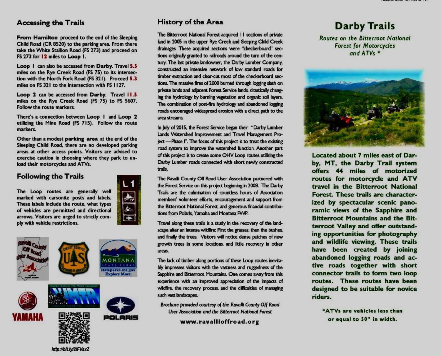
Loop 2 is a route consisting of a variety of roads connected together by newly constructed 50" ATV trails to form a 16-mile loop route. Many of the roads incorporated into this route are old abandoned logging roads, some of which have been converted to ATV trails. This route passes through a portion of the Bitterroot National Forest east of Darby, Montana that was severely burned during the wildfires of the summer of the year 2000. Travel over Loop 2 is essentially a snapshot of the recovery process after intense wildfire. In this case, the mixture of deciduous trees and bushes with emerging evergreens offers a stunning visual landscape. The traveler on Loop 2 will experience a surprising variety of terrain, from dense stands of mixed vegetation to open areas offering spectacular panoramic views. The tread is generally stable and wide, but there are occasional segments that offer more modest challenges. In general, this loop is suitable for novice riders and family groups. The first photo supplied with this description is a map of the Darby Trails system. The second photo is a brochure that describes the trail system in more detail.
Photos of Darby Trails Loop 2

Difficulty
This loop route offers modest challenges and is suitable for novice riders.
History
Loop 2 was designed and constructed by the Ravalli County Off Road Users Association with assistance from Forest Service Specialists. Funding was supplied by the Yamaha and Polaris Corporations and the State of Montana. Construction was completed in 2016.
Status Reports
Darby Trails Loop 2 can be accessed by the following ride types:
- ATV (50")
- Dirt Bike
Darby Trails Loop 2 Map
Popular Trails

Iron Mountain - FSR 344

Powerline Road

Ratio Mountain Majesty Loop

Lincoln View ATV Trail
The onX Offroad Difference
onX Offroad combines trail photos, descriptions, difficulty ratings, width restrictions, seasonality, and more in a user-friendly interface. Available on all devices, with offline access and full compatibility with CarPlay and Android Auto. Discover what you’re missing today!