Tram - NPS 123
Total Miles
8.2
Technical Rating
Best Time
Spring, Summer, Fall, Winter
Trail Type
Full-Width Road
Accessible By
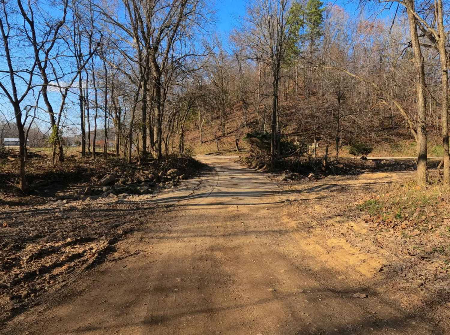
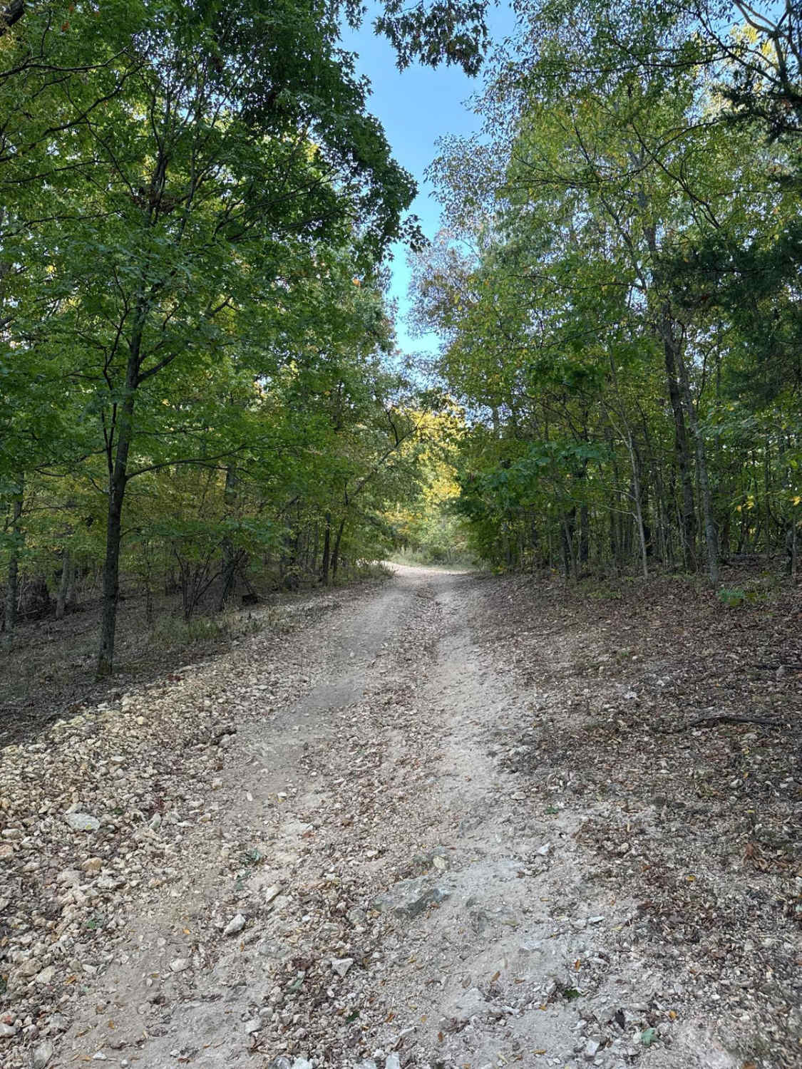
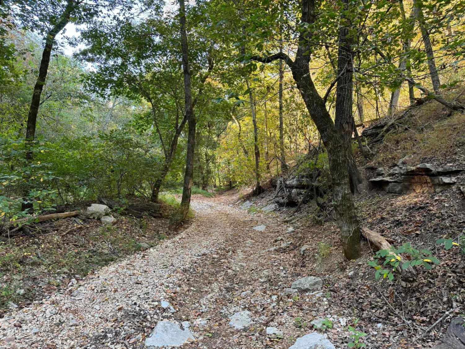
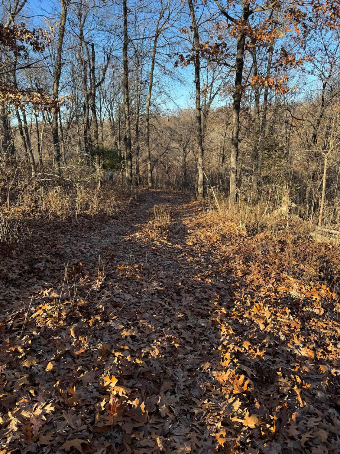
Trail Overview
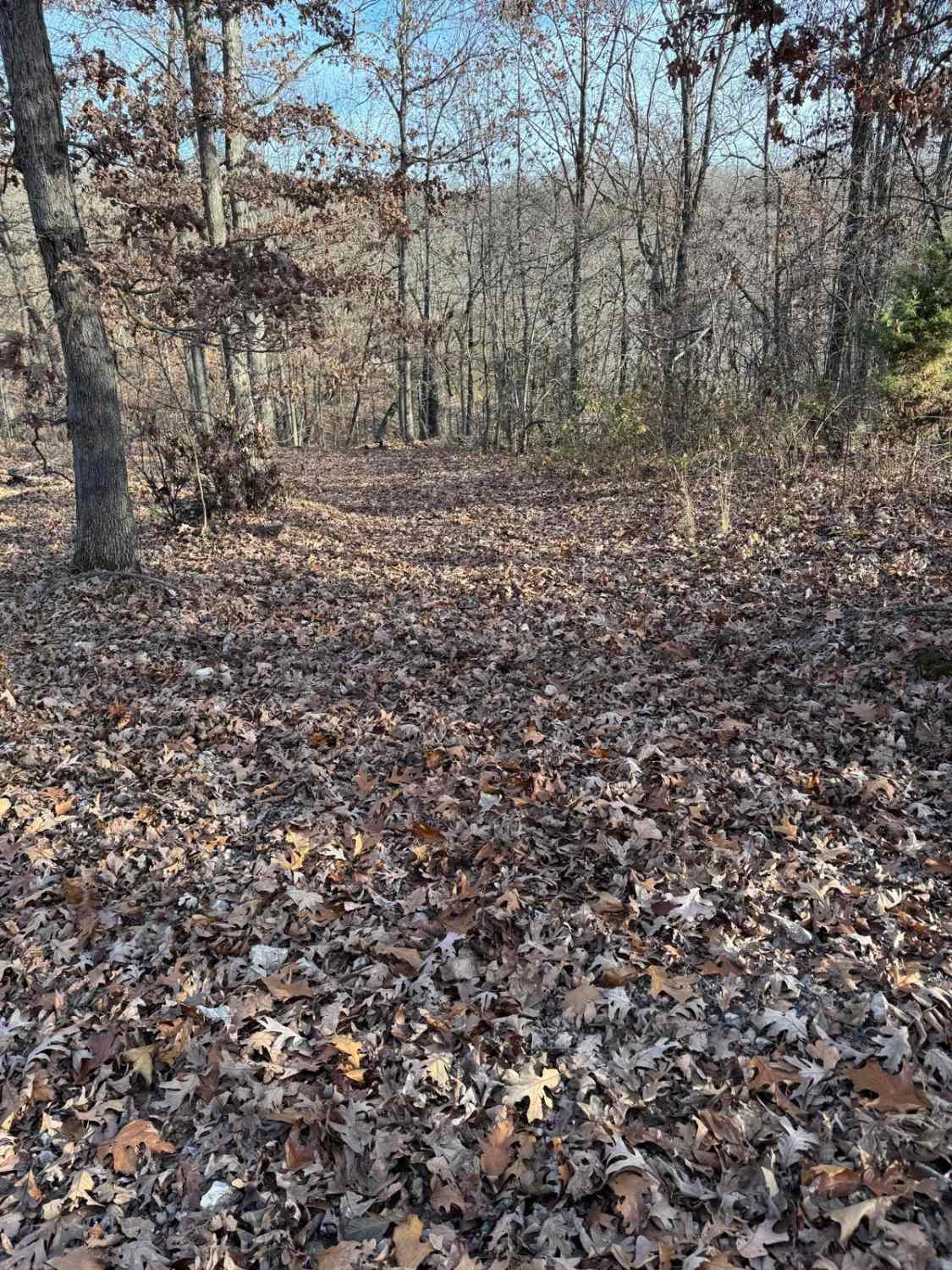
The Tram, National Park Service Road 123, also known as Clubhouse, or the Hillbilly's Katy Trail is a gravel and natural terrain trail within the Ozark National Scenic Riverways land. Leading alongside the Current River in Carter County, southeast of Van Buren, Missouri, the Tram follows the historic track of the Current River Line (Railroad), which traced its way through the hills and valleys of the Missouri Ozarks, chasing the sales of timber. This specific section of line serviced between the timber operations in Van Buren, Chicopee, Short, Chilton, and Clubhouse, then to Hunter, where it went down to the sawmill in Grandin (formerly Lakewood). After the tracks were removed, the raised railbed remained, and the automobile quickly took advantage of its placement, then merely for logistics, still used as so today, but now with the second purpose of relaxing scenic recreation. The terrain along the track ranges from a maintained gravel road to sand-covered portions to coarse natural gravel and natural rock at the surface of a dirt path, with potential surface mud and smaller water collection holes. This is all over a mostly flat track, with only moderate elevation changes at the rainwater chutes that come down from the bluffs and hills to the north and east of the track and then feed into the Current River. At these chute locations, former walking trail bridges can be seen slowly fading with time, the flooding of the River being the cause of this slow demise. Along the Northwestern portion of the track, Big Spring campground can be seen across the river, along with old bridge piers in the middle of the river, roughly at 36.96036, -90.98172. On the southeastern end, the trail passes the hillside cabin (private property) near the former train stop of Clubhouse. Please respect the property and enjoy its presence from the road. This is found at 36.92922, -90.9054. Come and witness the tram, the once timber mecca of the Ozarks, perhaps of the Midwest, where the train whistle still seems to echo despite being gone for over 50 years.
Photos of Tram - NPS 123

Difficulty
The Tram is given a base rating of 2/10, though large portions of this trail feature a semi-maintained gravel road, it can be rough having large potholes washboards, and natural rock poking out at the surface. Where this track earns the 2/10 rating is the natural sections the further southeast you go from Van Buren, these sections feature a pathway primarily of dirt, and natural rock, with sparse gravel, potential surface mud and occasional 6"-12" water collection holes all within the flat sections. Additionally, the 2/10 is earned crossing several water drainage chutes that feed into the Current River, these are recognizable by the abandoned walking bridges, the trail drops 10-20 in elevation at each spot, featuring natural terrain, mild forms of active erosion, high potential of surface mud, water collection spots up to 12" and a few slab rocks ledges poking out at the surface 6"-12". Due to the proximity to the Current River, it is not out of the question for this trail to have serious flooding and influences of rain or wet conditions, in these times difficulty will increase, and lead to the potential of trail closure, be mindful of these conditions, and look for water levels of the Current River, documentation of this trail was taken in 11/2024 when the river was at the depth of 3.65 foot on the Van Buren water gauge. This gauge can be found at https://waterdata.usgs.gov/monitoring-location/07067000/#dataTypeId=continuous-00065-0&period=P365D&showMedian=false
History
In 1880, John Barber White was assigned by Tidioute, a conglomerate of wealthy Pennsylvania businessmen, to run a new venture called the Missouri Lumber & Mining Company. After years of trying to materialize the established Iron Mountain railroad company to build a spur to the Greater Van Buren area with a Sawmill based out of Mill Spring Missouri, John Barber moved south to Grandin (then known as Lakewood) at the same time negotiations where made with George H. Nettleton of the Kansas City, Fort Scott & Memphis Railroad guaranteeing the spur tracks would produce twenty million board feet a year, as to justify building a rail system through the Missouri Ozark from Chicapee (South Van Buren) to the Grandin sawmill. The railroad arrived in Grandin on July 1st, 1889, with the sawmill already having six million board feet of lumber ready for shipment. The rail would become known as the Current River Line. The stops along the Tram Road, from the original CR line leading from Grandin (Lakewood) and excluding Hunter, were Clubhouse, Chilton, Short, and Chicapee (South Van Buren). It remained until the late 1970s when freight and timber shipments were no longer meeting efficiency standards to keep the Current River Line running, so Frisco shut the line down and ripped up the tracks. This would align with President John F Kennedy endorsing the formation of the concept of the park in 1962, then the 1964 Act of Congress to protect the riverways by forming it as an NPS unit, followed in 1971 with the official dedication as the Ozark National Scenic Riverways, and a ribbon cutting ceremony at Big Spring in 1972. Without deep research, it is safe to assume that when the railroad put the land for sale/release, the National Park was ready to purchase/possess, thus becoming what it is today. Modern History, in 2017, a record-setting flood hit the Current River and Van Buren, MO, cresting at 37 feet, 8 feet above the old record set in 1904, this destroyed several structures along the Tram, including several buildings and campsite accommodations across the river at Big Spring, and was the main force that left the former hiking bridges along the Tram in the condition they are still in now (2025). - Researched By Christopher Menz
Status Reports
Tram - NPS 123 can be accessed by the following ride types:
- High-Clearance 4x4
- SUV
Tram - NPS 123 Map
Popular Trails
Yellow 258
The onX Offroad Difference
onX Offroad combines trail photos, descriptions, difficulty ratings, width restrictions, seasonality, and more in a user-friendly interface. Available on all devices, with offline access and full compatibility with CarPlay and Android Auto. Discover what you’re missing today!