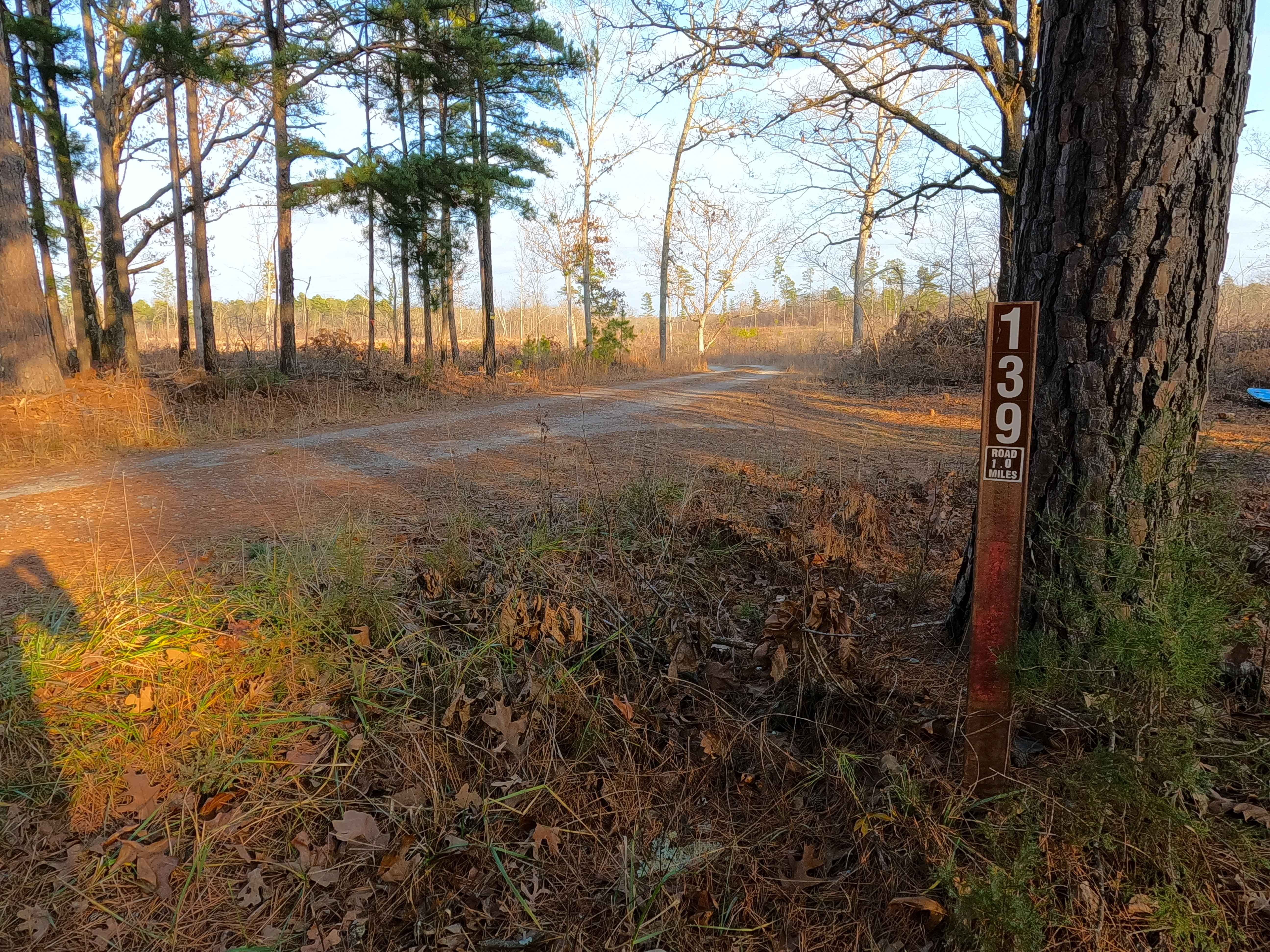
Bull Knot - FS 139
Total Miles
0.9
Technical Rating
Best Time
Spring, Summer, Fall, Winter
Trail Type
Full-Width Road
Accessible By
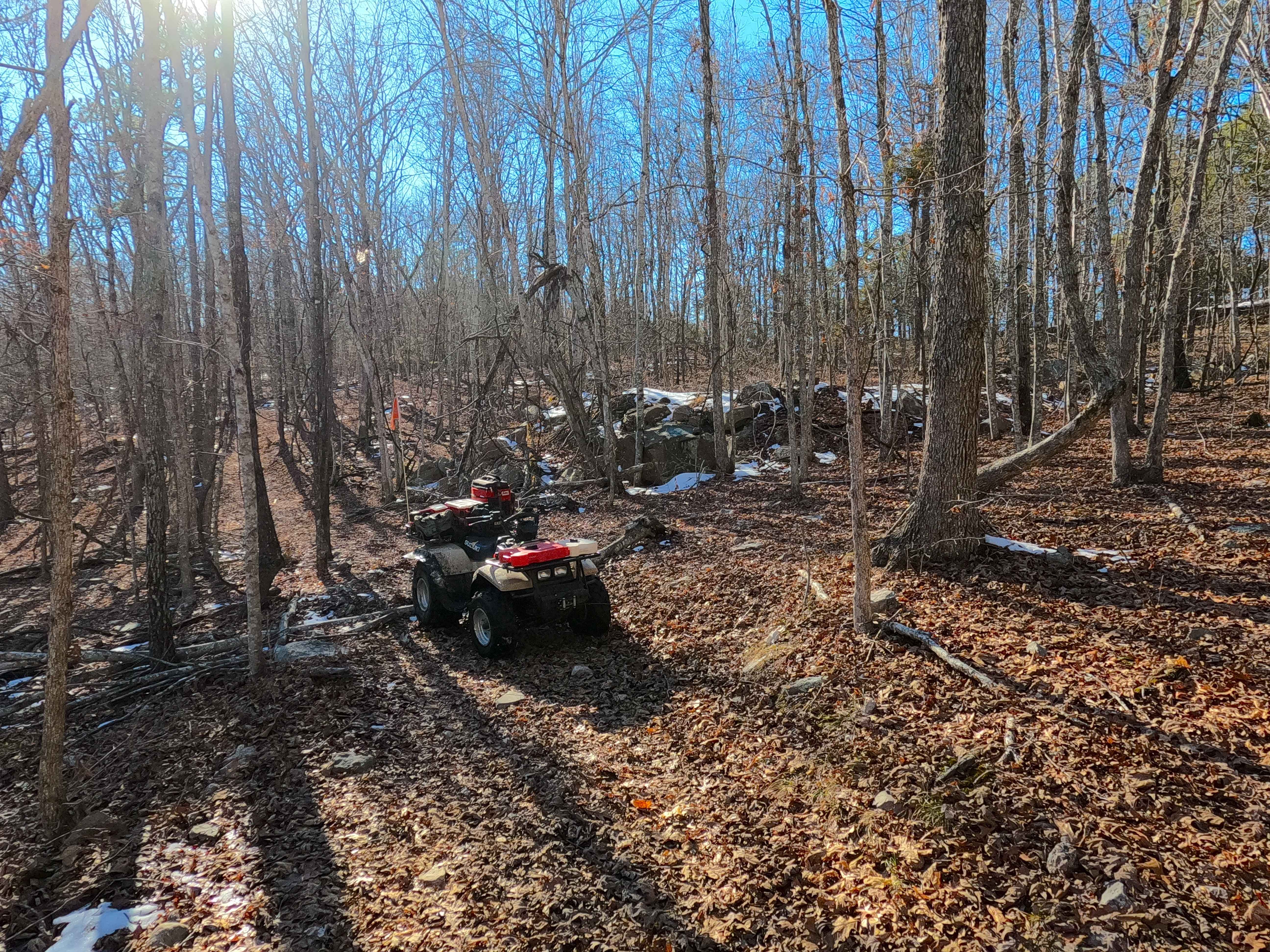
Trail Overview
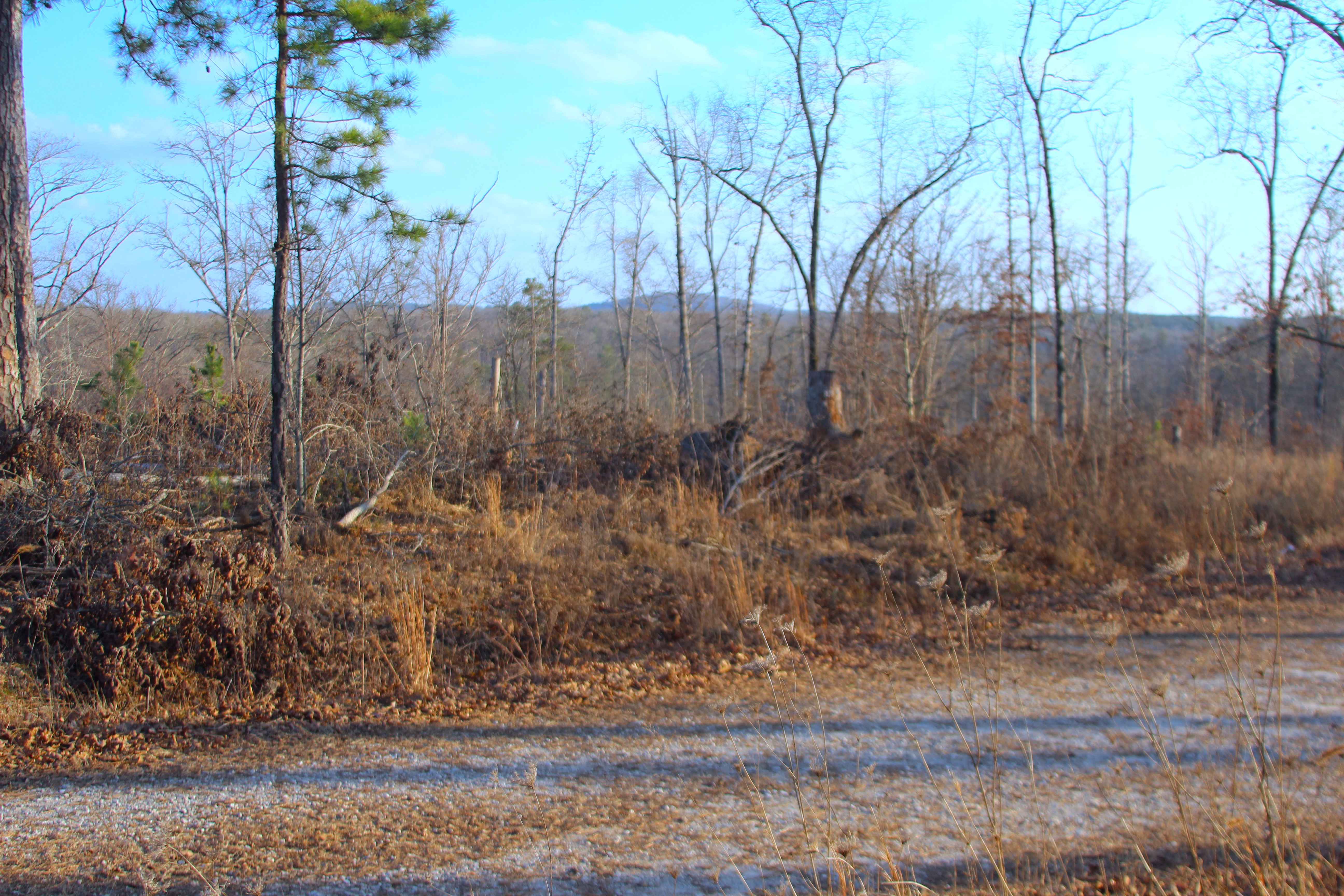
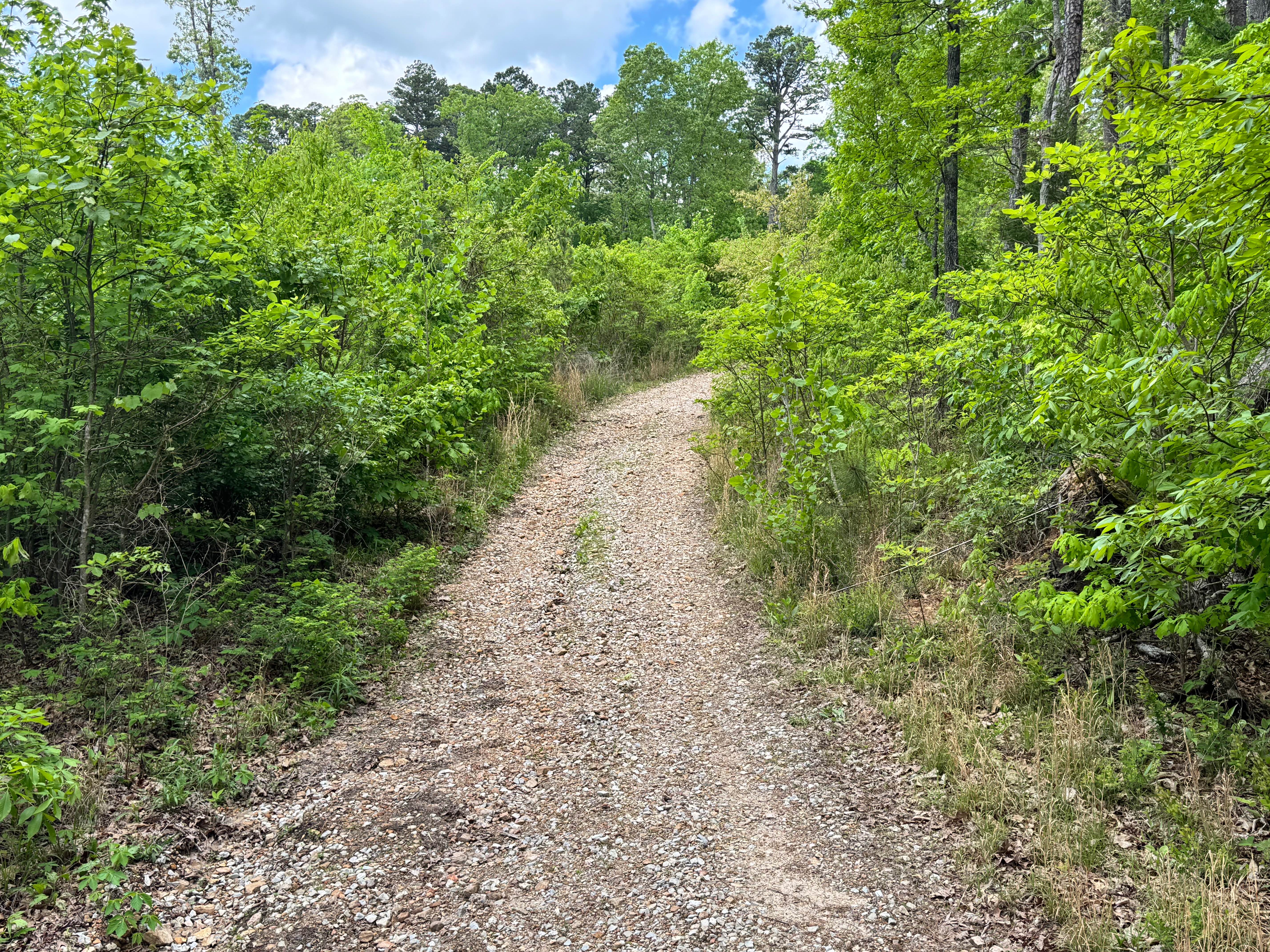
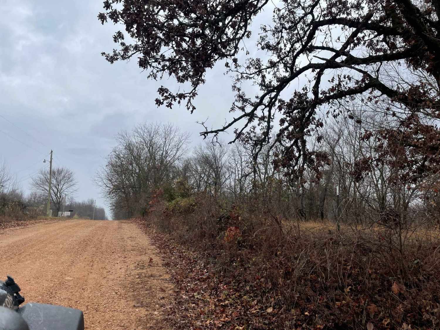
Bull Knot (FS 139) is a gravel Forest Service road within the Mark Twain National Forest Willow Springs Unit. Bull Knot heads southeast off Missouri Route 181, riding along the ridge, having scenic views of the surrounding knobs and tree lines, with a few small valleys, featuring mild grades, with feeder water channels trickling in the bottom of these small elevation changes before going to the deeper valley. Ultimately, the road goes down a small final grade to a turnaround at the MVUM-sanctioned end, with a great look south-southeast to the Little Indian Creek, and further to the Blue Buck Knob, and Tater Hill, looking like micro-mountains in the distance. The endpoint shows signs of being well-loved by the local hunters and offers a rock fire ring to those wanting it. Please be responsible in using this turnaround for more than turning around.
Photos of Bull Knot - FS 139
Difficulty
Bull Knot is given a base rating of 1/10 for having a coarse gravel base over mild graded hills, mild erosion washes, potholes, washboards, mounding of gravel, with sections of the road that fade to dirt, with a potential for surface mud. Difficulty can increase in times of wet or inclement conditions, heavy use, and through a lack of maintenance, likely having temporary water collection spots at splash depth. With some maintenance and mending, this road could be a more solid 1/10 rated road, but if the bowl-like small valley spots were to have more water erosion and start collecting and holding water, this could lean into being a 2/10.
History
When looking back at old maps as early as 1951, the road simply was not illustrated/designated until the 2004 edition of the Cabool SE, Missouri topo map. This topo shows the FS 139, designated and established in the same modern placement and length, suggesting it is a more modern-created road, likely being created for logging or fire management operations, versus the less likely, yet still possible, an old private land road that the Forest acquired and used as-is for its network. Documented by Christopher Menz (1/2026)
Status Reports
Bull Knot - FS 139 can be accessed by the following ride types:
- High-Clearance 4x4
- SUV
- SxS (60")
- ATV (50")
- Dirt Bike
Bull Knot - FS 139 Map
Popular Trails
Pocket Eddy Ford Spur A
Ozark to Nettle
Sutton Bluff ATV 4 North - SB 4
The onX Offroad Difference
onX Offroad combines trail photos, descriptions, difficulty ratings, width restrictions, seasonality, and more in a user-friendly interface. Available on all devices, with offline access and full compatibility with CarPlay and Android Auto. Discover what you’re missing today!