Red Top Loop
Total Miles
8.2
Technical Rating
Best Time
Spring, Summer, Fall
Trail Type
60" Trail
Accessible By
Trail Overview
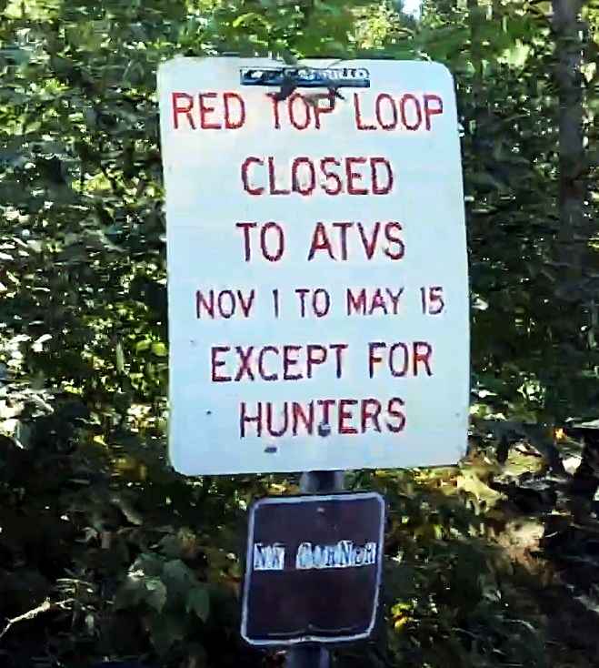
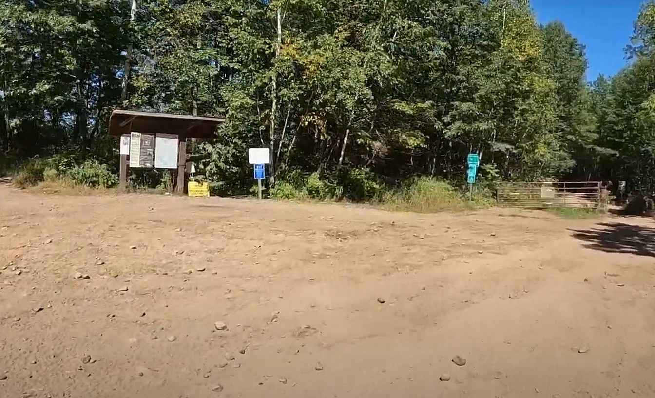
The Red Top Loop is located within a wooded area between the communities of Isle and McGrath in Aitkin County. The Red Top Loop trail network is made up of several different trails, all generally looping back to the main Red Top Loop. The entire network consists of more than 25 miles of ATV accessible tracks (some are restricted). The primary loop is 8.2 miles, which loops from the Soo Line Trail. The trail can be run in either direction and is open to Class I and II as well as OHM vehicles. It should be noted that several of the side trails are restricted to Class I and OHM vehicles only. The Red Top trail network offers a wide variety of terrain from open-packed dirt trails that allow for two-way traffic to rocky, steep, and restricted forest trails barely wide enough for a 50" vehicle. This main loop offers a variety of riding conditions. Several unique areas along the trail are great for practice. This includes an area with several up and over bumps allowing for balance training, several bowls that allow for higher speed circles, and several mud pits that are generally filled with water that may exceed 18" or more, depending upon time of year and weather conditions. Many of the side trails will traverse through lower areas that are sure to be muddy or filled with water most of the season. The Red Top trail network is part of the Minnesota Department of Natural Resources managed areas, and the Drift Skippers Snowmobile and ATV Club maintains the network. Drift Skippers is a 501(c)3 non-profit club established in 1970, and the club maintains approximately 106 miles of trails year-round. Expect lots of water and mud in the May/June timeframe and dusty, dry trails in the early fall before seasonal rains begin. The trail is normally open from 15 May to 31 October for wheeled off-roading. This main loop is open to both Class I and II ATVs (with a maximum width of 65" (outside rim to rim) as well as OHM. OHV riding in Minnesota requires either a vehicle registered with the state or the purchase of a non-resident OHV state trail pass. Food and fuel can be found to the south along the Soo Line in Isle. The trail is rated moderately difficult by the Minnesota Department of Natural Resources.
Photos of Red Top Loop
Difficulty
Wide trails with plenty of bypass, standing water after rains, water holes and fun beginner obstacles.
Status Reports
Red Top Loop can be accessed by the following ride types:
- SxS (60")
- ATV (50")
Red Top Loop Map
Popular Trails


32nd Avenue Northeast

Pancore Lake

Vermillion Falls - FS 491
The onX Offroad Difference
onX Offroad combines trail photos, descriptions, difficulty ratings, width restrictions, seasonality, and more in a user-friendly interface. Available on all devices, with offline access and full compatibility with CarPlay and Android Auto. Discover what you’re missing today!