FS 3579
Total Miles
4.1
Technical Rating
Best Time
Spring, Summer, Fall, Winter
Trail Type
Full-Width Road
Accessible By
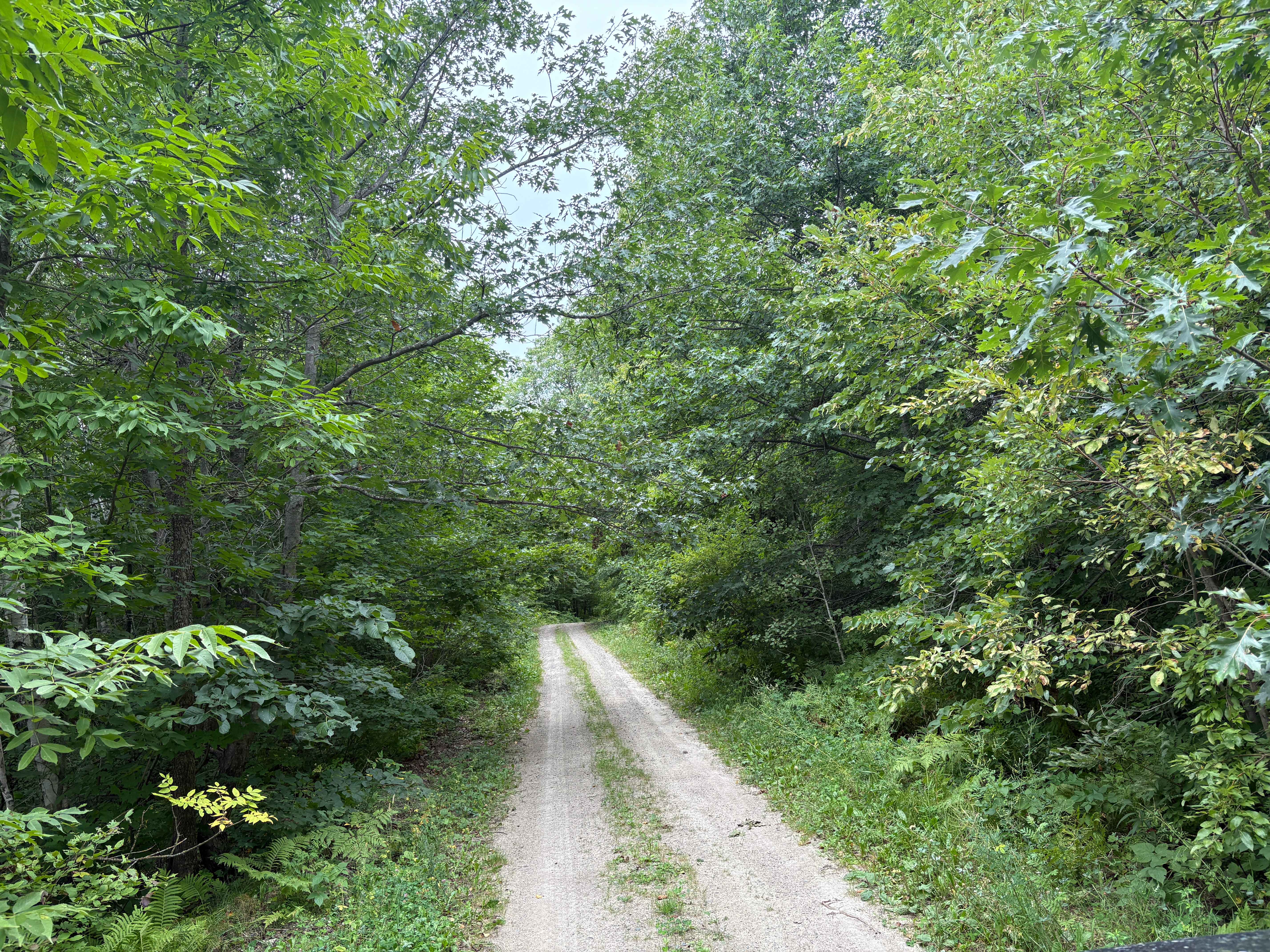
Trail Overview
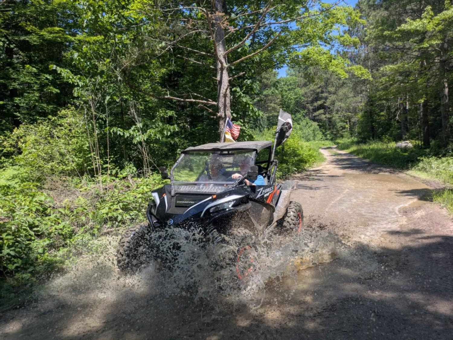
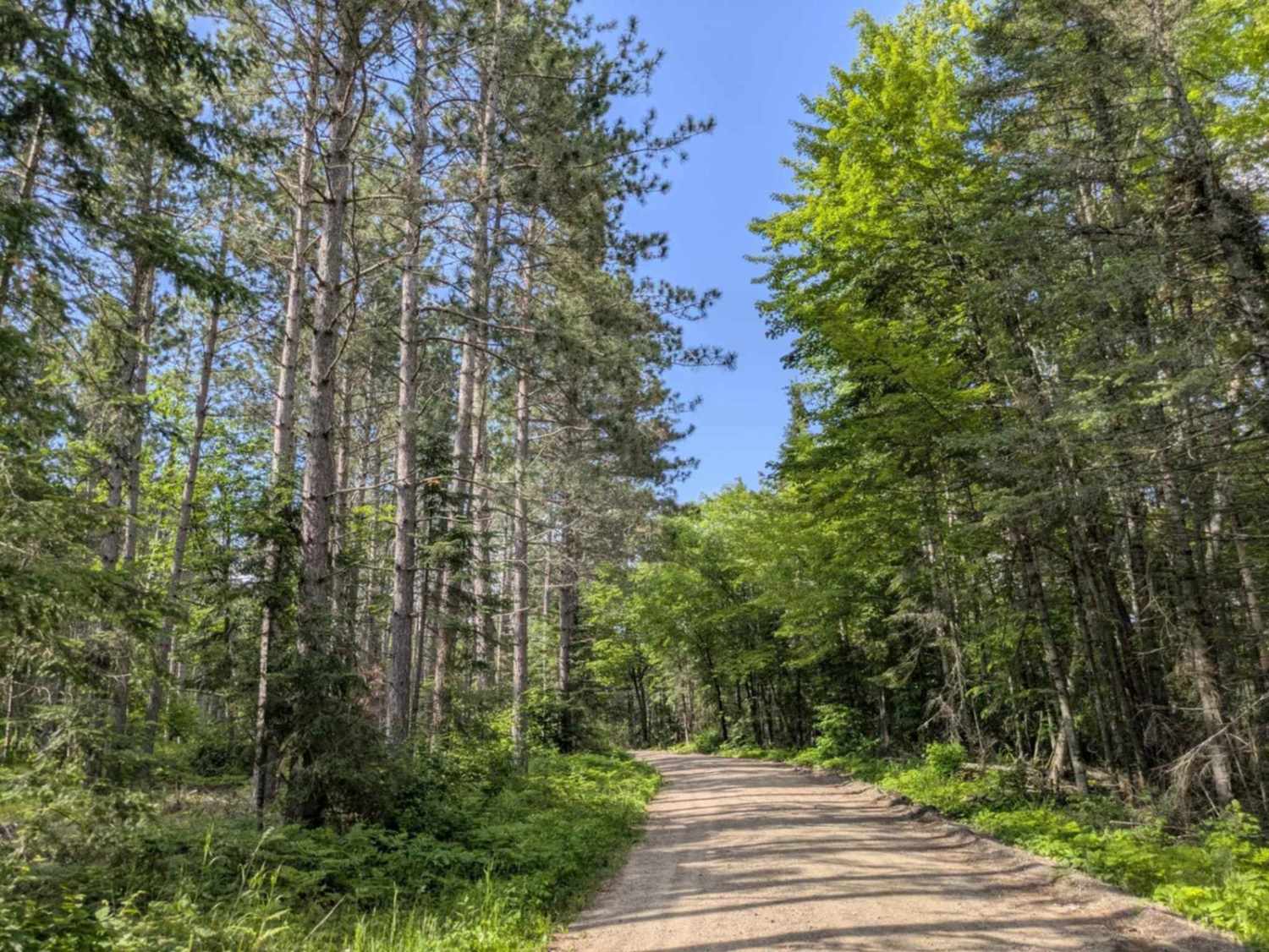
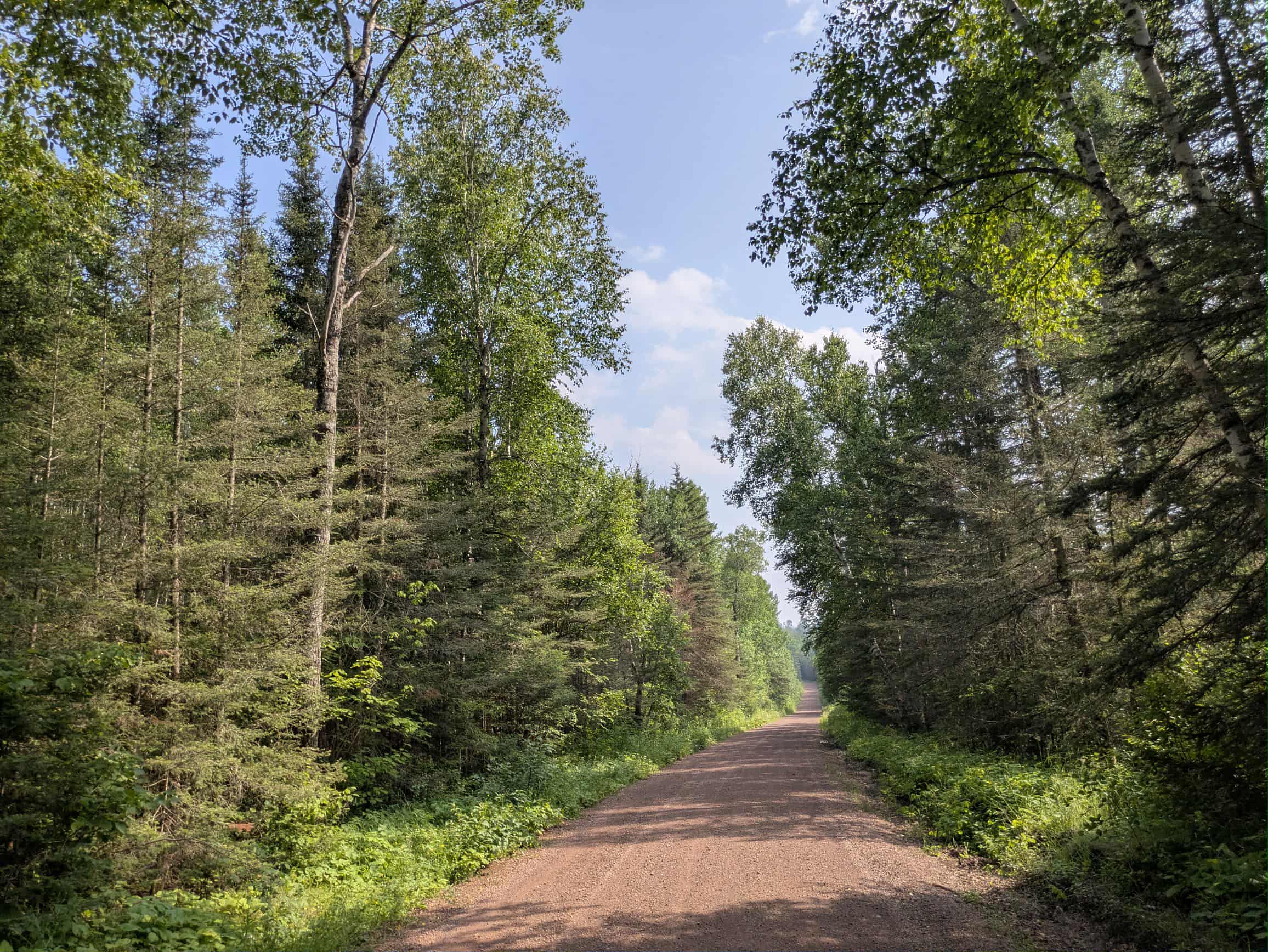
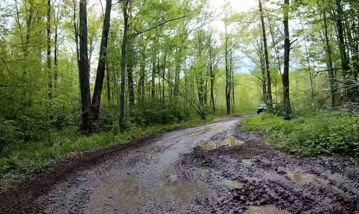
This trail begins as a wide, well-maintained gravel road that travels past a small lake, an open field, and patches of forest. It's an easy and scenic start, but after a noticeable change in the road, a sign appears warning of active logging operations ahead. From there, the trail climbs steadily into a denser forested area where extensive logging is taking place. Although the trail remains relatively wide in this section, the surface becomes sandy and is often busy with logging vehicles, so drivers should proceed with caution. As the route progresses, the trail narrows considerably and the condition deteriorates. This section is unmaintained, featuring muddy pools, uneven surfaces, small protruding boulders and rocks, and off-camber areas that demand a high-clearance, four-wheel-drive vehicle. There are a few pull-offs and turnarounds scattered along the narrower stretch, and several smaller trails branch off the main route. ATVs and side-by-sides are commonly encountered in this more technical portion, so stay alert. There are no established or dispersed campsites along this trail, and it lacks basic amenities such as potable water and waste disposal. Cell service may also be limited throughout much of the route.
Photos of FS 3579
Difficulty
This trail is not maintained but is regularly used by OHV users, so be cautious of other off-roaders and adventurers.
History
Covering more than 1.6 million acres of glacial lakes, red-pine uplands, and sphagnum bogs, Minnesota's Chippewa National Forest lets motorists experience the North Woods at an unrushed pace. Paved state highways soon yield to a lattice of numbered forest roads, most of them well-graded gravel that thread between kettle ponds and stands of towering white pine, the tree that helped earn the forest its 1908 designation as one of America's first national forests. The forest harbors one of the highest breeding densities of bald eagles in the continental United States, and patient drivers often glimpse loons, black bears, and white-tailed deer as they move from shoreline to clear-cut regrowth and back again.
Status Reports
FS 3579 can be accessed by the following ride types:
- High-Clearance 4x4
- SUV
- SxS (60")
- ATV (50")
- Dirt Bike
FS 3579 Map
Popular Trails
Cascade River Road
Heart Lake Trail

High Lake Road
The onX Offroad Difference
onX Offroad combines trail photos, descriptions, difficulty ratings, width restrictions, seasonality, and more in a user-friendly interface. Available on all devices, with offline access and full compatibility with CarPlay and Android Auto. Discover what you’re missing today!