Destination Road
Total Miles
1.0
Technical Rating
Best Time
Spring, Summer, Winter, Fall
Trail Type
Full-Width Road
Accessible By
Trail Overview
This trail is narrow and uneven, with a surface marked by rocks, puddles, and occasional washouts. It winds through dense forest, offering a quieter, more remote driving experience. Several trails branch off from the main route, including wide, well-maintained paths designated for snowmobiles and cross-country skiing. These intersecting trails are clearly marked and appear to receive regular upkeep. As the trail progresses, it becomes increasingly rough in places, requiring a slow and careful pace. Toward the end of the route, the trail reaches an intersection. A gate blocks access to the road on the right, even though maps identify it as a public roadway. Continuing straight along Destination Trail, the route narrows further and becomes heavily overgrown before arriving at a large, uneven clearing. This open area is set on slightly hilly terrain and may be suitable for dispersed camping, though it shows little sign of regular use. There are no developed campsites or services along this trail. Travelers will not find toilets, drinking water, or trash disposal, and the cell signal is likely to be weak or absent. Dispersed camping is generally permitted within the Superior National Forest as long as it occurs outside the Boundary Waters Canoe Area Wilderness, but campers should confirm current regulations with local authorities and follow Leave No Trace principles.
Photos of Destination Road

Difficulty
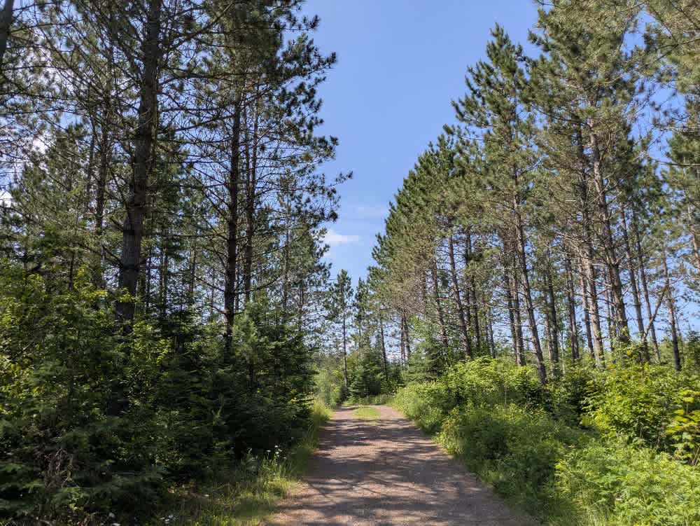
This forest trail is well-maintained and used by adventurers. The route is wide and clear of debris, with established tread and minimal overgrowth, making it ideal for a smooth and scenic drive.
Status Reports
Destination Road can be accessed by the following ride types:
- High-Clearance 4x4
- SUV
Destination Road Map
Popular Trails

Airport Road

Meridian Road

Elbow Creek

Root Forest Road
The onX Offroad Difference
onX Offroad combines trail photos, descriptions, difficulty ratings, width restrictions, seasonality, and more in a user-friendly interface. Available on all devices, with offline access and full compatibility with CarPlay and Android Auto. Discover what you’re missing today!