Bandana Trail
Total Miles
6.0
Technical Rating
Best Time
Spring, Fall, Winter, Summer
Trail Type
Full-Width Road
Accessible By
Trail Overview
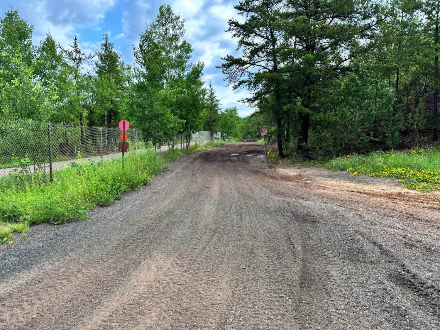
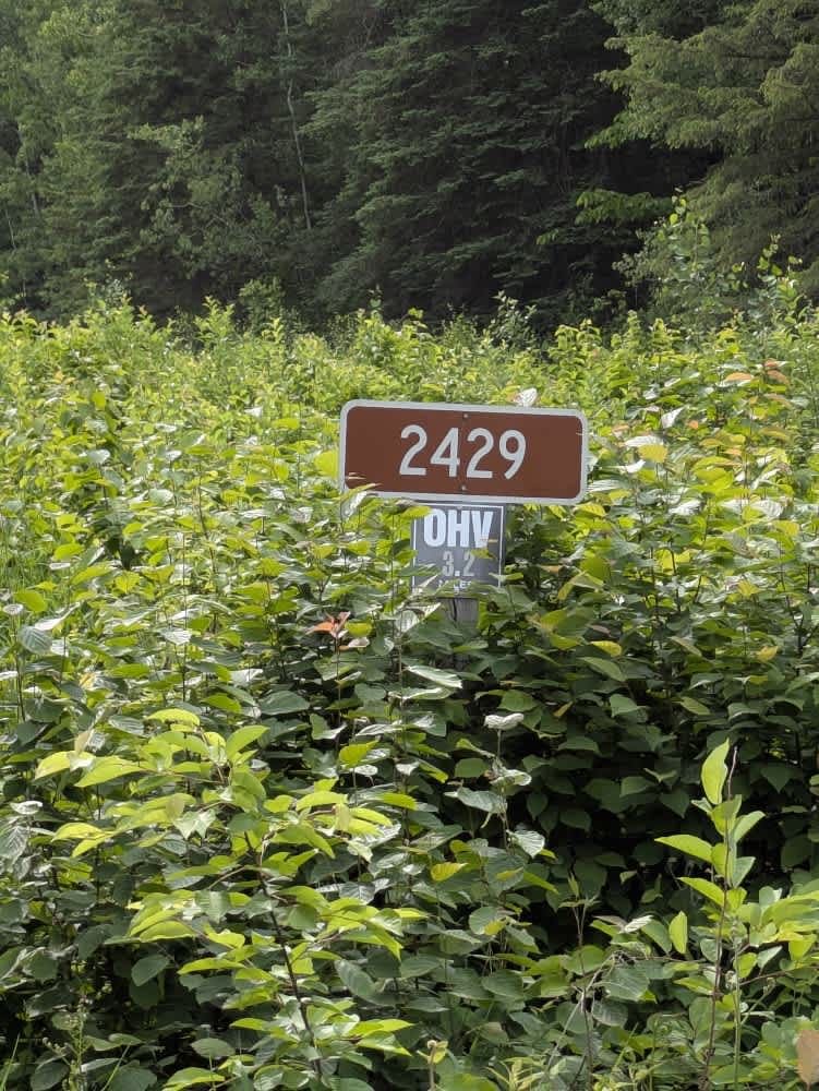
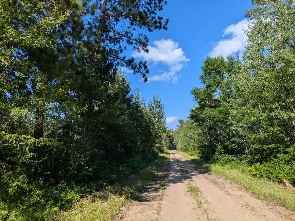
The Bandana Trail begins as a narrow two-track route in the northern section. This section includes bumpy, rocky stretches along with wet and muddy patches, and features a series of mild ascents and descents. It appears to be a popular route for ATV and side-by-side users. Partway along the trail, there is a large clearing that can accommodate parking and may be suitable for dispersed camping, although no formal facilities are present. The trail passes through attractive forest and offers a reasonably enjoyable driving experience, especially for those equipped for rougher terrain. As the trail continues toward Highway 1, it transitions into a wider, well-maintained gravel road that winds gently through the woods. Several spur trails branch off from this main route, some of which are accessible, while others are posted as private or closed. The trail does not provide any developed campsites or amenities, and users should be prepared for limited or no cell service.
Photos of Bandana Trail


Difficulty
This forest trail is well-maintained and used by residents and adventurers. The route is wide and clear of debris, with established tread and minimal overgrowth, making it ideal for a smooth and scenic drive.
Status Reports
Bandana Trail can be accessed by the following ride types:
- High-Clearance 4x4
- SUV
- SxS (60")
- ATV (50")
- Dirt Bike
Bandana Trail Map
Popular Trails

Trigstead East
The onX Offroad Difference
onX Offroad combines trail photos, descriptions, difficulty ratings, width restrictions, seasonality, and more in a user-friendly interface. Available on all devices, with offline access and full compatibility with CarPlay and Android Auto. Discover what you’re missing today!