No. 19 Road
Total Miles
2.3
Technical Rating
Best Time
Spring, Summer, Fall
Trail Type
High-Clearance 4x4 Trail
Accessible By
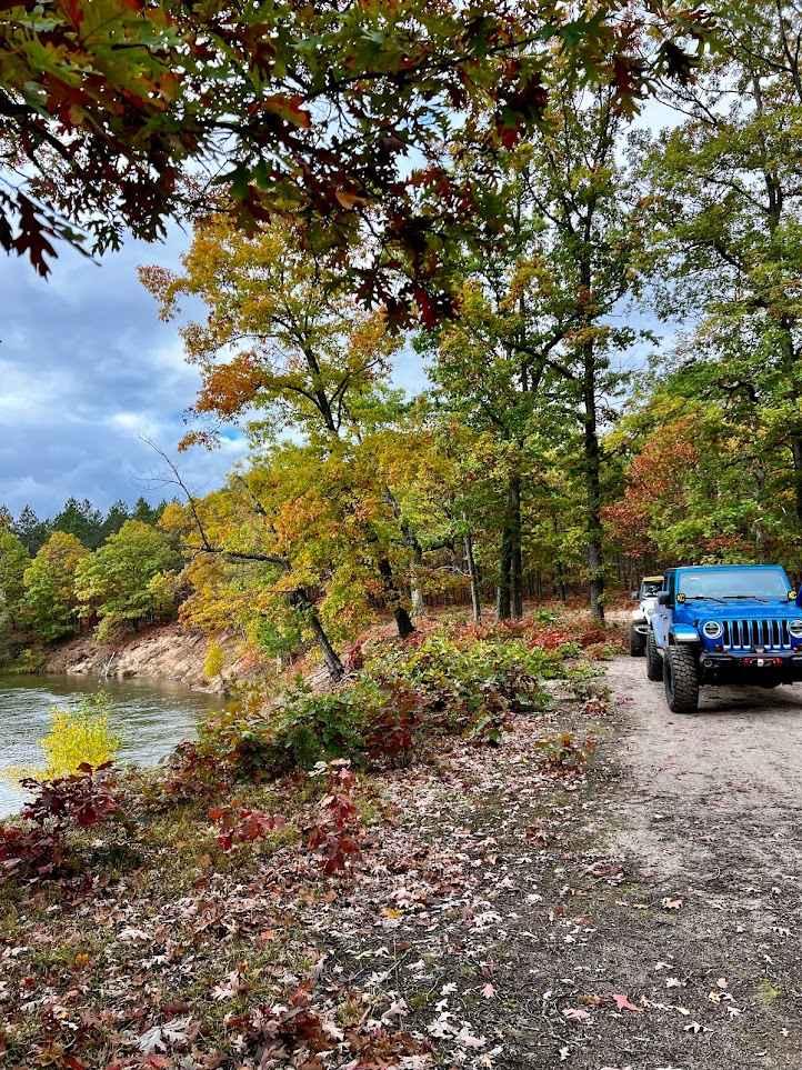
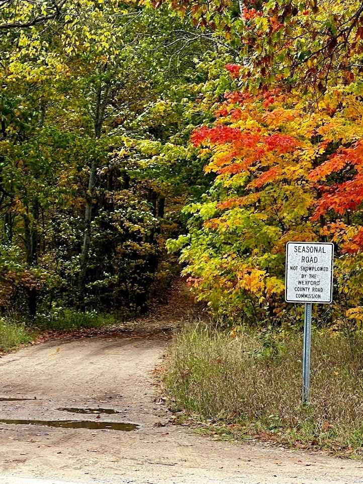
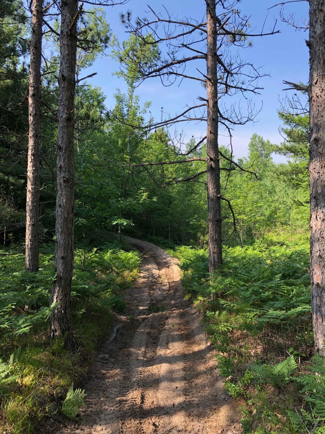
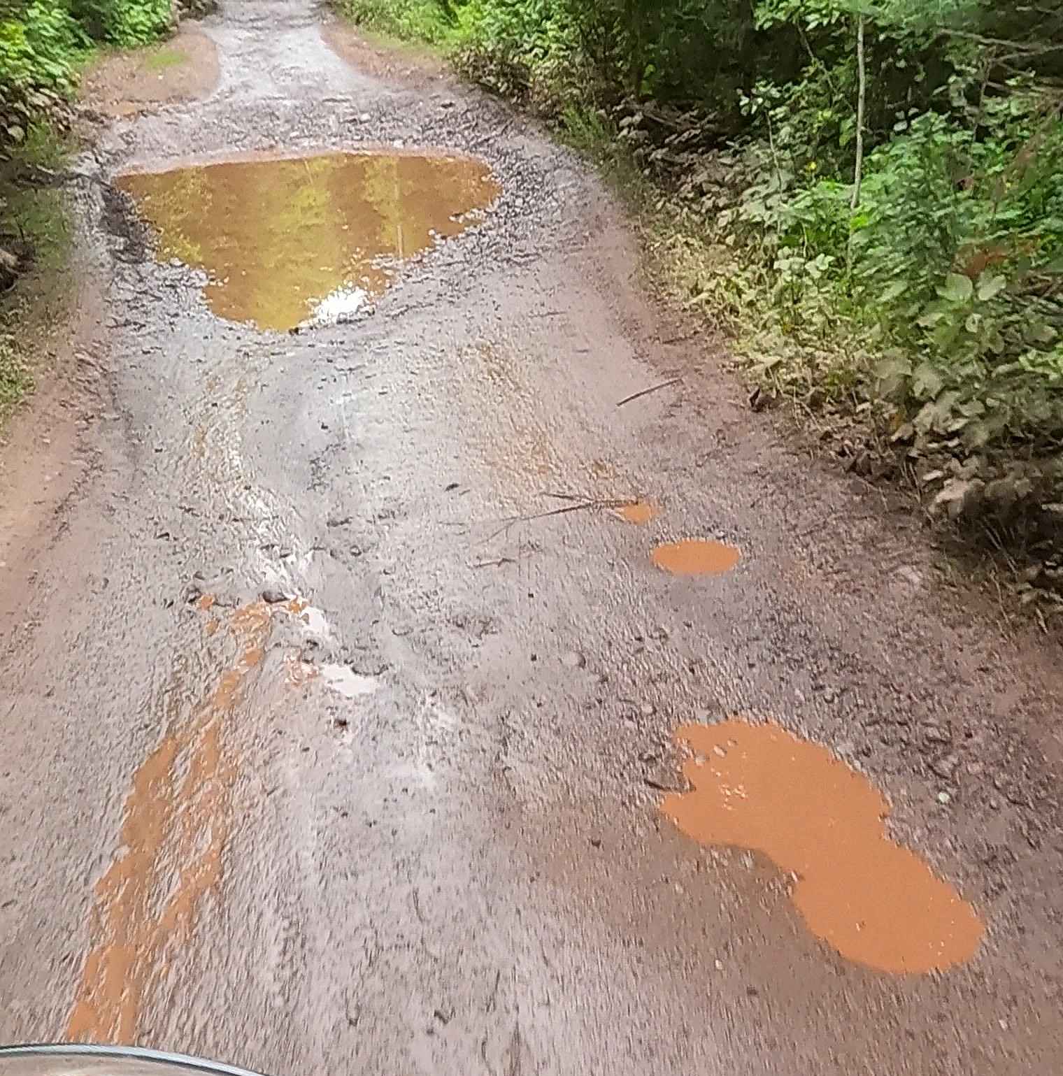
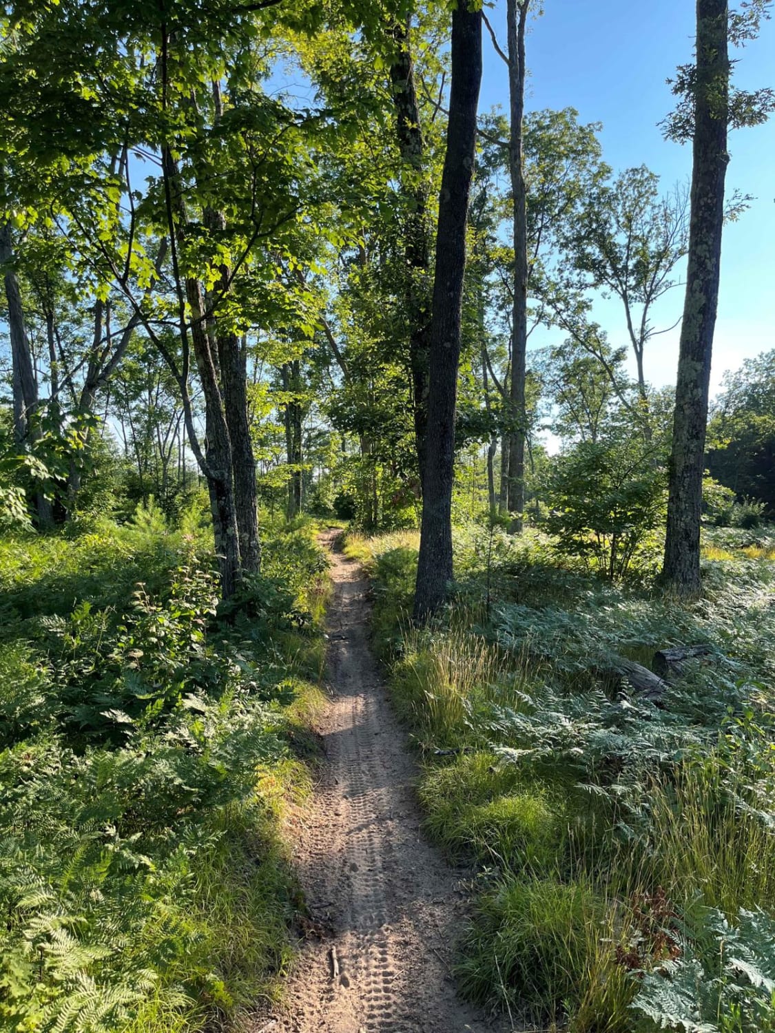
Trail Overview
This is an "out and back" trail that starts as a dirt road before switching into an easy two-track through the Cadillac Forest Management Unit. It makes a turn down the hill and it begins to slow down. At this turn, you'll cross over the Iron Belle Trail/North Country Trail. If you're unfamiliar with it, the Iron Belle Trail is a set of two trails that span the state of Michigan, one for biking and the other for hiking. The hiking trail when complete will be 1,204 miles long and the biking trail 828 miles long. Also, the North Country National Scenic Trail is a footpath stretching over 4,800 miles from Central Vermont to Central North Dakota. From the turn on this trail, you'll begin descending down toward the river. At the top of the hill, there's a sandy washed-out section that has a roughly 1-foot drop. There are typically logs stacked here. Even a vehicle with high clearance and 4WD can have fun here as the sandy trail can rut up and make this obstacle somewhat challenging. Just beyond the first obstacle, the trail turns into all soft sand. In the center of the trail is a large boulder. This boulder is probably about 18 inches or so tall. Be careful because the soft sand can get thrown onto this boulder and be deceiving; you may think there's no boulder until it's too late and you're on top of it. There's also very little room to navigate around each side of it. A high clearance 4X4 (with rock sliders) can navigate over top of this boulder, but please use caution. As you continue down the trail, it will continue to descend as you make some tight twists and turns through a beautiful forest. As you approach the river, the trail has a couple of small side hill areas as well as a few "flexy" areas where the trail suddenly has some large mounts on only one side of your tires. High clearance 4X4 should have no issue here. Once you get to the river, you'll continue left on the trail, traversing alongside the "bluff." You'll then come along a large campsite area overlooking the river. This space can accommodate a large group. Just beyond this campsite through one last section of trail is another opening on a bend of the Manistee River. This final stretch of trail ends in a shaded area that can host a medium-sized to small-sized group for a campsite as well as an open field that could host a large group right along the riverbank. Since it's technically a county road, use caution when traveling with a dirt bike, ATV, or SXS on this trail. Know before you go. This is a great trail to get off the beaten path, with some very scenic views and some more technical terrain for this area in Michigan. It's a fun, thrilling, and beautiful trail.
Photos of No. 19 Road
Difficulty
The trail starts off as a dirt road, turning into a dirt and muddy two-track. It switches into a sandy trail before going back to dirt as you descend towards the river. Between the loose and soft sand, the drop-off and the logs, the large boulder in the center of the trail in the loose soft sand, the tight twisting tree sections, as well as the side hilling and "flexy" areas, this trail is rated as a 4. A Subaru or a standard SUV is not recommended for this trail, but a stock Jeep Wrangler should be able to navigate this "difficult" trail with good tire placement and good driving.
Status Reports
No. 19 Road can be accessed by the following ride types:
- High-Clearance 4x4
No. 19 Road Map
Popular Trails
North Missaukee Trail - 14478 & 14167
Schlatter Lake Trail
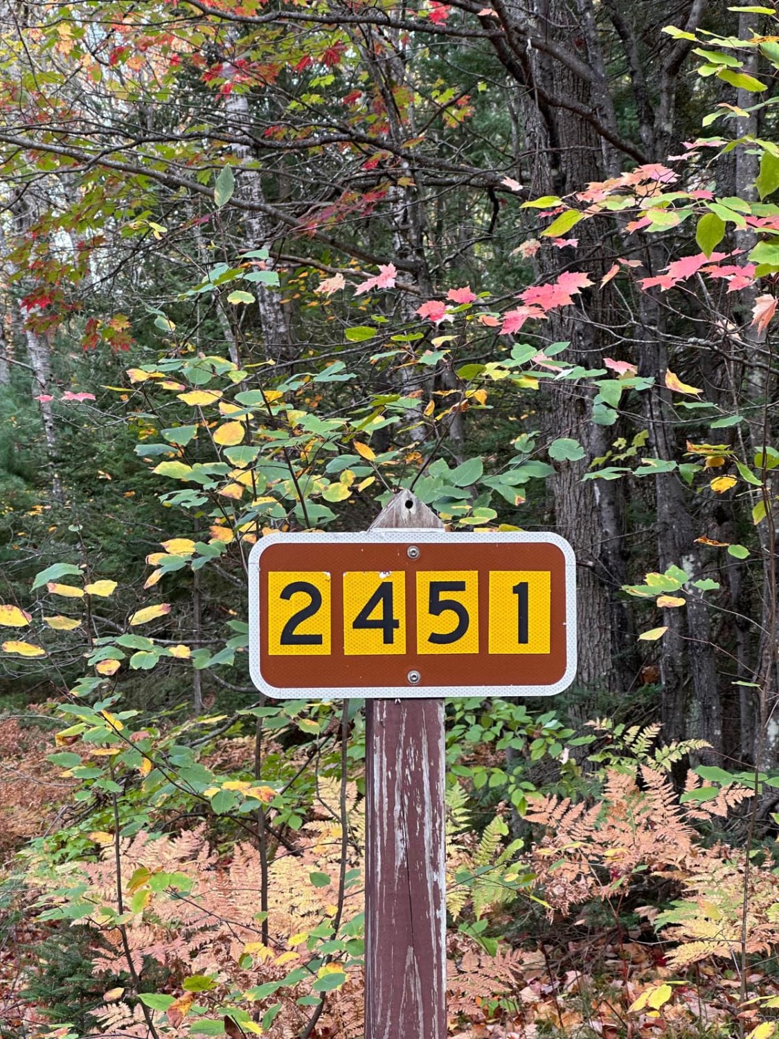
Deer Creek - FS 2451
Tin Cup Springs Motorcycle Trail
The onX Offroad Difference
onX Offroad combines trail photos, descriptions, difficulty ratings, width restrictions, seasonality, and more in a user-friendly interface. Available on all devices, with offline access and full compatibility with CarPlay and Android Auto. Discover what you’re missing today!