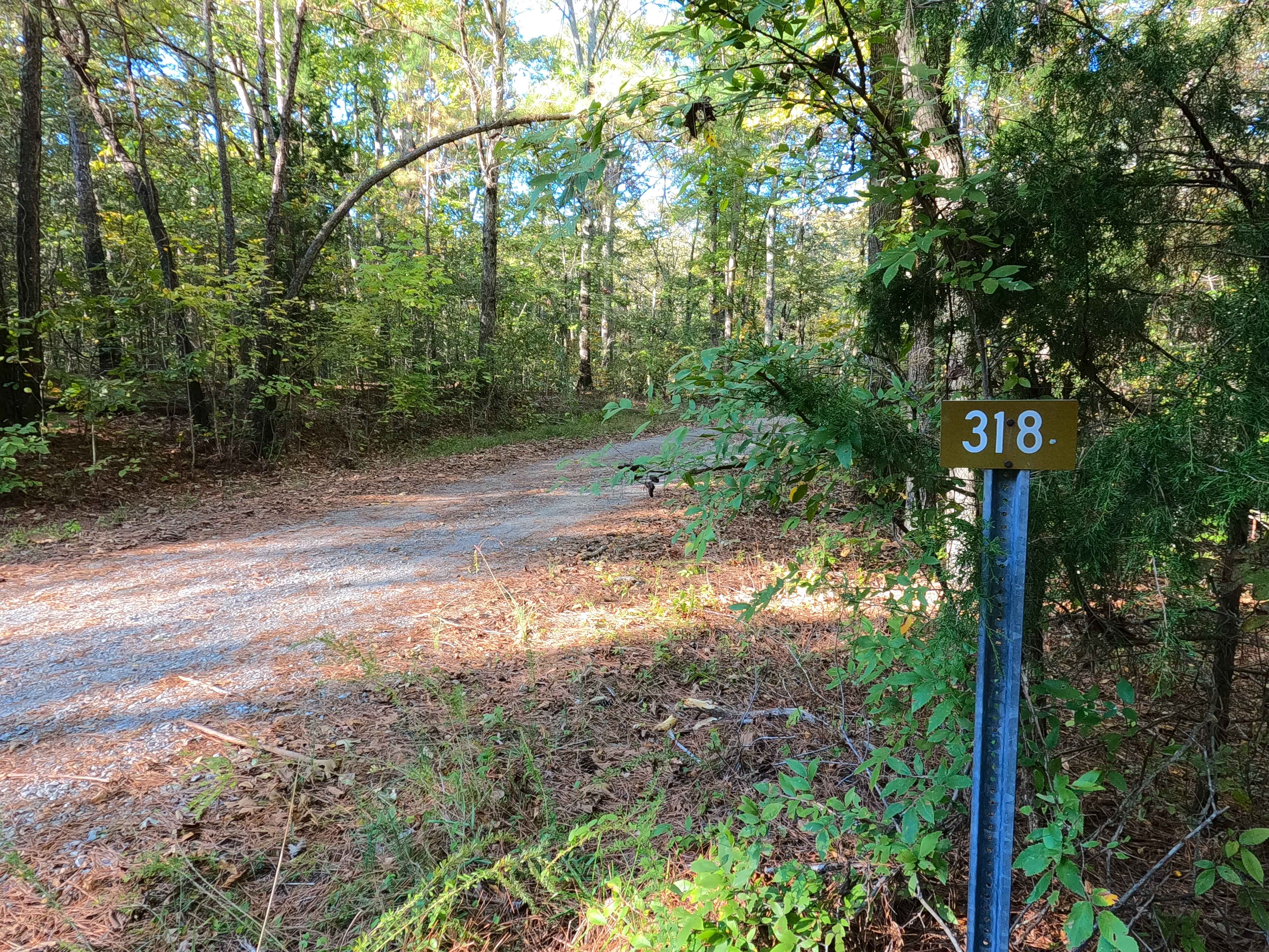
Sugar Creek - FS 318
Total Miles
2.1
Technical Rating
Best Time
Spring, Summer, Fall, Winter
Trail Type
Full-Width Road
Accessible By
Trail Overview
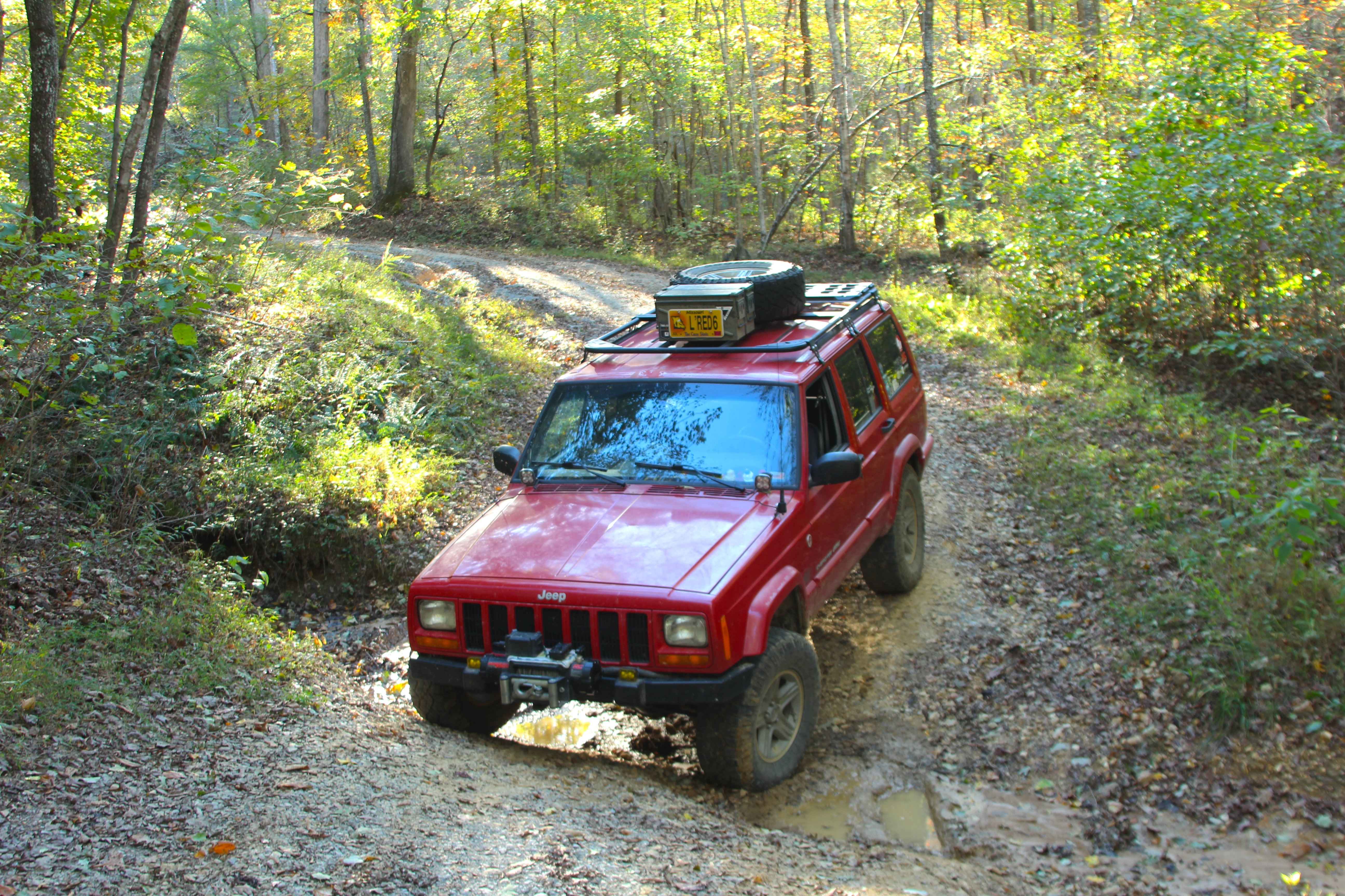
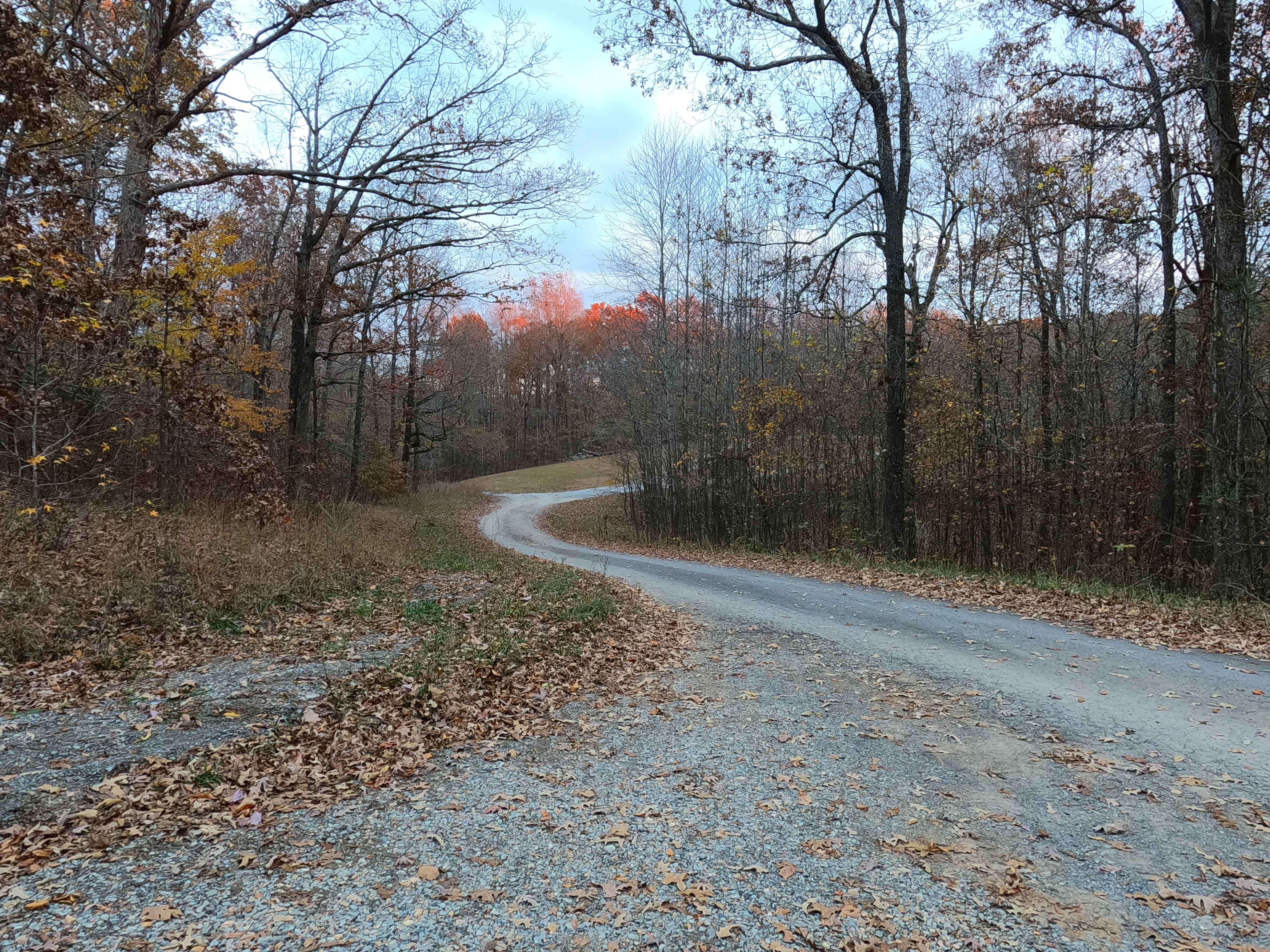
Sugar Creek Road (FS 318) is a natural-improved forest service road through the center-west Kentucky section, Kentucky Lake side, of the Land Between the Lakes National Recreation Area. Sugar Creek connects between the Pinnegar Cemetery (FS 139) to the north, and Ironton Road I (FS 140) to the south, crossing from ridge to ridge going into the valley bottoms that host the North Fork Sugar Creek. The terrain goes from gravel on either end, rapidly becoming rutted and washed away, turning into a natural path of rock and dirt, crossing the creek in several places along the valley bottoms, featuring creek gravel, mounded sandy washes, and mud. One section alongside a cornfield between two of the creek crossings turns into a full dirt path, with major rutting and moderate mud holes, created from the mix of heavy use with damp conditions of the nearby creek. On the north side of the valley bottoms, the road passes closely by a short hiking path on the east known as the Sugar Jack Spring, which trickles to the west past FS 318 into the Sugar Creek, before going further west and meeting the Sugar Bay. Ultimately, a fun road to hit for a shorter length thrill, but it still contains all the Land Between the Lakes 300 road elements.
Photos of Sugar Creek - FS 318
Difficulty
Sugar Creek (FS 318) is given a base rating of 4/10 for the water crossings, ranging between the splash to 12 inches in depth, with the active erosion ruts and washes leaning into the 18 inch range on the mildly graded hills, and the ruts and mud holes being a similar 18 inches in depth along the field section of the trail, with high potential to be completely surface mud when wet. Difficulty would increase in times of wet conditions, inclement weather, or from further heavy use and lack of maintenance. The road could be mended and see a difficulty rating drop, especially in the field section. If that section were fixed, the road could see a likely drop to as low as a 2/10, more likely a 3/10 rating, leaving the creek crossings as the main consistent feature.
History
In OnX Offroad History, the early days of the OnX Offroad service, large routes were more so common, as to cover more ground and gave a broader idea of what a larger geographical region looked like. Within LBL this included "Geezers Part 1" which included (from north to south) the FS roads 316, 139, 318, 140, and 141, forming an 11-mile route looping with the Woodland Trace FS 100. Geezers was broken down in late 2025 to give a more accurate and detailed look at each of these roads individually, except FS 140, which is paved.
Status Reports
Sugar Creek - FS 318 can be accessed by the following ride types:
- High-Clearance 4x4
- SUV
Sugar Creek - FS 318 Map
Popular Trails
Bethlehem Cemetery - FS 122

Green Branch Road - FS 409

Curry Road - FS 311

The onX Offroad Difference
onX Offroad combines trail photos, descriptions, difficulty ratings, width restrictions, seasonality, and more in a user-friendly interface. Available on all devices, with offline access and full compatibility with CarPlay and Android Auto. Discover what you’re missing today!