Panther Gulch - Imperial Connect
Total Miles
1.4
Technical Rating
Best Time
Fall, Summer, Spring
Trail Type
Single Track
Accessible By
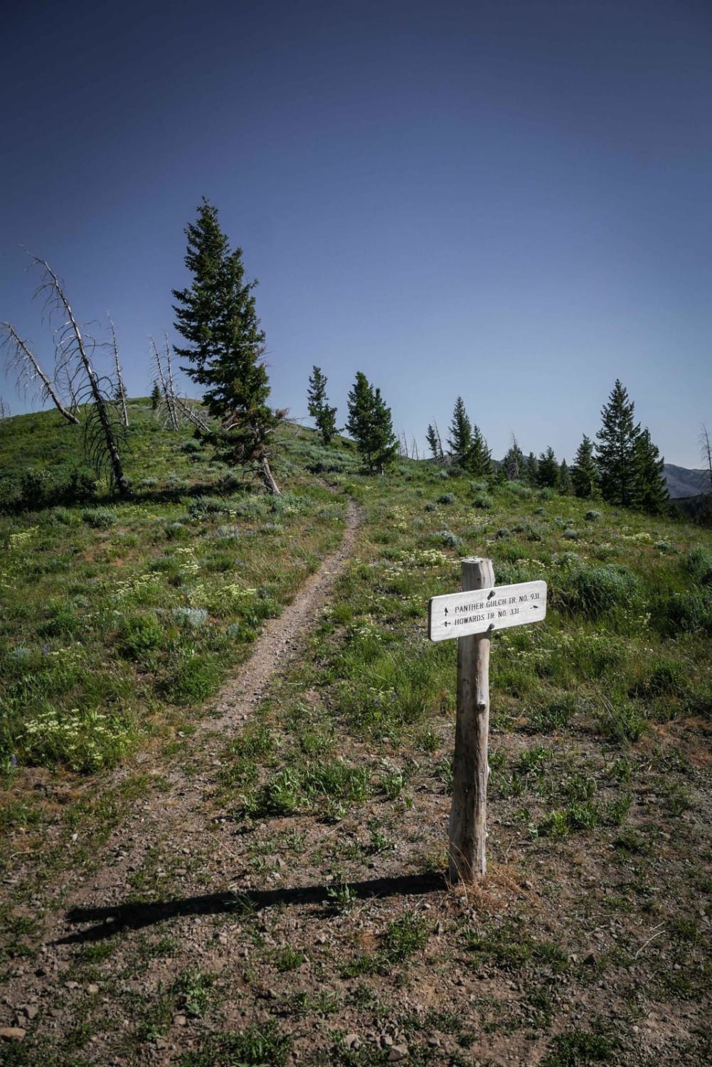
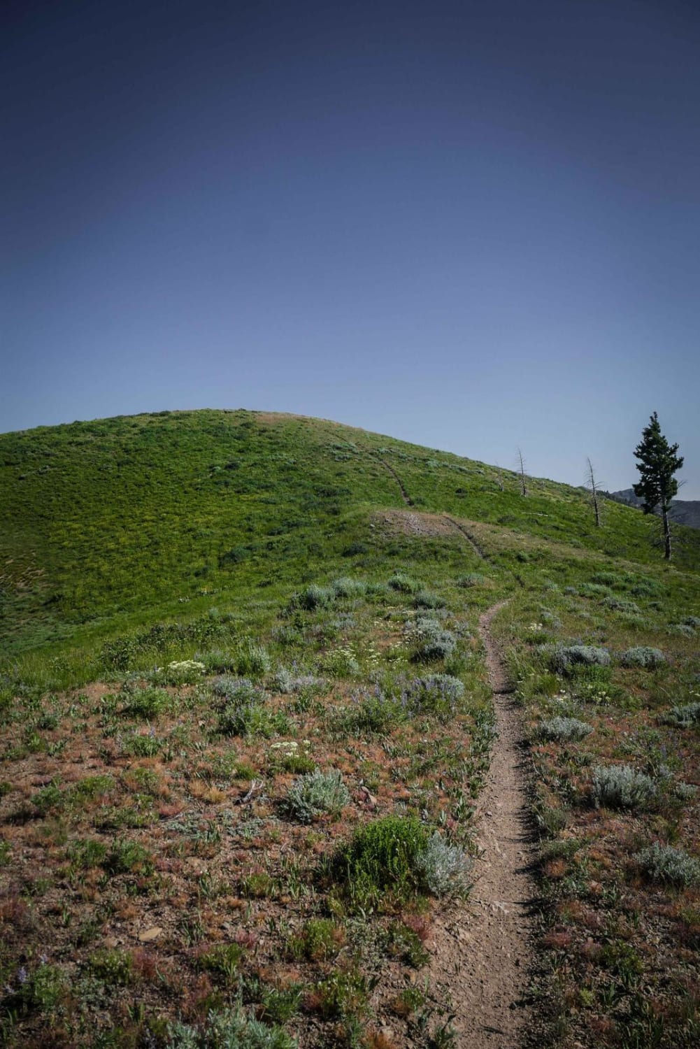
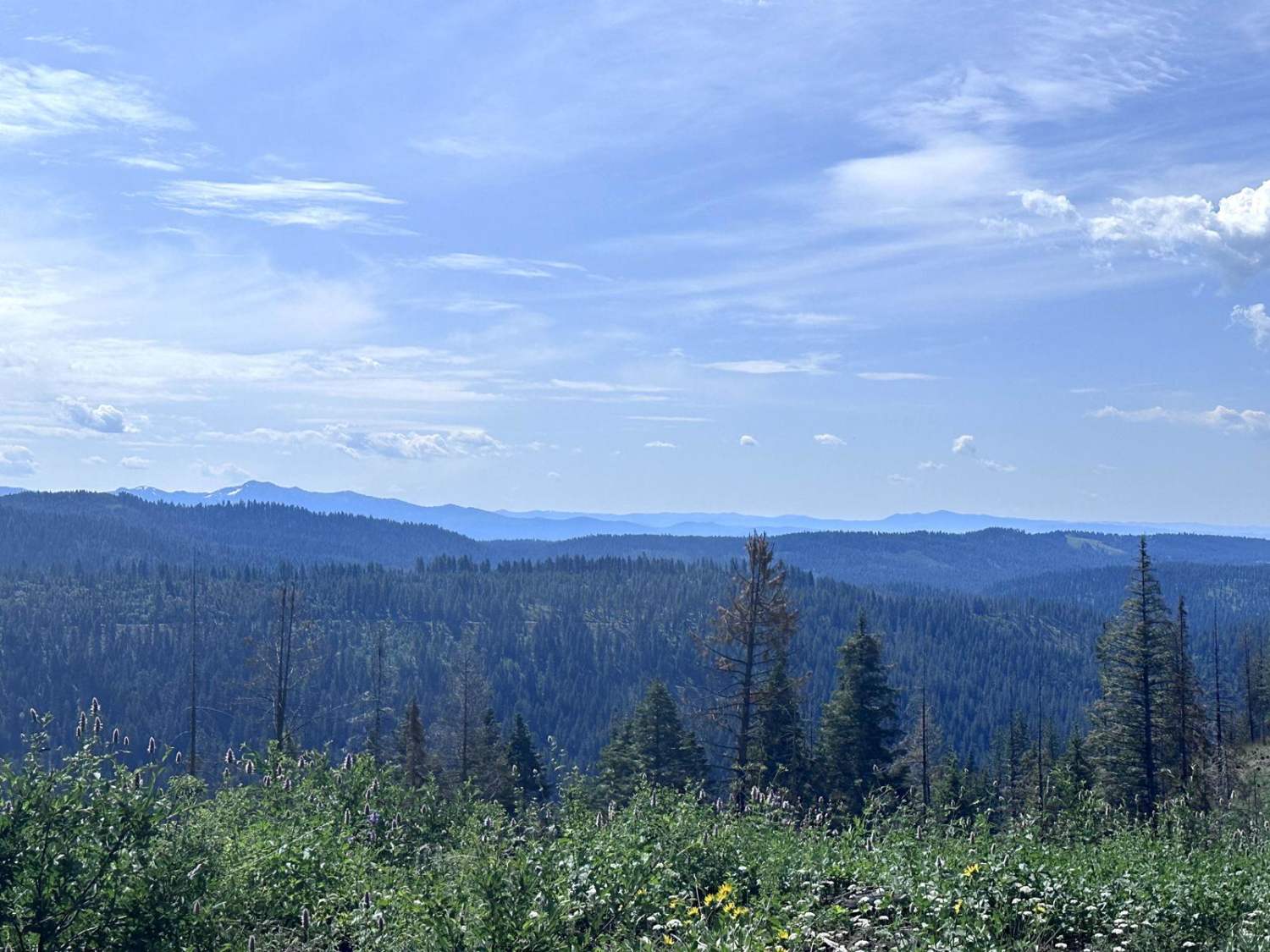
Trail Overview
This short but moderately challenging connector trail starts on a saddle at the intersection with Howard's Trail and goes along an exposed spine with no trees on a narrow trail with lots of loose rock. It goes up and over several rolling hillsides as a ridge line trail, with several climbs and descents up to the top of each hill from each saddle between the hills. There is one really long steep hill with loose rock on loose dirt that is a bit rutted and requires lots of throttle and clutch control to go up. There are a couple of sections of chunky jagged embedded rock in the trail creating little ledges that are not too difficult because there are multiple lines to choose from. The south end of the trail crosses the switchbacks of Panther Gulch Road as it connects with this road. This is a great connector trail to take from the northern part of the Greenhorn trail system to access the southern trails off of Deer Creek Road, or to access the northern trails if camped on Deer Creek Road.
Photos of Panther Gulch - Imperial Connect
Difficulty
Intermediate difficulty due to long climb (or descent) with loose rock on loose dirt surface.
Status Reports
Panther Gulch - Imperial Connect can be accessed by the following ride types:
- Dirt Bike
Panther Gulch - Imperial Connect Map
Popular Trails
Snake River Overlooks
Old Stage Road - Salmon River Idaho
Meadows Goose Lake
Anderson Butte Lookout
The onX Offroad Difference
onX Offroad combines trail photos, descriptions, difficulty ratings, width restrictions, seasonality, and more in a user-friendly interface. Available on all devices, with offline access and full compatibility with CarPlay and Android Auto. Discover what you’re missing today!