Oberlin Trail
Total Miles
5.0
Technical Rating
Best Time
Spring, Winter
Trail Type
Full-Width Road
Accessible By
Trail Overview
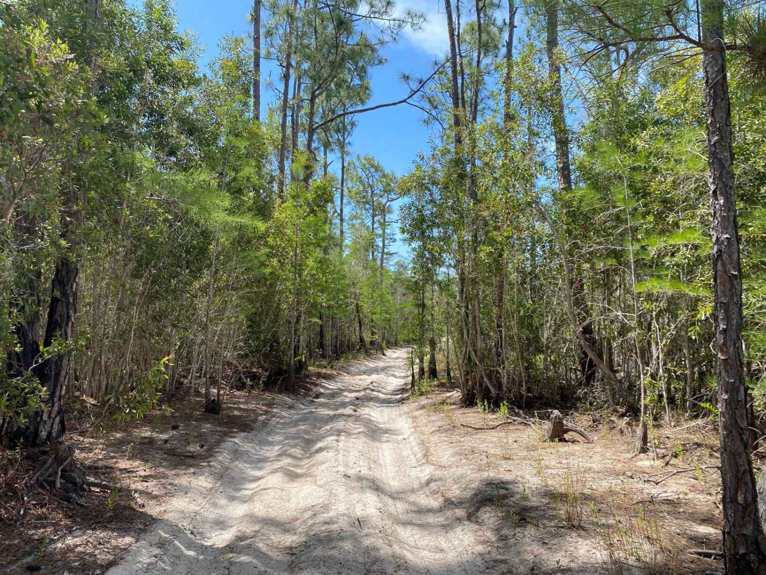
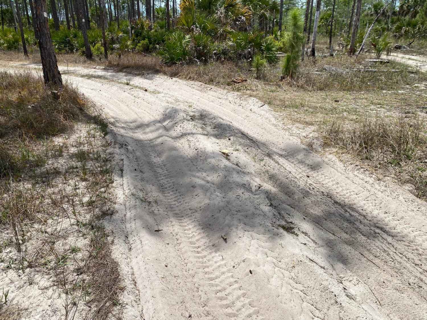
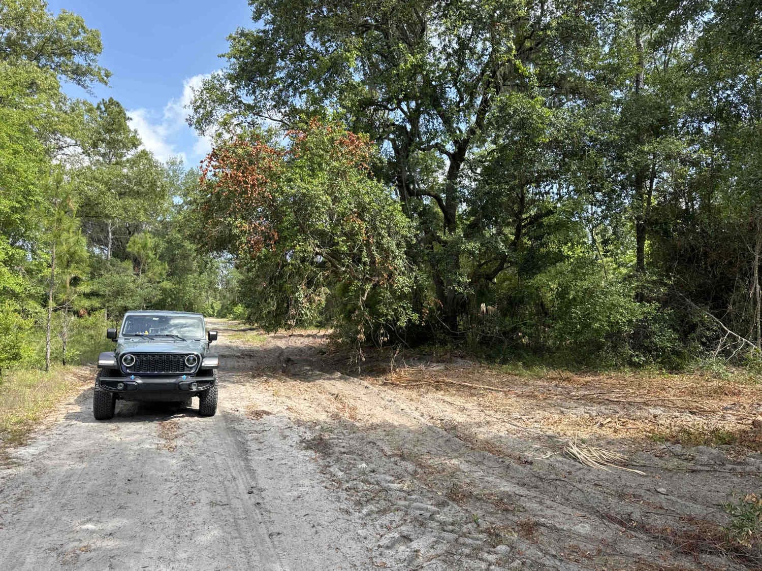
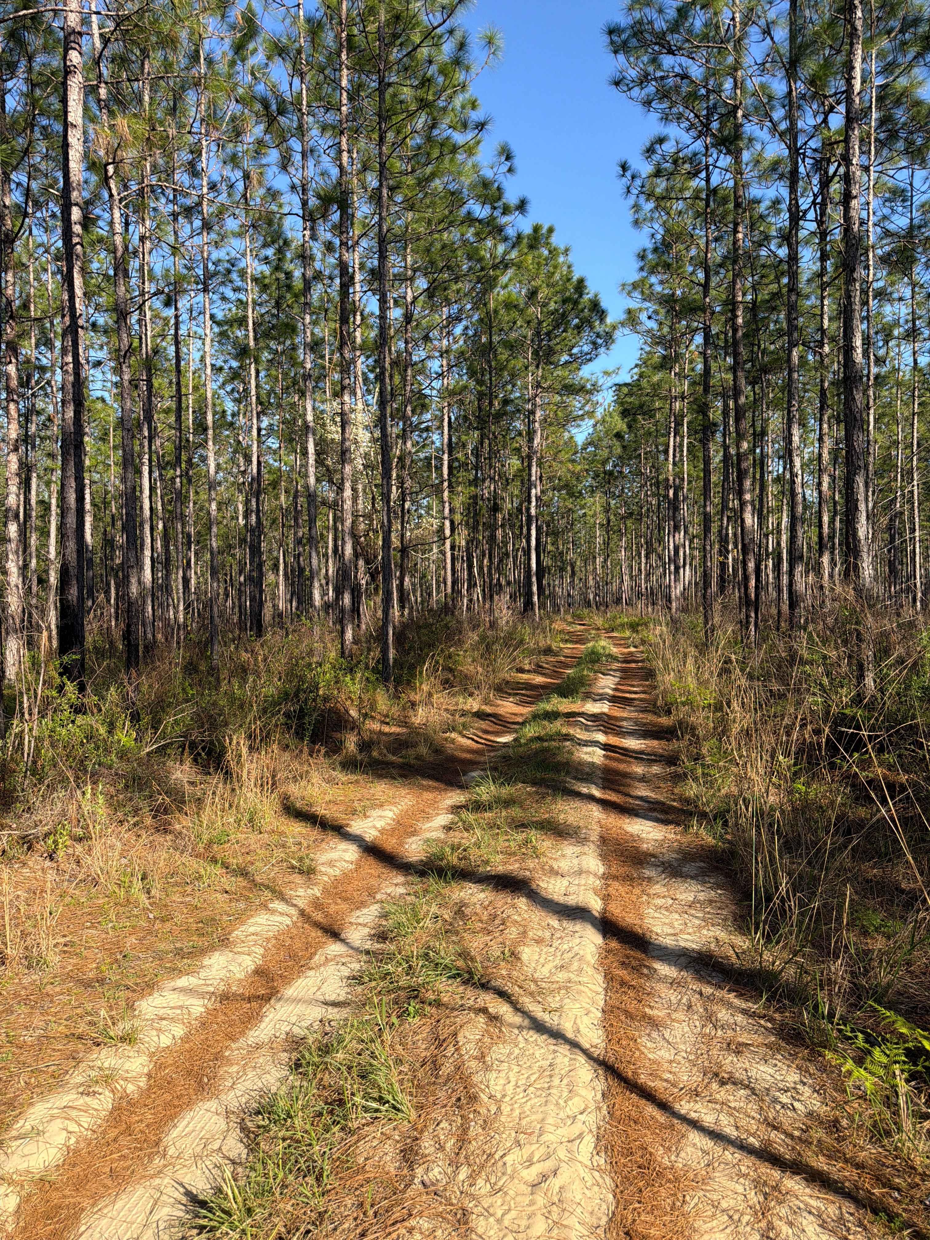
This trail is located within the Picayune Strand State Forest and the Florida Fish and Wildlife Commission's (FWC) Picayune Strand Wildlife Management Area (WMA). This trail and WMA are open to public recreational access year-round. Although access is open year-round, it is limited to registered motor vehicles. The use of airboats, all-terrain vehicles, recreational off-highway vehicles (side-by-sides), swamp buggies, tracked vehicles, or unlicensed or unregistered motorcycles is prohibited. Class 1 electric bicycles may be operated according to rules for traditional, non-motorized bicycles. All other electric bicycles may be operated only on named or numbered roads open to motorized vehicles. The trail extends from West Sabal Palm Road to the RCW Way trail. The trail will have painted white blaze patches on trees along the trail to help mark trail boundaries. Areas off-limits to vehicles are posted with signage. Stay on the designated trail and do not extend beyond the blazed boundary limits. Most of the trail is very tight, barely single vehicle wide, with little or no areas to pull off or turn around. The trail traverses across a variety of wildlife habitats ranging from cypress swamps, wetland marsh prairies, strands of bottomland hardwoods, upland pine land flats, and oak hammocks. The trail bottom varies as it crosses these ecosystems and habitats. The trail coming off West Sabal Palm Road is very deep and loose sugar sand, with numerous deep ruts. 4WD was needed to traverse this area. Other areas of the trail vary greatly. The trail bottom can be loose deep sand, then transition to loose soft dirt, then into compacted dirt/sand, then areas of mud or areas having large rocks and dirt. These transitions can occur quickly, turning from solid, compacted tracks to deep, loose material that will hang a vehicle not equipped properly. The grades on the trail also vary; there are some areas where the trail drops off several feet in elevation, through marsh areas. There are numerous tight/blind corners with moderate banking. These areas frequently have soft, loose sand, which may affect the handling of the vehicle. The trail is also very heavily rutted, with large rocks, stumps, and buried branches or remnants of fallen trees that could potentially damage the undercarriages of low-clearance vehicles. Note that much of this trail may be very wet with deep mud during summer, and as late as early-mid winter. There are numerous areas that can have deep sticky mud that can be up to 3' in depth. Even the bypass areas have deep rutting, and in the wet season, can be sticky with mud and difficult to cross. In addition to the mud, during the wet season, it is possible to encounter very deep water. This is not a maintained roadway, therefore, following storms, wind events, or wildfires, obstacles greater than 18" such as fallen trees, branches, exposed roots, stumps, rocks or washes/erosion is possible. Wildlife observation opportunities abound. There is a possibility of observing a variety of wildlife. This is being an active WMA and preservation area, there are several open hunting seasons starting late summer extending through Spring. This is bear and panther habitat, if you choose to venture away from your vehicle for a hike or walk remember to be aware of your surroundings, keep your pets on a leash, lock your vehicle and secure any food items. During drought conditions, wildfires can pop up quickly and unexpectedly, spreading fast. Watch the Department of Forestry website and the Florida Fish and Wildlife Commission website for any adversaries.
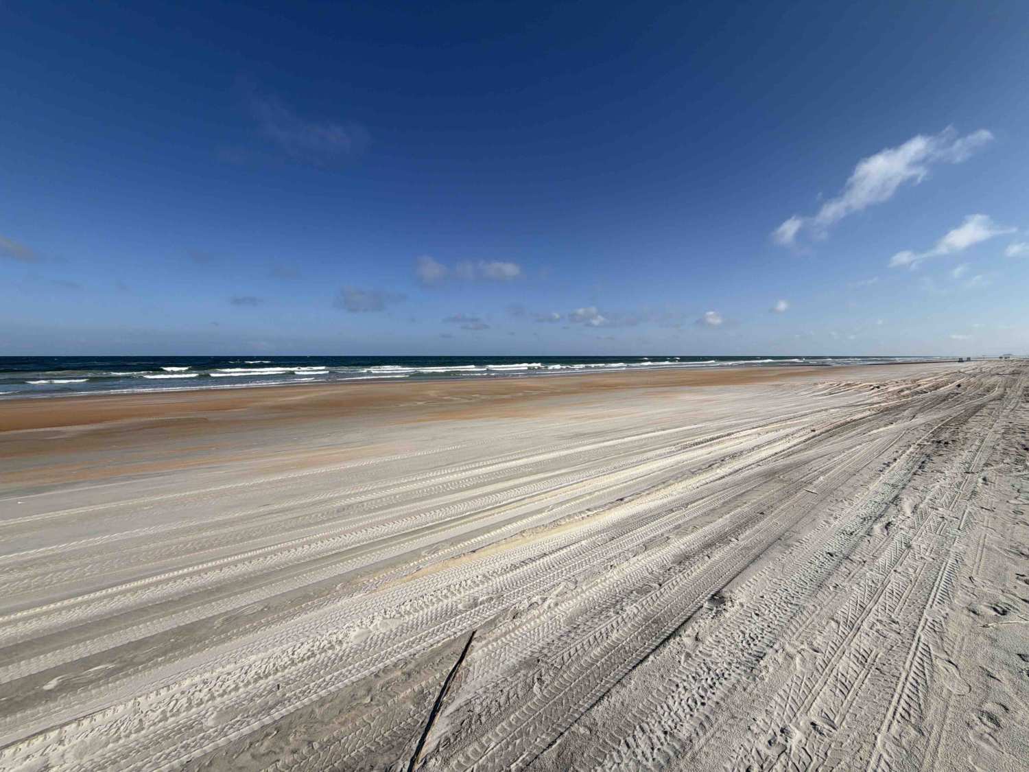
Photos of Oberlin Trail
Difficulty
The trail coming off West Sabal Palm Road is very deep and loose sugar sand, with numerous deep ruts. 4WD was needed to traverse this area. Other areas of the trail vary greatly. The trail bottom can be loose deep sand then transition to loose soft dirt, then into compacted dirt/sand, then areas of mud or areas having large rocks and dirt. These transitions can occur quickly, turning from solid compacted tracks to deep loose material that will hang a vehicle not equipped properly. The grades on the trail also vary, there are some areas where trail drops off several feet in elevation, through marsh areas. There are numerous tight/blind corners with moderate banking. These areas frequently have soft loose sand, which may affect handling of vehicle. The trail is also very heavily rutted, with large rocks, stumps, and buried branches or remnant of fallen trees that could potentially damage undercarriages of low clearance vehicles. Note much of this trail may be very wet with deep mud during summer to as late as early-mid winter. There are numerous areas that can have deep sticky mud that can be up to 3' in depth. Even the bypass areas have deep rutting and in wet season can be sticky with mud and difficult to cross. In addition to the mud, during wet season it is possible to encounter very deep water. This is not a maintained roadway, therefore, following storms, wind events, or wildfires, obstacles greater than 18" such as fallen trees, branches, exposed roots, stumps, rocks or washes/erosion is possible.
History
The Picayune Strand is part of the planned Everglades restoration project. The forest and surrounding lands play crucial and vital roles in the health of the Everglades ecosystem. In the 1940's and 1950's this land was logged for hardwoods. After logging of cypress and pines were completed, the land was sold to developers who planned the world's largest subdivision development, which later turned into a scam. In the mid 1980's the first purchase of lands to preserve the land was completed. Today, the forest is composed of nearly 75,000 acres dedicated to the Everglades restoration and preserving habitat for the Florida Panther and many other wildlife species.
Status Reports
Oberlin Trail can be accessed by the following ride types:
- High-Clearance 4x4
- SUV
- Dirt Bike
Oberlin Trail Map
Popular Trails
Jeep Trail - Grove Park South WMA

Cemetery Road
South Ormond Beach
The onX Offroad Difference
onX Offroad combines trail photos, descriptions, difficulty ratings, width restrictions, seasonality, and more in a user-friendly interface. Available on all devices, with offline access and full compatibility with CarPlay and Android Auto. Discover what you’re missing today!