The Maze Trail
Total Miles
5.5
Technical Rating
Best Time
Fall, Spring, Summer
Trail Type
Single Track
Accessible By
Trail Overview
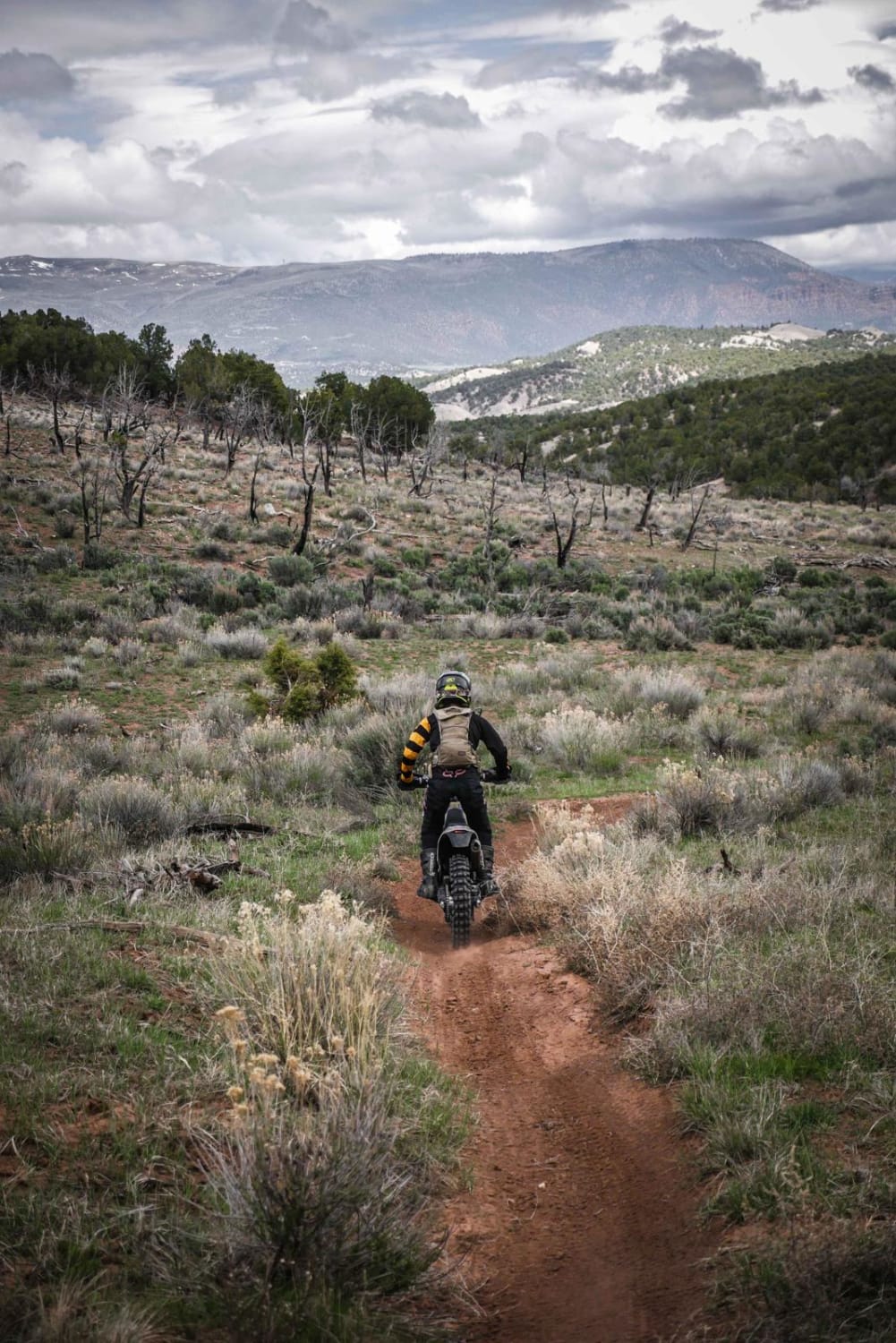
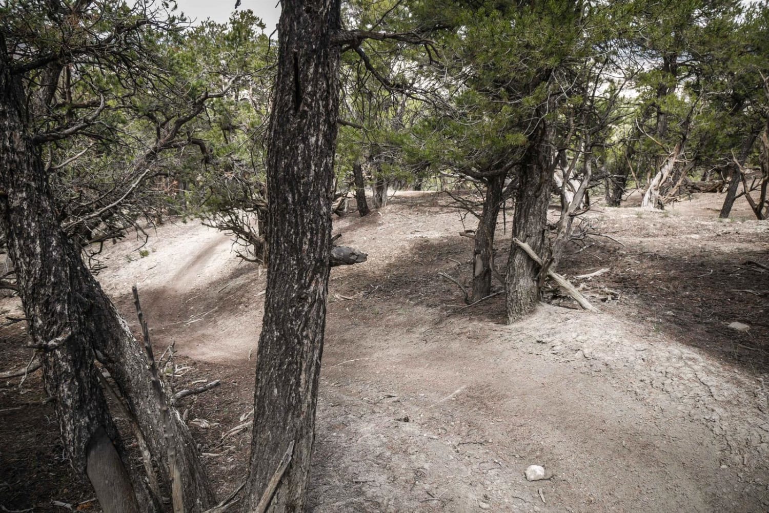
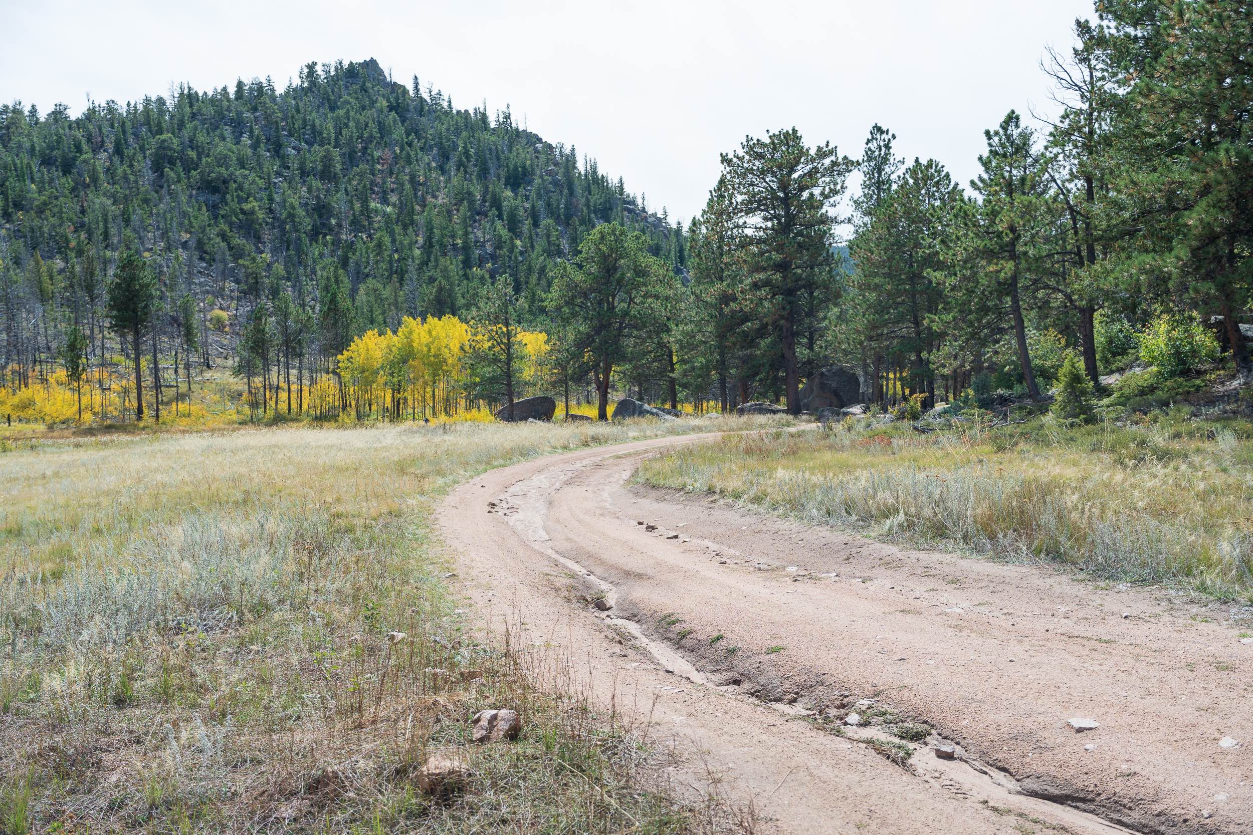
The Maze Trail is part of the Hardscrabble Trail System in Gypsum, Colorado, and is one of the closest trails to the staging area accessed off of Spring Creek Road. It starts winding in and out of the pinyon trees near the staging area, the first section being more like a practice loop in a play area rather than a defined single trail. It has tight turns through the trees, crossing lots of intersections with roads where everyone camps and stages. It would be impossible to follow this exact route without a GPS track, especially because there are no trail markers in the beginning. Eventually, it becomes more of a single defined track as it leaves the play area. It still weaves in and out of the pinyon pine trees with tight curvy turns, small roots and rocks, low branches, but no big obstacles. The beginning is a great practice loop or warm up for your ride, or good for beginners. There is an offshoot that connects to the jeep road that goes back to the camping and staging areas. After this spur, the trail crosses road 830, and there is a trail sign for the entrance to the second part of the trail, which is a more defined single track and looks more ridden. It is similar to the beginning with tight twisty turns. The trail is smooth dirt with not many rocks, some tree pinches, and has moderate accents and descents. For example, there are steep short climbs with a tight turn at the top with trees closely lining the trail. There are lots of brake bumps that make the climbs and downhills more difficult. Keep your eyes up and watch your handle bars on the trees. The trail opens up out of the trees at the end with an awesome view towards the town of Eagle, red cliffs and snow-capped mountains. Taking the Maze from the staging area is the best way to access most of the other single track in this trail system. From here you can get on several other trails including Easy Rider or Cat Walk. This is a shared-use trail close to town, so it gets higher use. You may see a hiker or mountain biker, or deer.
Photos of The Maze Trail
Difficulty
This is an easy trail with lots of tight twisty turns through pinyon pine. It is aptly named the Maze because it is very much a maze through the trees. The hardest part of the first half of the trail is route finding due to all of the other intersections, and a GPS track is necessary to follow this exact route. The hardest part about the second half of the trail is all the brake bumps.
The Maze Trail can be accessed by the following ride types:
- Dirt Bike
The Maze Trail Map
Popular Trails
Little Cimarron Creek
Forest Service Road 181A
Happy Platte Road Forest Road 295
The onX Offroad Difference
onX Offroad combines trail photos, descriptions, difficulty ratings, width restrictions, seasonality, and more in a user-friendly interface. Available on all devices, with offline access and full compatibility with CarPlay and Android Auto. Discover what you’re missing today!