Snow Mesa Trail
Total Miles
5.0
Technical Rating
Best Time
Summer
Trail Type
Single Track
Accessible By
Trail Overview
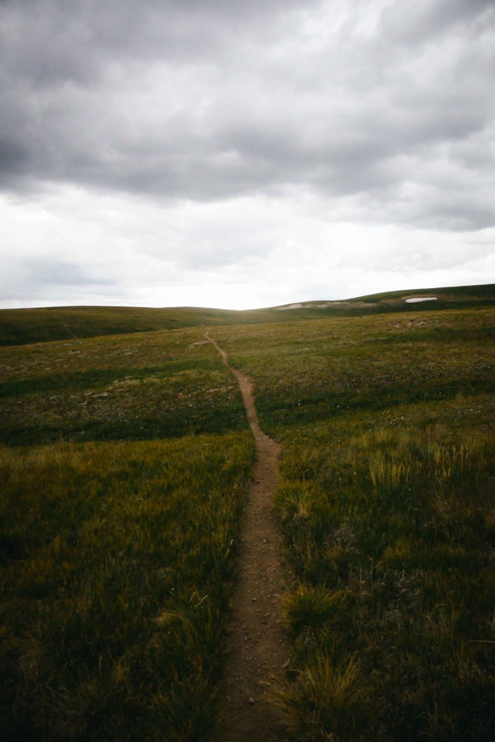
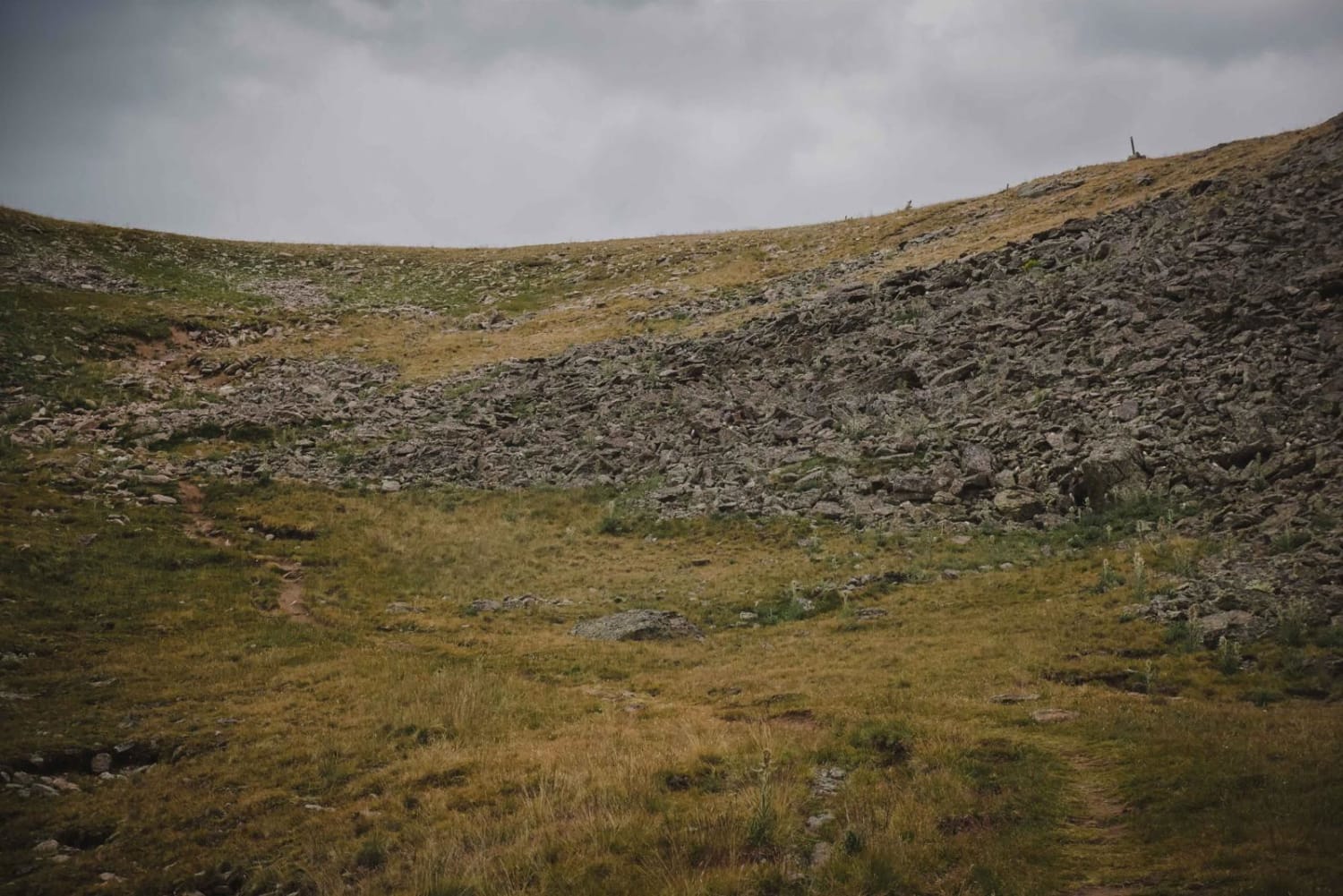
The Snow Mesa single track starts at 12,000 feet up on a flat mesa in the tundra. The east end of the trail is not very rocky and is pretty smooth dirt. It's a very straight trail for a long way with epic views from this elevation. It has a couple of washouts to be careful of. Then it drops down a nasty rocky switchback section with some tricky hard enduro moves that would be required if going up. It gets easier after this quarter-mile section and then goes through a pine tree forest down to the west end of the trail, where it dumps out at Highway 149. There is a river crossing required to get to the highway, which has been cut out as a pinch point, but it makes it more difficult to cross.
Photos of Snow Mesa Trail
Difficulty
This trail is a 7 difficulty due to the one rocky climb with switchbacks, otherwise, the rest of the trail is pretty easy.
Status Reports
Snow Mesa Trail can be accessed by the following ride types:
- Dirt Bike
Snow Mesa Trail Map
Popular Trails

Blanco River Road-Fr Rd 656

Right Hand ATV Trail
Penrose Commons BLM#6102A
The onX Offroad Difference
onX Offroad combines trail photos, descriptions, difficulty ratings, width restrictions, seasonality, and more in a user-friendly interface. Available on all devices, with offline access and full compatibility with CarPlay and Android Auto. Discover what you’re missing today!