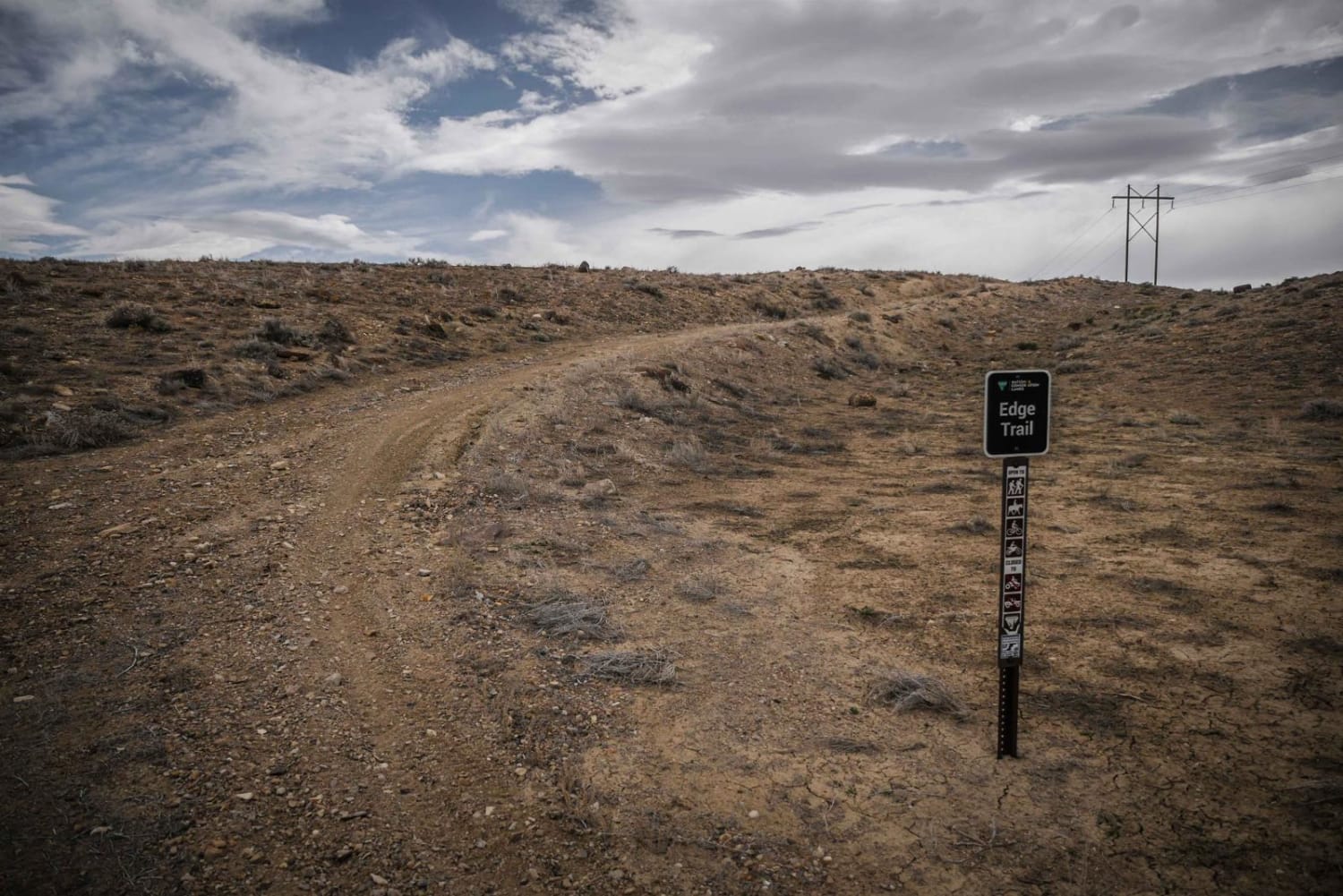
Edge Trail
Total Miles
1.5
Technical Rating
Best Time
Fall, Spring
Trail Type
Single Track
Accessible By
Trail Overview
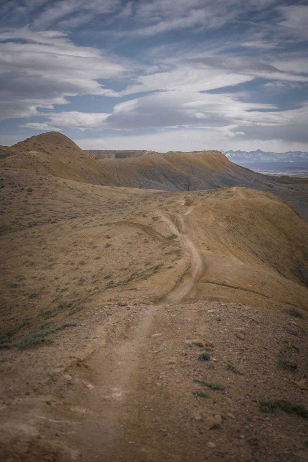
The Edge Trail is an adobe ridgeline trail in the Peach Valley Recreation Area that goes through an adobe clay badlands landscape. Starting from the northern trailhead, it starts wide but narrows up on the first adobe ridge lines. While on the ridge, you can see straight down to the steep grey fins of the hills below you, which is a crazy feeling. It's easy to miss a left turn, in the beginning, to stay on this trail because there is a right turn that looks more ridden. The right turn (which is the wrong turn) goes down a grey adobe hill that takes you off of the ridge line onto a wide whooped-out track on the ridge lines of a hill below you. Stay left instead even though it looks less ridden, and it continues along an epic narrow ridge line. It's a mix of soft adobe hills, and hills that are more dirt mixed with adobe with loose rock on the surface. This trail differs from some of the other trails through the badlands because of the addition of small rocks on the surface, whereas most of the adobe ridge line trails are super smooth on clay with zero rocks. There still aren't any big rock obstacles or ledges on this trail, but there is a loose rocky downhill when you reach the fence line down to the end of the trail. The south trailhead meets up with the Candy Cane ATV Loop. This is a short and fun trail riding on the edge. If riding north, you can continue north onto the Ditch Run Trail, but at this point you are nearing the northern end of the trail system and more trails can be accessed by heading south again. Visit this area in the spring or fall for good riding temperatures and not much moisture. Wildlife sightings are rare out here but you may see a fox running across the badlands.
Photos of Edge Trail
Difficulty
Easy ridge line trail with narrow spines, smooth dirt and no obstacles.
Status Reports
Edge Trail can be accessed by the following ride types:
- Dirt Bike
Edge Trail Map
Popular Trails
Music Pass Road


BLM Route 015
The onX Offroad Difference
onX Offroad combines trail photos, descriptions, difficulty ratings, width restrictions, seasonality, and more in a user-friendly interface. Available on all devices, with offline access and full compatibility with CarPlay and Android Auto. Discover what you’re missing today!