Chinook Road
Total Miles
2.8
Technical Rating
Best Time
Summer, Fall
Trail Type
Full-Width Road
Accessible By
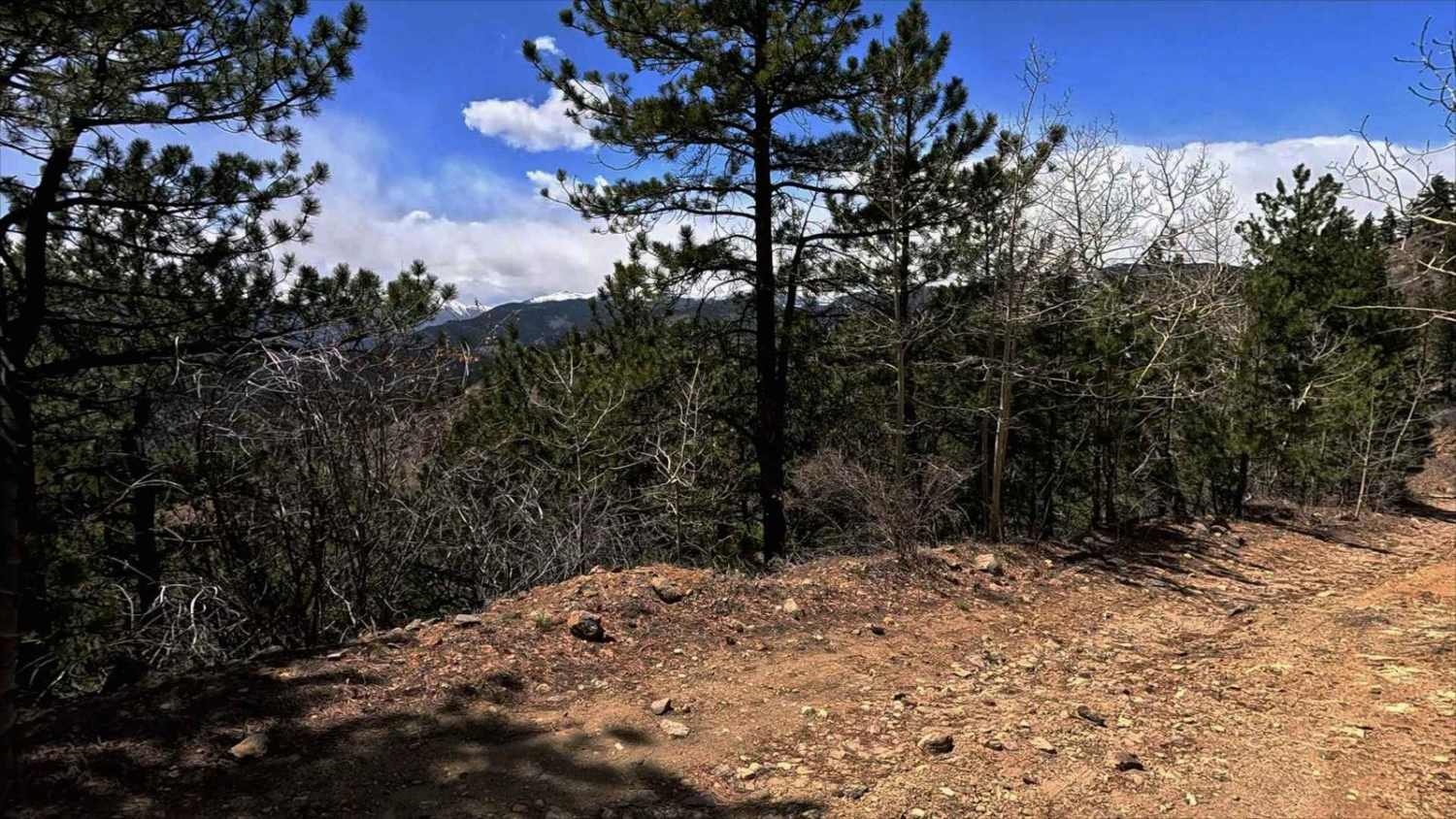
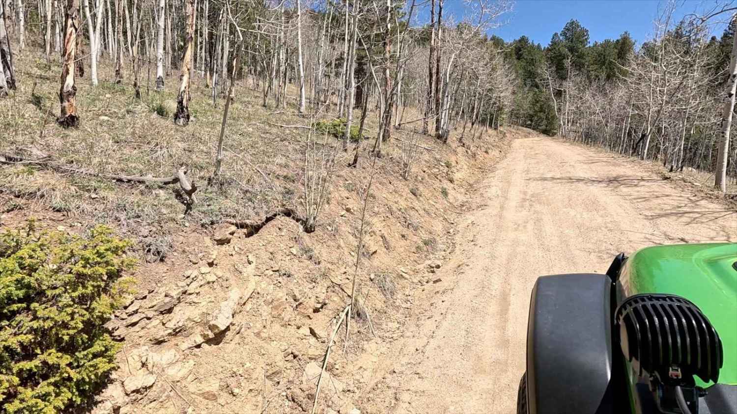
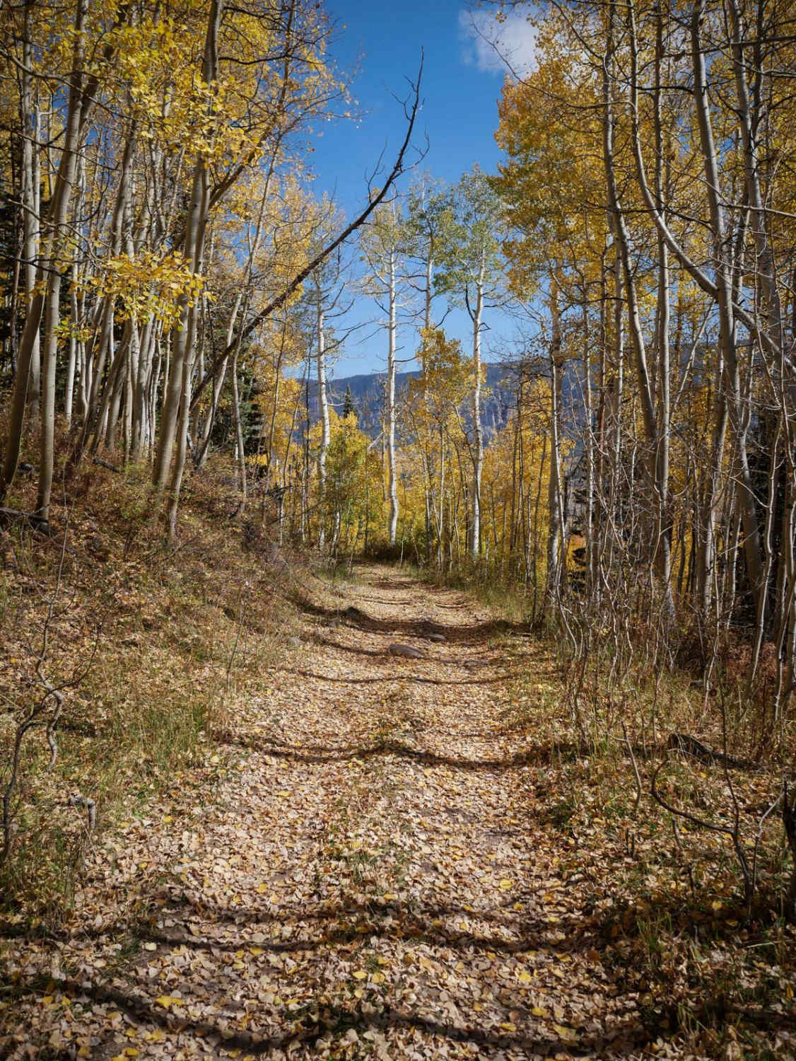
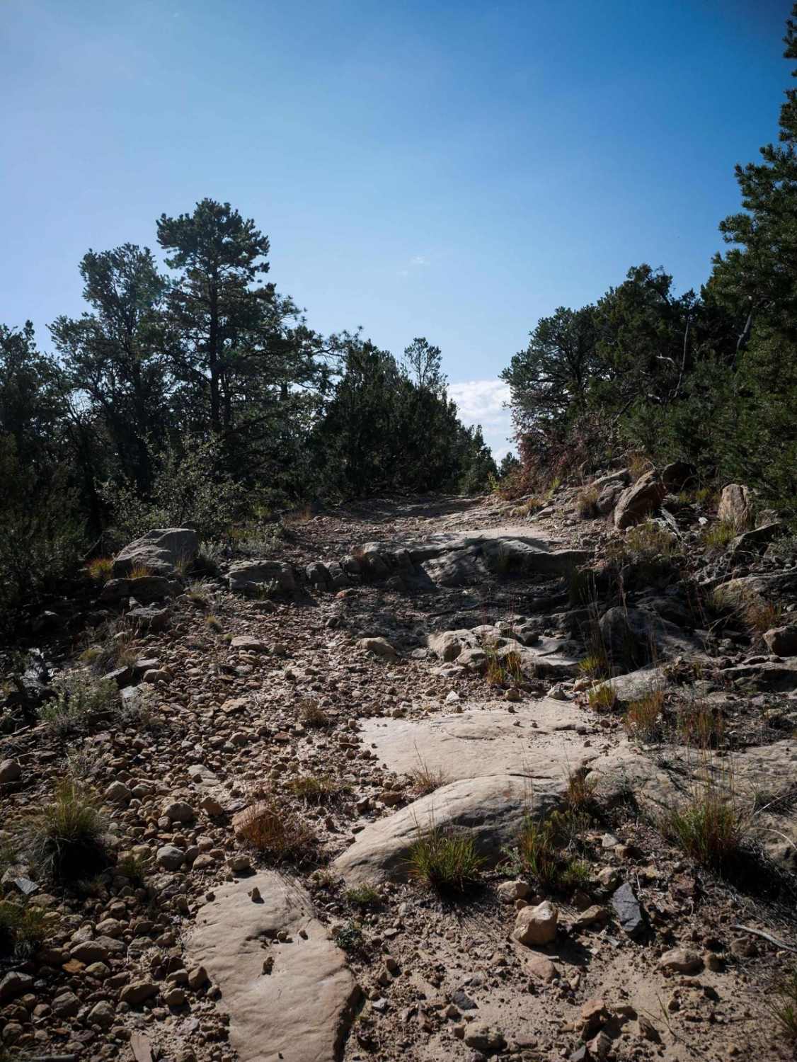
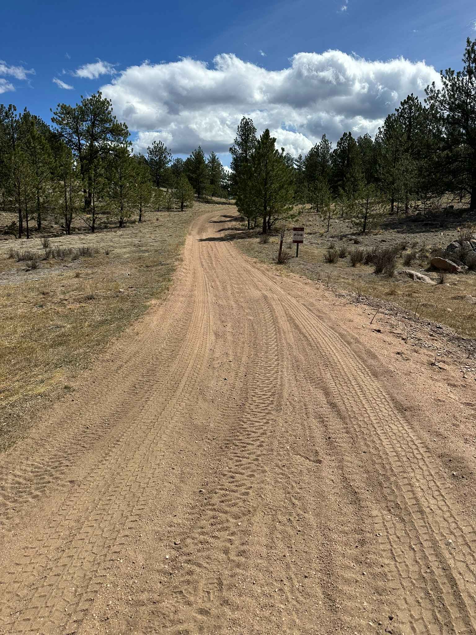
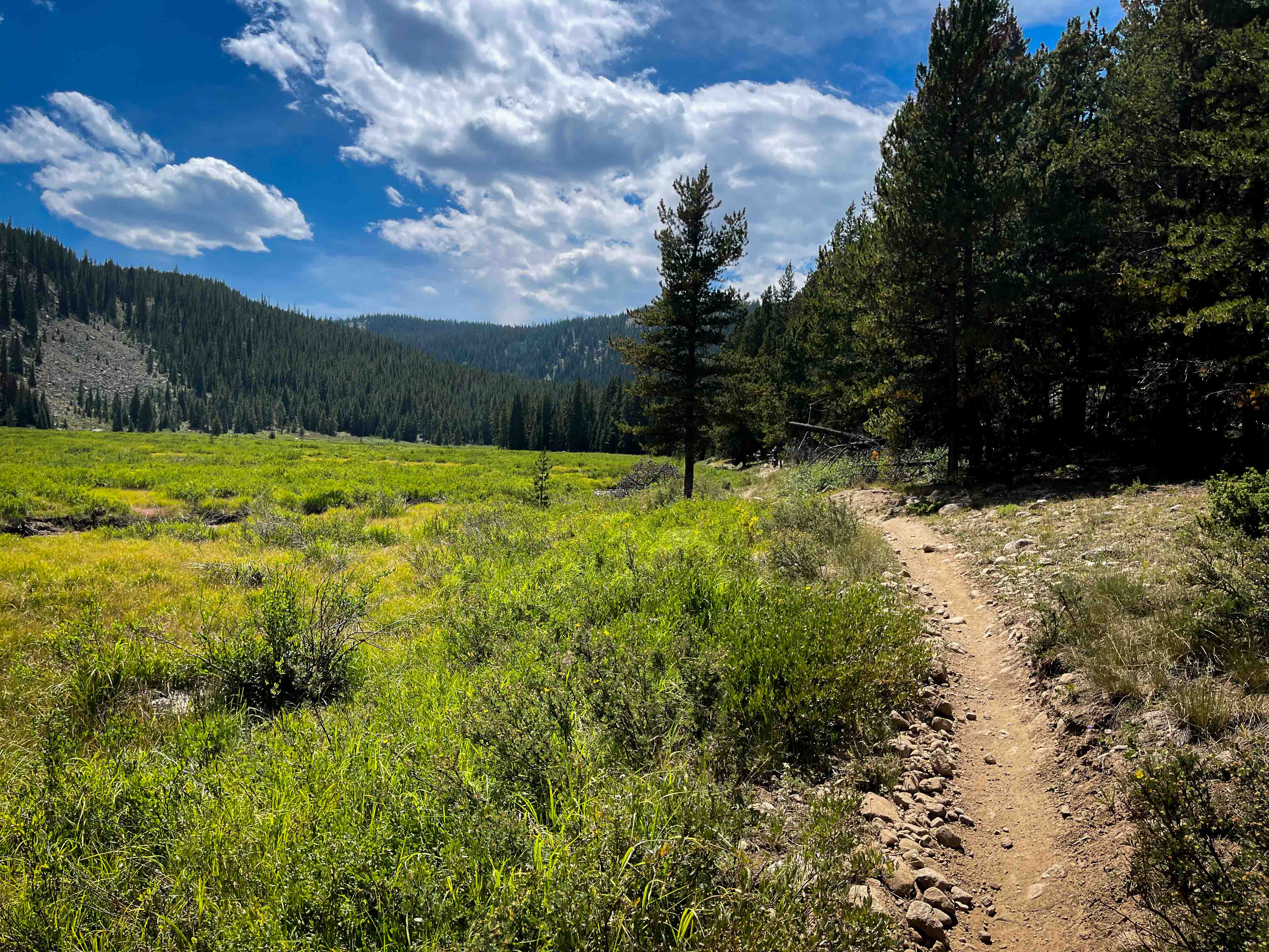
Trail Overview
Vehicle Requirements: High clearance 4WD with low-range capability is essential. Lockers are strongly recommended for boulder navigation. Minimum 33" tires advised. Critical Warnings: Single-lane only with extremely limited passing opportunities. No turnaround spots when approaching from south - commit to completing the route or potentially back down a significant distance. Passes through private property - transit only, no stopping or camping permitted. Chinook Road offers an unexpected technical adventure connecting the Georgetown area to Boulder Canyon via County Roads 275 and 279. What begins as an easy forest road quickly transforms into a legitimate 4WD challenge, making this an excellent discovery for drivers seeking technical terrain between major destinations. The trail operates primarily at difficulty level 3 for the first and final thirds, featuring a well-maintained dirt road suitable for most high-clearance vehicles. However, the middle section escalates to level 4 with unavoidable technical obstacles that define the overall experience. The challenging midsection presents multiple boulder fields requiring careful line selection through rocks measuring 18-24 inches in height. These obstacles coincide with narrow shelf road sections where erosion has compromised the passenger side, forcing drivers to position their vehicle against the uphill bank while navigating around substantial boulders. The combination of technical rock work and exposure creates an engaging challenge requiring 4LO and precise vehicle placement. Loose rock and ongoing erosion characterize the most technical sections, with occasional rockfall creating dynamic obstacles. The road shows minimal maintenance, with vegetation encroachment adding to the remote wilderness feel. Despite these challenges, the route remains clearly defined and navigable with proper vehicle capability. Alpine scenery provides a spectacular backdrop throughout the journey, with expansive mountain vistas visible from multiple elevations. The route climbs nearly 1,400 feet through diverse terrain, offering excellent photography opportunities for those seeking dramatic Colorado mountain landscapes. Alpine scenery provides a spectacular backdrop throughout the journey, with views of Willis Gulch, Russell Gulch, and surrounding Front Range peaks visible from multiple elevations. The route climbs nearly 1,400 feet through diverse terrain, offering excellent photography opportunities. This hidden gem exemplifies why onX navigation occasionally leads to unexpected adventures, rewarding prepared drivers with technical challenges and pristine alpine scenery away from typical tourist routes. Practical Tips: Fuel up before attempting - no services along the route. Carry recovery gear appropriate for boulder navigation. Scout the boulder sections on foot if the line selection appears questionable. Respect private property boundaries - several residences exist along the route with driveways that provide the only turnaround opportunities when approaching from the north.
Photos of Chinook Road
Difficulty
Most of Chinook Road operates at level 3 difficulty, but unavoidable boulder fields in the middle section, combined with narrow shelf road elevation, require level 4 skills. The technical challenge occurs where 18-24" boulders must be navigated while positioning the vehicle against the uphill bank due to passenger-side erosion. No bypass options exist - drivers must successfully navigate rock obstacles on exposed shelf road sections. 4LO is essential for precise control, and lockers recommended for traction on loose rock approaches to boulders.
History
Chinook Road served as a mining access route connecting Georgetown area claims with the extensive Russell Gulch and Davenport Gulch mining operations. The numerous abandoned structures visible throughout these gulches reflect the area's rich silver and gold mining heritage. The road's minimal maintenance reflects its transition from active mining thoroughfare to recreational 4WD route.
Status Reports
Chinook Road can be accessed by the following ride types:
- High-Clearance 4x4
- SUV
- SxS (60")
- ATV (50")
- Dirt Bike
Chinook Road Map
Popular Trails
Star Lily Connector #623
The onX Offroad Difference
onX Offroad combines trail photos, descriptions, difficulty ratings, width restrictions, seasonality, and more in a user-friendly interface. Available on all devices, with offline access and full compatibility with CarPlay and Android Auto. Discover what you’re missing today!