8601DB
Total Miles
1.0
Technical Rating
Best Time
Fall, Summer, Spring
Trail Type
Single Track
Accessible By
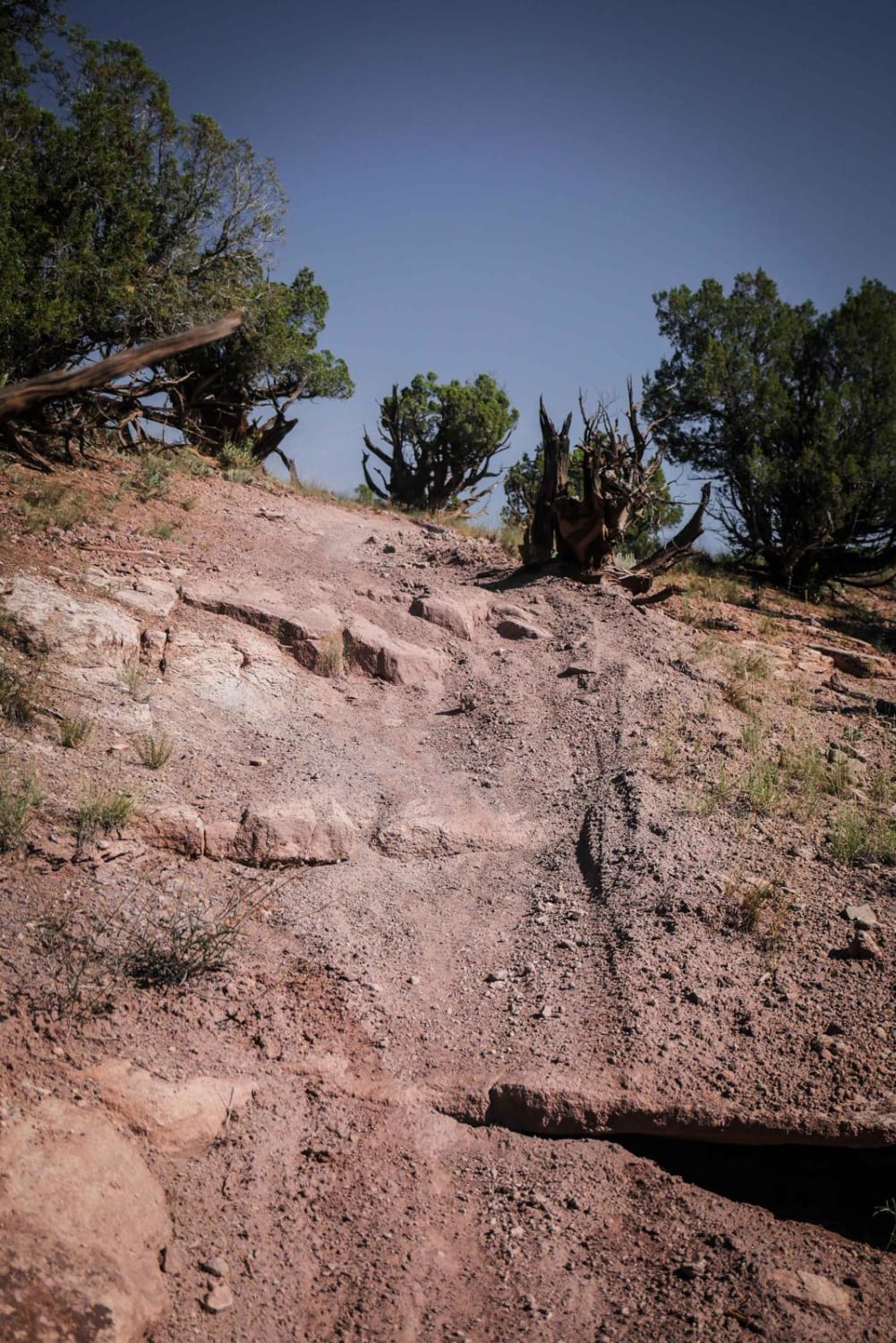
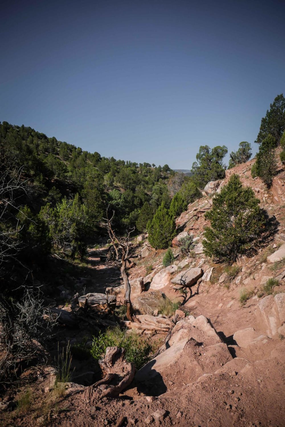
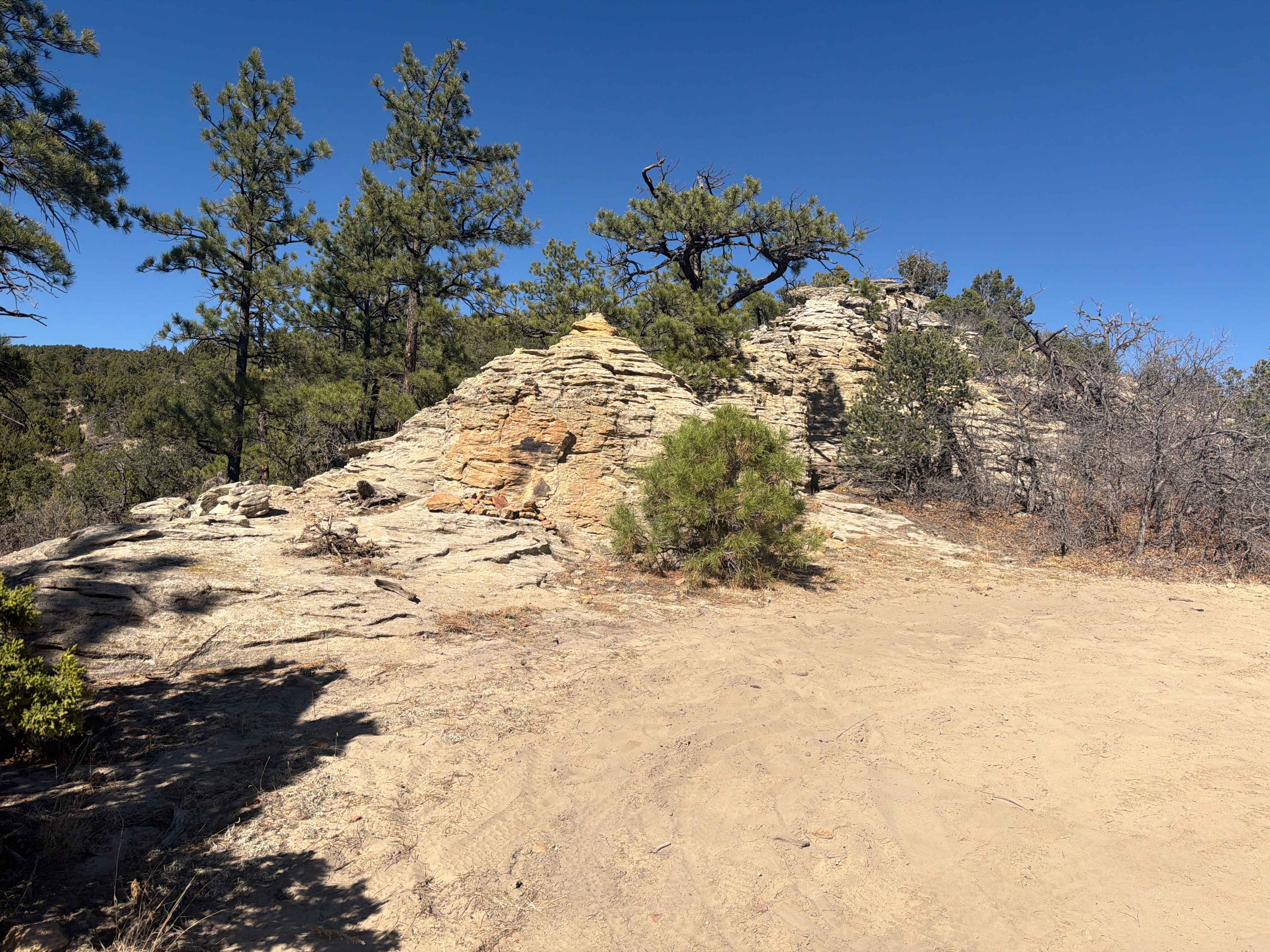
Trail Overview
This short desert trail starts in an overgrown wash full of tall bushes, at the same intersection as 8601C, then climbs up to the ridge line of a small hill, and meanders on the desert mesas between pinyon pine trees. It has a steep and loose downhill with big rock ledges, slab rock, and boulders that add a challenge. The trail turns south into a wash that requires going down a big rock ledge to drop 5 feet into the wash. It is like stair steps down between a rock pinch on the edge of the wash and is harder going up it than down. It ends in the camping/staging area that is accessed off of Colorado River Road 301.
Photos of 8601DB
Difficulty
This trail features steep loose downhills and the one big obstacle to a drop into the wash making this an intermediate trail.
Status Reports
8601DB can be accessed by the following ride types:
- Dirt Bike
8601DB Map
Popular Trails
Old mine roads off of Imogene Pass Rd

Warden Gulch Road
The onX Offroad Difference
onX Offroad combines trail photos, descriptions, difficulty ratings, width restrictions, seasonality, and more in a user-friendly interface. Available on all devices, with offline access and full compatibility with CarPlay and Android Auto. Discover what you’re missing today!