6102A
Total Miles
1.7
Technical Rating
Best Time
Summer, Spring, Fall, Winter
Trail Type
50" Trail
Accessible By
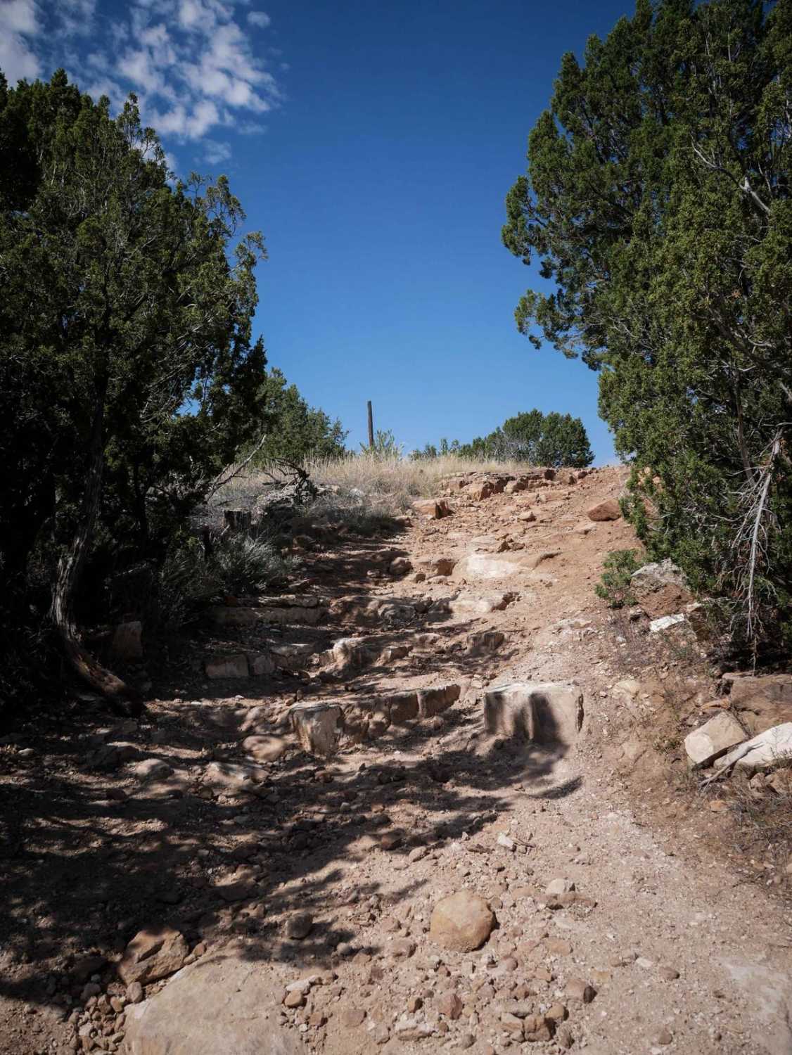
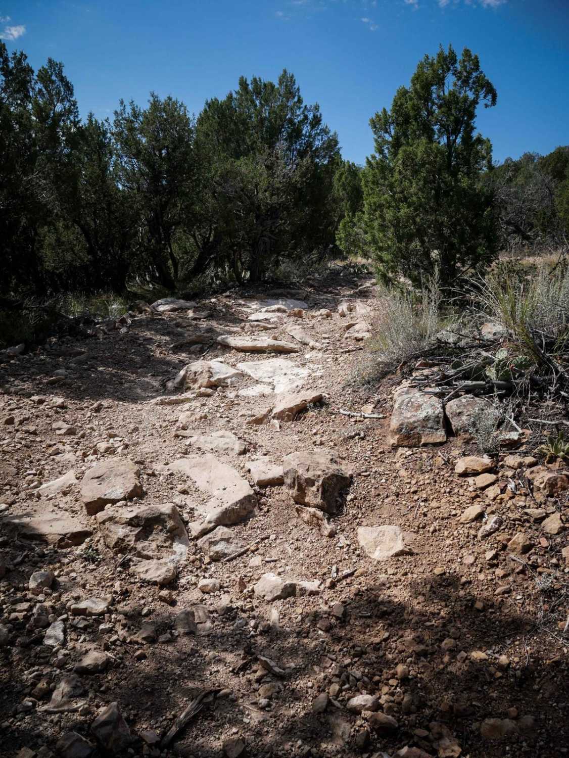
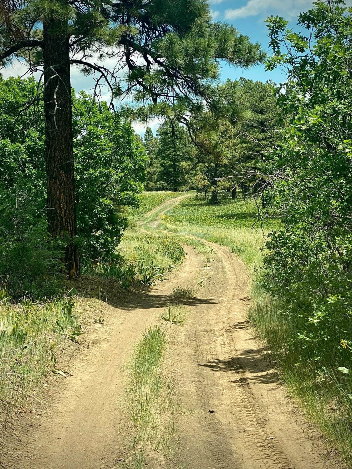
Trail Overview
This ATV trail starts off of BLM Route 6102, just north of the Penrose Commons parking lot. It starts as a flat two-track with small loose rocks, going through wide open grassy terrain with pinyon pine bushes. After 0.2 miles, it splits. Left is an easy direct route north for 0.4 miles to the road (BLM Route 6102d). This option is straight with some sweeping gradual curves. You can see very far ahead as the bushes are really spread out. It ends on the road at a cattle grate. The other option from the split is to go right, which weaves around for another mile and has some rockier more interesting features. There's a small rock ledge right away going downhill that is less than a foot tall. Parts of the trail have more small pieces of rock, or slightly steeper descents/ascents, but it is still very easy overall. It would be easy for any type of ATV and any skill-level rider to just ride right over everything. The longer option from the split puts you almost at the exact same spot on BLM Route 6102d. The last bit is really flat and smooth and straight and easy.
Photos of 6102A
Difficulty
This is an easy ATV trail with several sections that are rockier, with small rock ledges, but this trail is overall manageable for most skill levels and types of ATVs.
6102A can be accessed by the following ride types:
- ATV (50")
- Dirt Bike
6102A Map
Popular Trails
Eight Mile Mesa E-USFS Rd #651E
The onX Offroad Difference
onX Offroad combines trail photos, descriptions, difficulty ratings, width restrictions, seasonality, and more in a user-friendly interface. Available on all devices, with offline access and full compatibility with CarPlay and Android Auto. Discover what you’re missing today!