6036 ATV
Total Miles
1.8
Technical Rating
Best Time
Spring, Summer, Fall, Winter
Trail Type
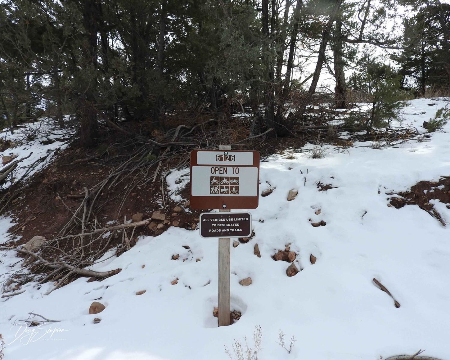
50" Trail
Accessible By
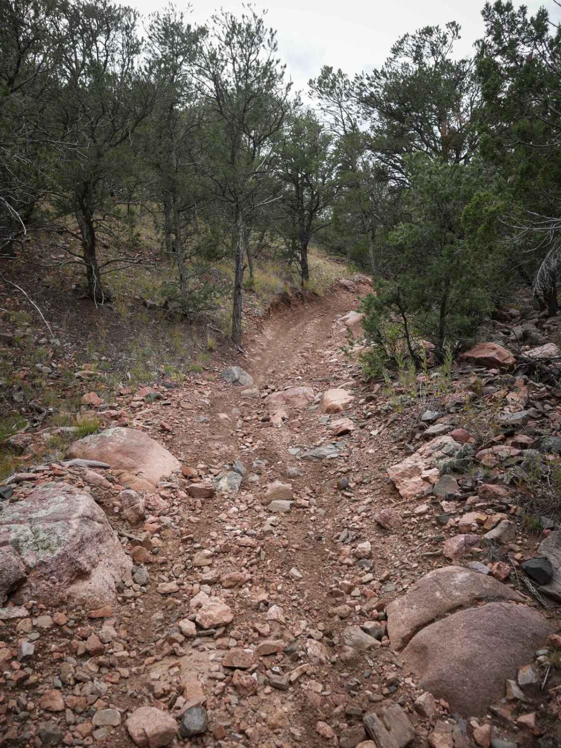
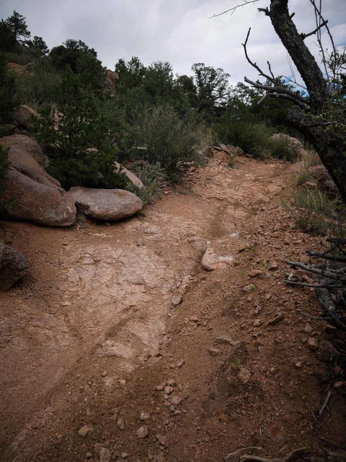
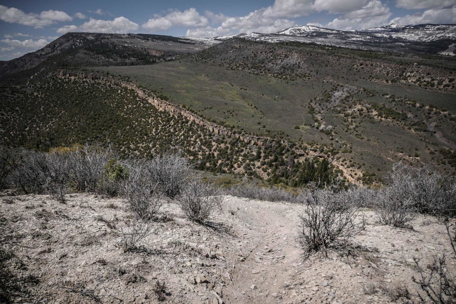
Trail Overview
This 50" trail starts off of FCR 27, just north of the staging area for the Texas Creek Recreation Area, and rides between the pinyon pine trees on a windy wide path covered in small loose rocks. It starts steeply climbing pretty quickly, and gets rockier right away, with larger embedded rocks and ruts. The trail goes into a sandy wash that curves through the pinyon, lined with big boulders, climbs up another mountainside, and then descends back down with several steep, but wide switchbacks. The trail is constantly rocky throughout the entire route, with big embedded rocks, and small 1-foot ledges. The descent on the west side is very steep, so it will require proper braking. It smooths out near the west end and ends at the intersection with 6035.
Photos of 6036 ATV
Difficulty
This is an intermediate ATV trail that is constantly steep and rocky, so it will require some hill climbing skills and proper braking techniques.
Status Reports
6036 ATV can be accessed by the following ride types:
- ATV (50")
- Dirt Bike
6036 ATV Map
Popular Trails
Round Mountain Road Forest Road 225
The onX Offroad Difference
onX Offroad combines trail photos, descriptions, difficulty ratings, width restrictions, seasonality, and more in a user-friendly interface. Available on all devices, with offline access and full compatibility with CarPlay and Android Auto. Discover what you’re missing today!