White House Loop
Total Miles
23.3
Technical Rating
Best Time
Fall, Winter, Spring
Trail Type
Full-Width Road
Accessible By
Trail Overview
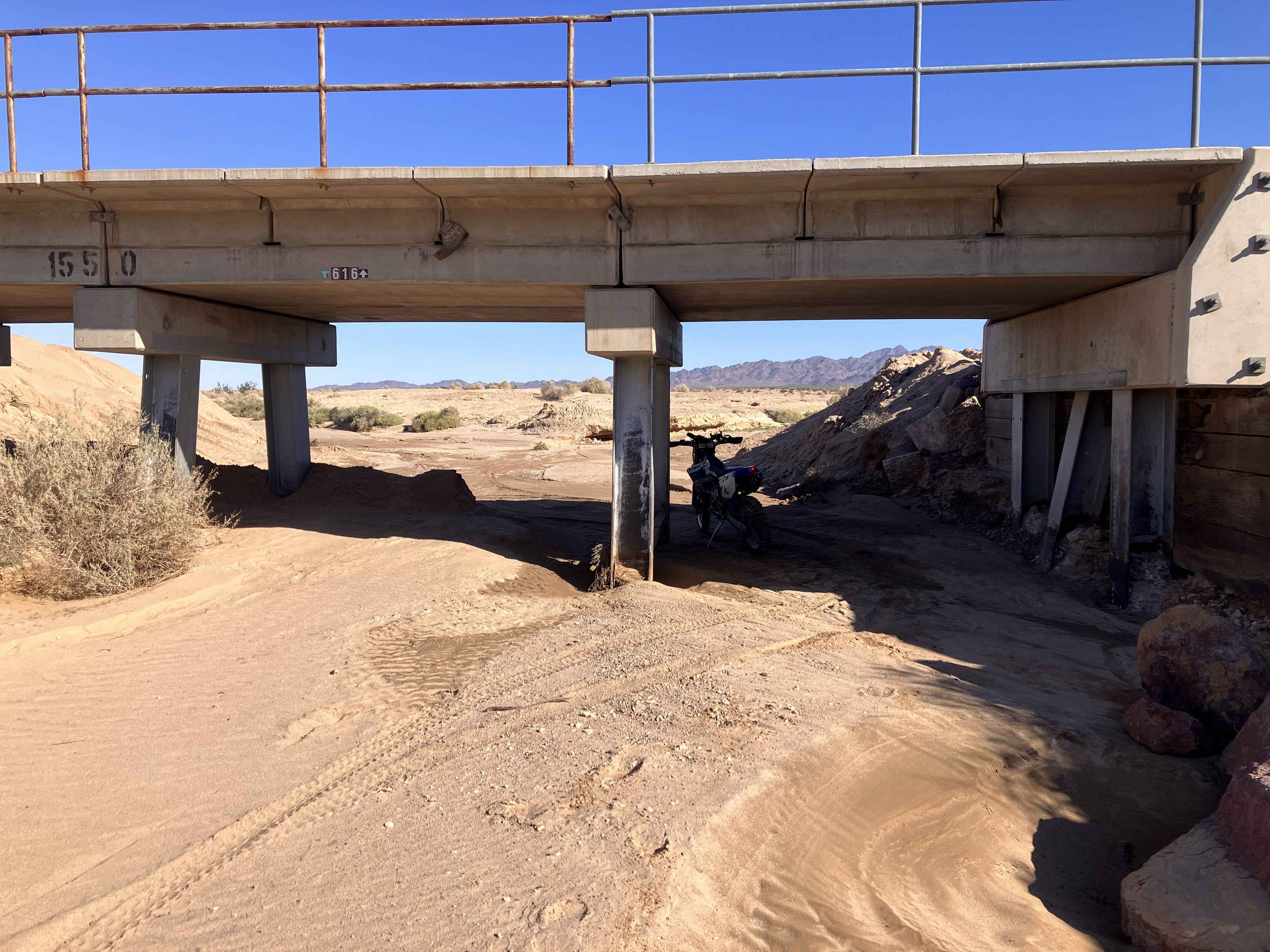
This trail will take you through multiple types of terrain, including sandy washes, packed dirt, loose gravel, and rocky hill climbs. The route begins and ends at train track underpasses, which might limit the entrance of higher-profile vehicles over 8 ft tall. Whether starting from the west or east side of this loop, the first several miles will be fairly easy and flat on two-track paths over shallow sand and dirt/gravel. Once you approach the foothills of the Turtle Mountains, the route becomes much more challenging, going in and out of washes, climbing rock-strewn hills, and managing washout ruts. At the halfway point, this route becomes a shelf road with several climbs and descents on loose rock hillsides. There is also a large turnout area halfway that can accommodate a large group of vehicles for a meal break or camping. This site is marked by a large, old abandoned truck on the side of the trail. Because portions of this trail run in and out of washes next to the mountains, be aware of the weather forecast in the area, as any rain will make for dangerous travel. This route also runs along a protected Wilderness Area in sections, so stay on the designated trail and adhere to posted signs restricting vehicle use. Tread Lightly and Pack It Out.
Photos of White House Loop

Difficulty
Most of the trail from either end up to the foothill area of the mountains is relatively easy and can be handled with moderate clearance and only two-wheel drive. Once you arrive in the foothills, though, this trail takes on a completely different character where high clearance is a necessity, and both skid plates and at least a rear locker on four-wheel vehicles would be advisable. Either direction on the trail will require climbs and descents on a loose rock shelf road, where one should carefully navigate to avoid dropping a wheel over the edge.
Status Reports
White House Loop can be accessed by the following ride types:
- High-Clearance 4x4
- SUV
- SxS (60")
- ATV (50")
- Dirt Bike
White House Loop Map
Popular Trails

Radford Truck Trail - FS 2N06

Redpole Spur - FS 8S042A
High Voltage Powerline Trail
The onX Offroad Difference
onX Offroad combines trail photos, descriptions, difficulty ratings, width restrictions, seasonality, and more in a user-friendly interface. Available on all devices, with offline access and full compatibility with CarPlay and Android Auto. Discover what you’re missing today!