Trail 4-1 (11E35)
Total Miles
1.1
Technical Rating
Best Time
Spring, Summer, Fall
Trail Type
Single Track
Accessible By
Trail Overview
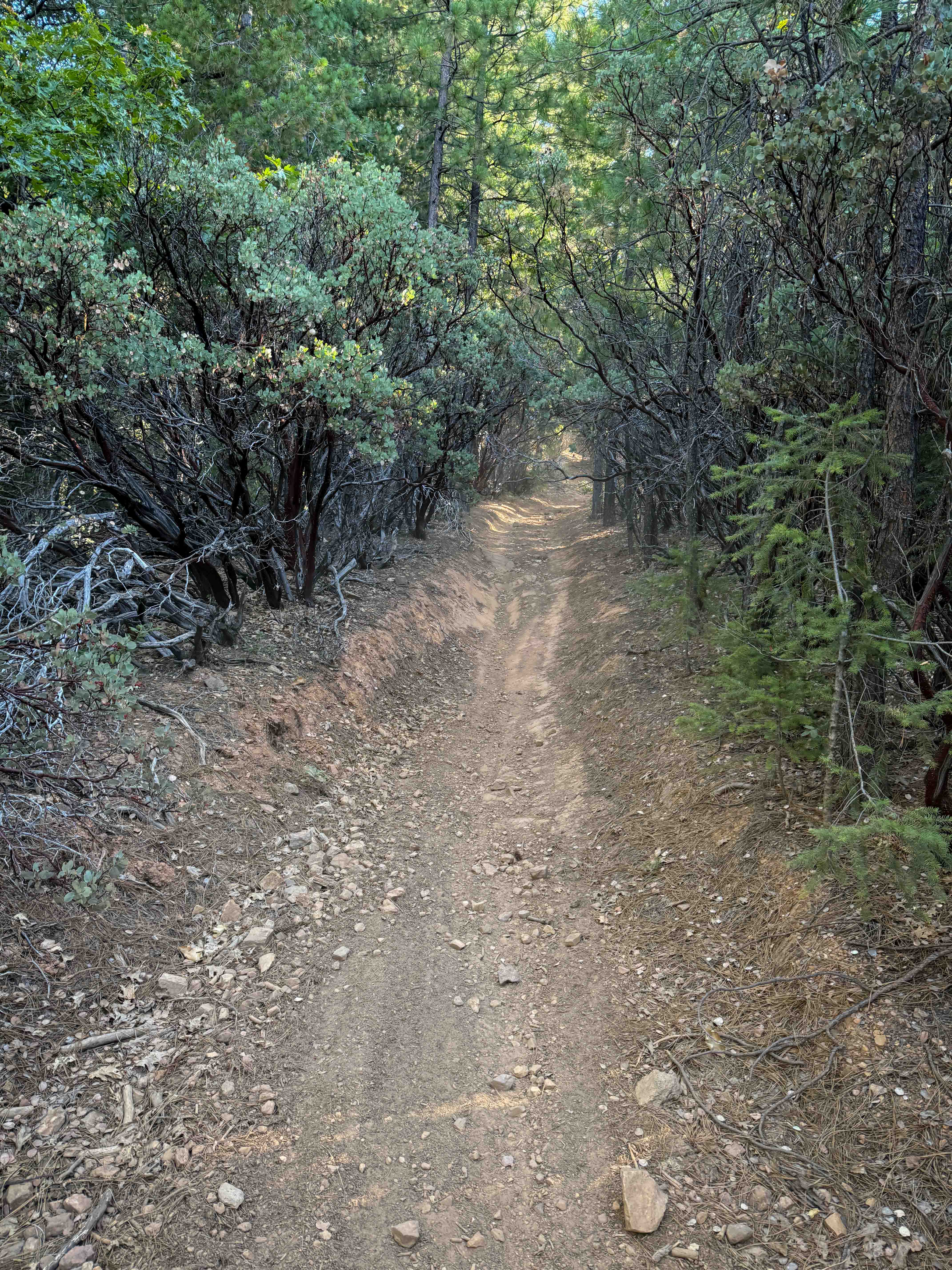
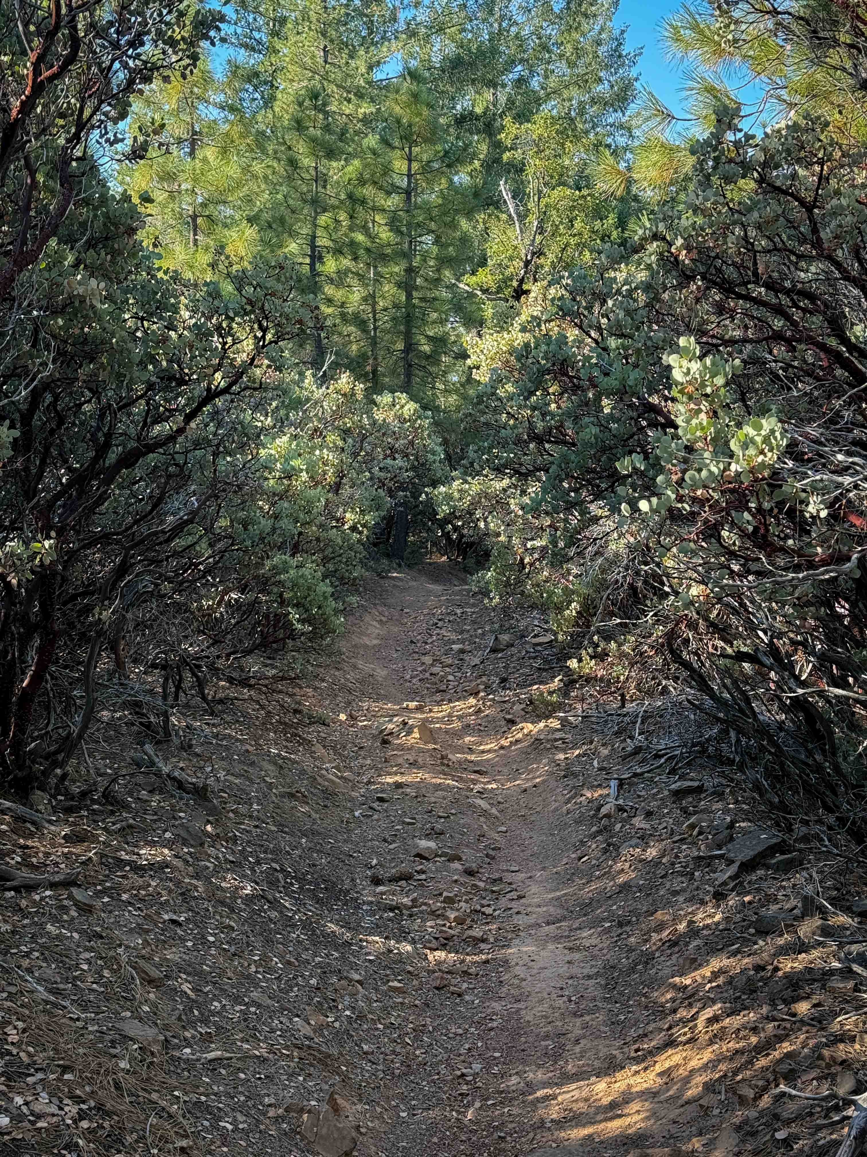
This is a short connector trail between Trail 10 and Trail 4. It's a wide path between low manzanita tree branches, like a tree tunnel. The surface is lightly covered in small loose rocks and pinecones, a bit troughed and rutted at times, and you need to watch out for small sticks and roots. It has tight turns through the trees and a couple of big hairpin corners. It's a steady descent from north to south the entire way, dropping 850 feet of elevation over 1.1 miles. It's mostly a semi-steep grade, but it stays really wide and approachable the entire way, making it still relatively easy and ideal for riders of most average skill levels.
Photos of Trail 4-1 (11E35)
Difficulty
This is an easy dirt bike trail that doesn't have any major obstacles, only a bit of loose rock and a steady, semi-steep grade. It's ideal for riders of all skill levels and is easily accessed by the staging area.
Status Reports
Trail 4-1 (11E35) can be accessed by the following ride types:
- Dirt Bike
Trail 4-1 (11E35) Map
Popular Trails
Old Coast Road

Haiwee Canyon Road - BLM SE776

Sawmill Meadows Side Trail
The onX Offroad Difference
onX Offroad combines trail photos, descriptions, difficulty ratings, width restrictions, seasonality, and more in a user-friendly interface. Available on all devices, with offline access and full compatibility with CarPlay and Android Auto. Discover what you’re missing today!