Odessa Canyon - BLM CM7635
Total Miles
2.5
Technical Rating
Best Time
Spring, Summer, Fall, Winter
Trail Type
Full-Width Road
Accessible By
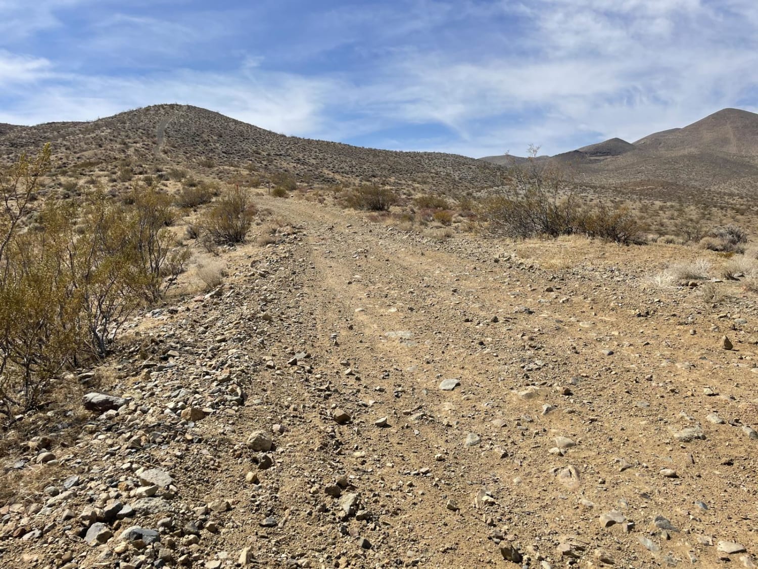
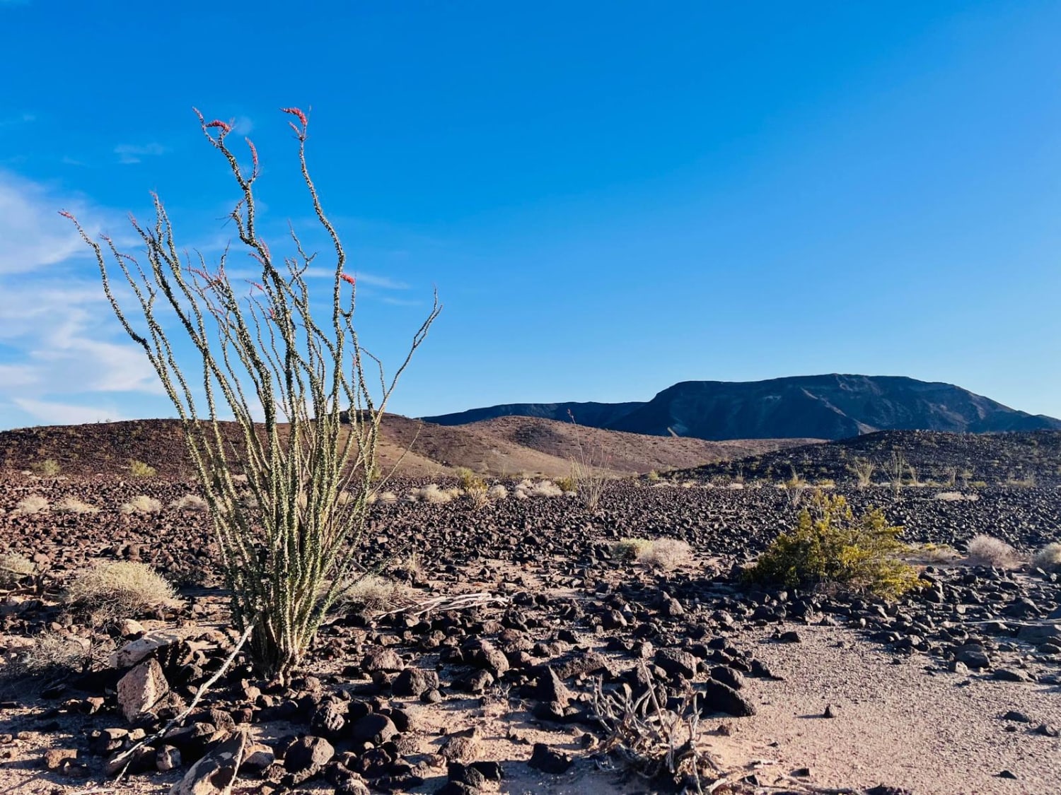
Trail Overview
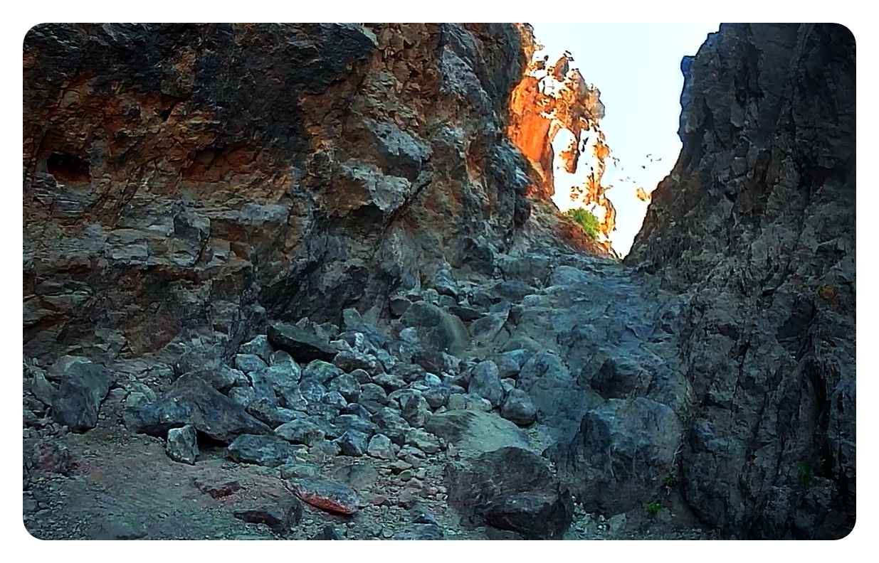
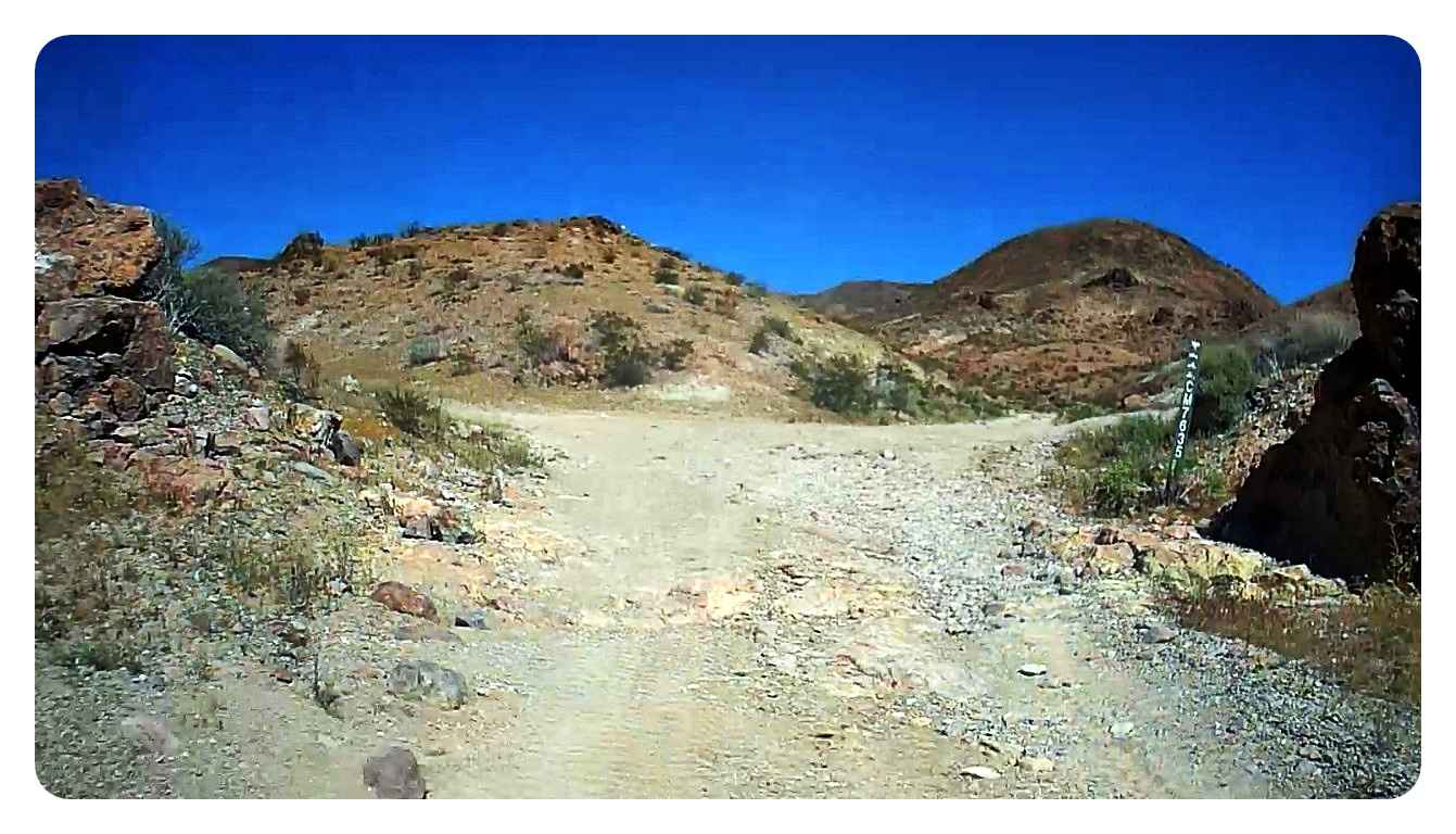
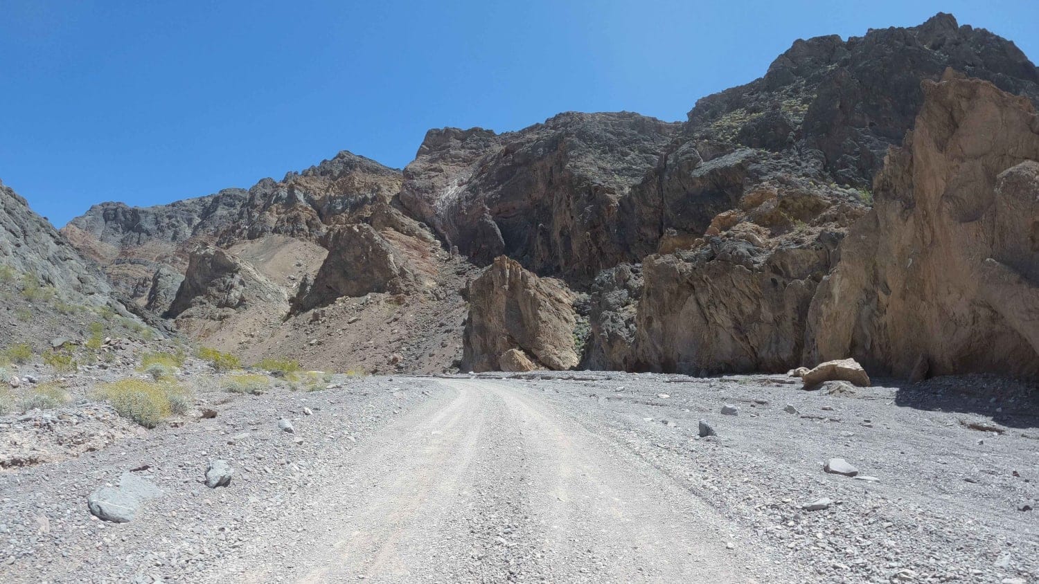
Odessa Canyon (BLM CM7635) is a 2.5-mile point-to-point (bi-directional) trail rated 6 of 10 located in San Bernardino County. Odessa Canyon is a well-marked BLM trail within the Barstow Management Area. The trail starts just north of Ghost Town Road, and as you approach the trailhead, you will see three distinct canyon trails. Doran Canyon is the center trail, and Odessa Canyon is on the right. This trail is made up of hard-packed dirt, loose sand and gravel, several rock gardens, several large waterfalls, and a narrow ledge known as Pucker Pass. When running south to north, the trail is a continuous climb of about 1000-feet and the ledge for Pucker Pass will be on the driver's side, and there is no bypass. When running north to south, a painted sign on the rock will announce the location of Pucker Pass. Just before dropping down, there will be a notch on the passenger side. This is a bypass, but many will high-center trying to get over the ledge (see red arrows in photographs). When this trail is combined with Doran Canyon (BLM CM7631), it is also known as the Odessa-Doran Loop. The trail runs through open sandy wash canyons on the south end before the walls of the canyon close in to restrict the trail. There is one off-camber waterfall that, if you get too far off line (either going up or down), the potential for hardtop damage is a real possibility. The middle section of the trail runs through narrow canyons with walls over 100 feet high, rocky ledges, and rocky waterfalls. The northern section of the trail opens back up as it reaches the intersections with Doran Canyon. Past the intersection, the trail runs uphill to a set of radio towers on Calico Peak. There are several side trails and mining tunnels that can be explored along the upper section of the trail. Taking this canyon back south would be the completion of the Odessa-Doran Loop. A challenging weekend includes running these two trails in both directions. Once in the canyons, there was no cell phone service. The nearest gas is located at Interstate 15. The nearest full-service is located in Barstow.
Photos of Odessa Canyon - BLM CM7635
Difficulty
Trails are difficult with considerable erosion damage, loose rocks, dirt, and slickrock. Steps not exceeding 36 inches. 4WD, tall tires (33-inches plus) with two traction-adding devices (lockers, limited slips) are required. A winch would be a plus. Enhanced suspension travel and good ground clearance are required. Excellent driving skills are recommended.
Odessa Canyon - BLM CM7635 can be accessed by the following ride types:
- High-Clearance 4x4
- SUV
- SxS (60")
- ATV (50")
- Dirt Bike
Odessa Canyon - BLM CM7635 Map
Popular Trails
Bear Valley Road
Echo Canyon Road
Iron Canyon
Senator Wash/Cistern Road
The onX Offroad Difference
onX Offroad combines trail photos, descriptions, difficulty ratings, width restrictions, seasonality, and more in a user-friendly interface. Available on all devices, with offline access and full compatibility with CarPlay and Android Auto. Discover what you’re missing today!