North Haiwee Road
Total Miles
0.9
Technical Rating
Best Time
Fall, Summer, Spring
Trail Type
Full-Width Road
Accessible By
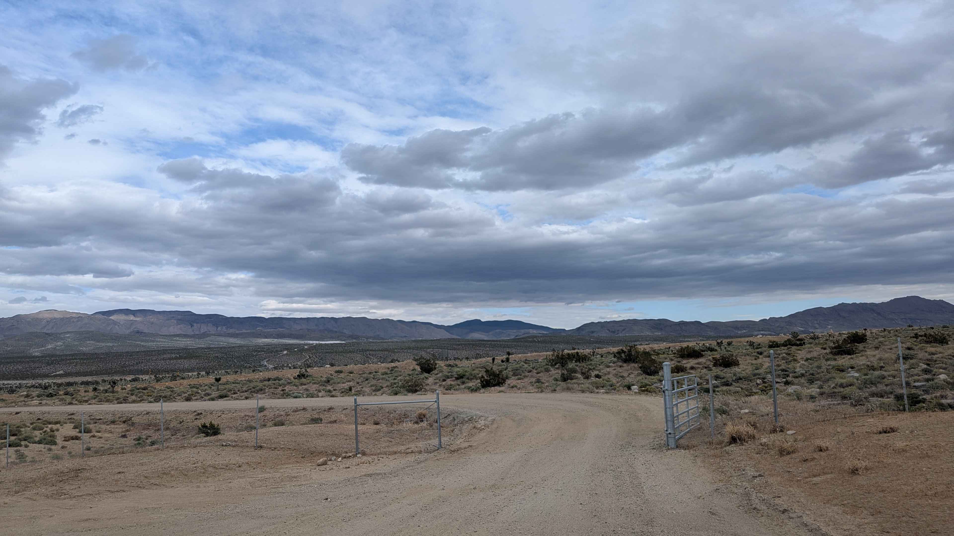
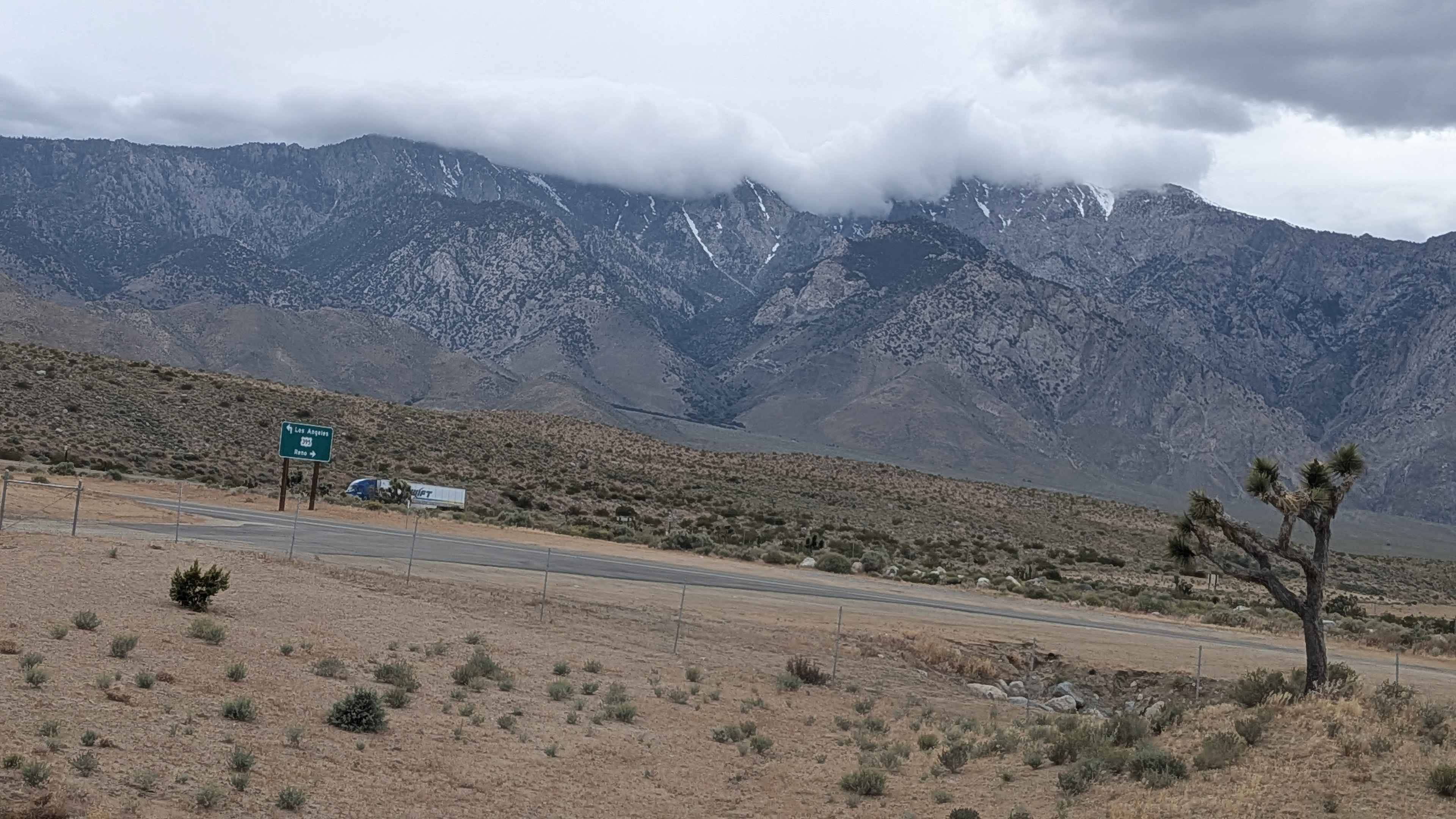
Trail Overview
North Haiwee Road departs from the CA-190 / US-395 junction and makes a run through open desert toward the North Haiwee Reservoir, one of the storage facilities in the Los Angeles Aqueduct system. The hard-packed sand surface and generous two-vehicle width make this one of the more approachable trails. The Eastern Sierra forms the western skyline, the Coso Range rises to the east, and the reservoir itself comes into view as the trail approaches its terminus just short of the water's edge.
Photos of North Haiwee Road
Difficulty
Hard-packed sand, wide and accessible. Do not proceed past the end of the trail, as it is private land.
Status Reports
North Haiwee Road can be accessed by the following ride types:
- High-Clearance 4x4
- SUV
- SxS (60")
- ATV (50")
- Dirt Bike
North Haiwee Road Map
Popular Trails
Laurel Lakes - FS 28E201
Chocolate Thunder
Trumbull Peak
The onX Offroad Difference
onX Offroad combines trail photos, descriptions, difficulty ratings, width restrictions, seasonality, and more in a user-friendly interface. Available on all devices, with offline access and full compatibility with CarPlay and Android Auto. Discover what you’re missing today!