Highway 20
Total Miles
0.6
Technical Rating
Best Time
Fall, Winter, Spring
Trail Type
Full-Width Road
Accessible By
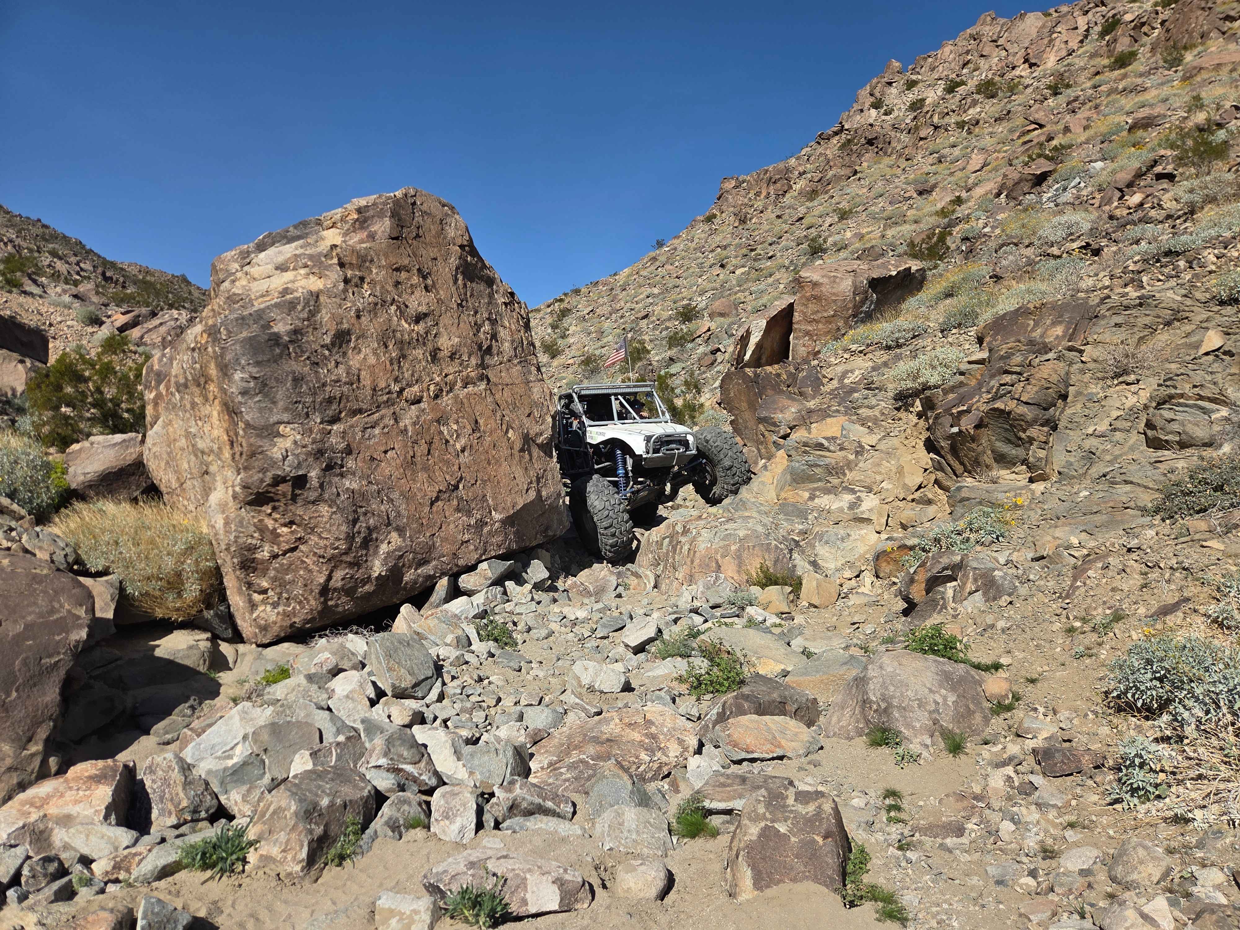
Trail Overview
The harder direction for Highway 20 is climbing up from Highway 19. There's a bailout road between Highway 19 and Highway 20 on the right while heading up if things go sideways. This trail features plenty of burnt-in bypasses, but it still has its share of obstacles--including a fairly off-camber tight squeeze around a large boulder. The views from the ridge at the top are pretty spectacular, and driving across the exposed ridgeline is an amazing experience. Expect loose rocks that shift constantly--pick your line by either staying in the main rocky sections or taking the burnt-in bypasses. The squeeze around the large boulder can be the toughest obstacle when you're in a full-bodied rig.
Photos of Highway 20

Difficulty
Trying not to get body damage in a full-body rig around the off-camber boulder is probably the hardest part. For the most part, you can drive around the harder obstacles. There are still some steeper loose climbs, but for Johnson Valley, this isn't that bad.
History
Highway 20 got its name from the race number of Walker Evans.
Status Reports
Highway 20 can be accessed by the following ride types:
- High-Clearance 4x4
- SUV
- SxS (60")
- ATV (50")
- Dirt Bike
Highway 20 Map
Popular Trails
Ellis Peak OHV Trail

Sulfur Mine Summit Crossing
Tungsten City Road
The onX Offroad Difference
onX Offroad combines trail photos, descriptions, difficulty ratings, width restrictions, seasonality, and more in a user-friendly interface. Available on all devices, with offline access and full compatibility with CarPlay and Android Auto. Discover what you’re missing today!