Forest Service Road 2N19
Total Miles
1.8
Technical Rating
Best Time
Summer, Fall, Spring
Trail Type
Full-Width Road
Accessible By
Trail Overview
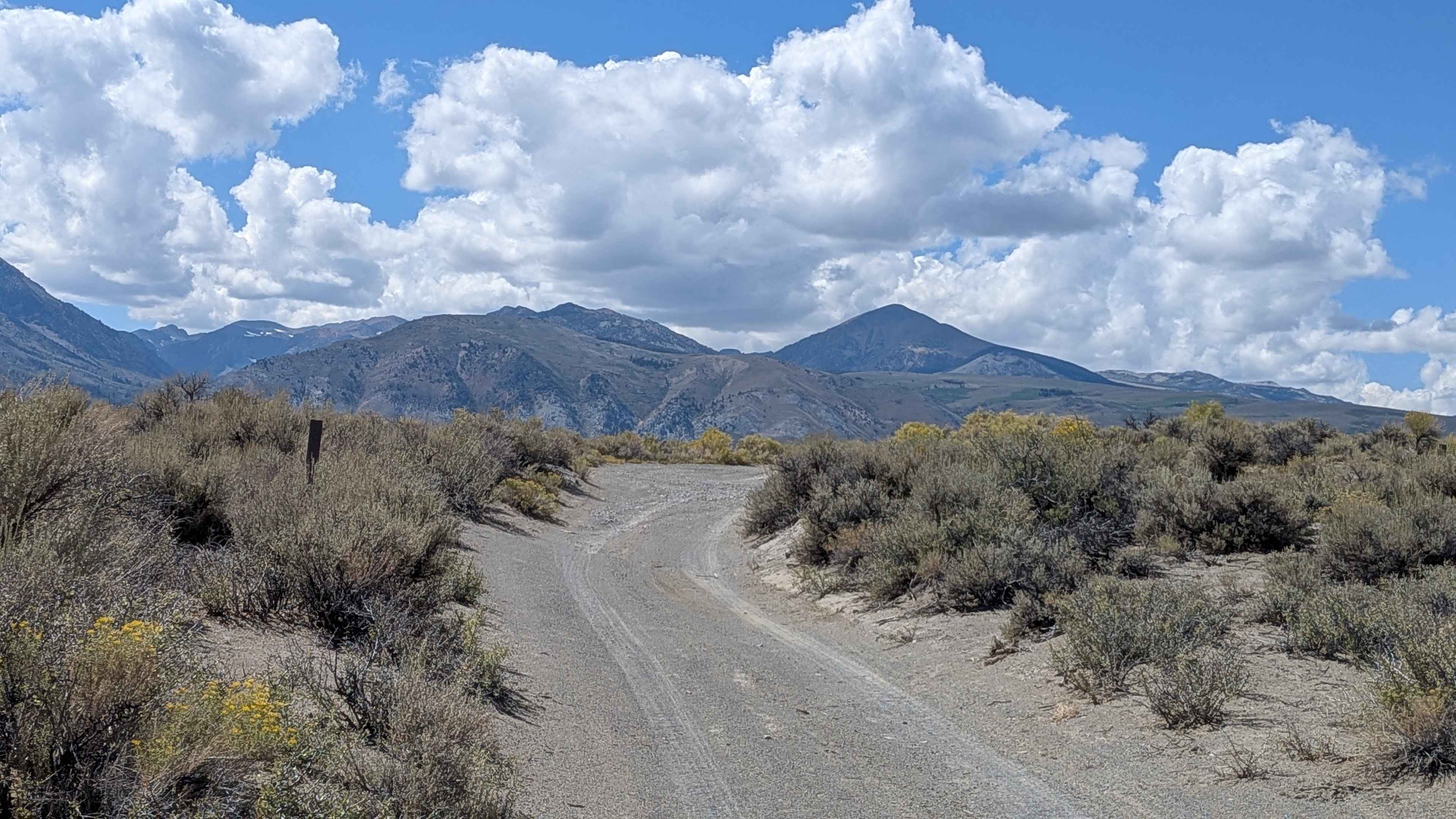
This route runs parallel to Mono Lake, providing 360-degree views of all the surrounding mountains. You can see the peaks of the Sierra Nevadas, including Mount Dana, Mount Gibbs, and Tioga Peak, which form the Sierra Crest to the west. You can also see the volcanic features of the Mono Craters to the south, such as Crater Mountain and Bodie Mountain. The trail offers stunning views of Mono Lake throughout the journey, with beautiful yellow wildflowers everywhere adding seasonal color. A few short spur trails branch off, including FS2N108, which takes you closer to the lake for enhanced viewing opportunities.
Photos of Forest Service Road 2N19

Difficulty
The trail is almost all rated 1, but there are a couple of low spot areas with some ruts and standing water about a half mile and 1.5 miles from the Black Point Trail that elevate it to a 2 rating. Another section, 1.5 miles from the Black Point Trail, has some ruts and could be harder to get through if it's wet for two-wheel drive vehicles. The trail is one vehicle wide and made of pumice and sand and pumice throughout.
History
Mono Lake is a vital stop on the Pacific Flyway, attracting over 100 bird species, including massive numbers of migratory birds like Eared Grebes, Wilson's Phalaropes, and California Gulls. These birds rely on the lake's abundant brine shrimp and alkali flies to feed and gain strength for their long journeys. In addition to these key migrants, the lake and its surrounding basin support a variety of resident and breeding birds, such as Ospreys, Western Kingbirds, and various sandpipers.
Status Reports
Forest Service Road 2N19 can be accessed by the following ride types:
- High-Clearance 4x4
- SUV
- SxS (60")
- ATV (50")
- Dirt Bike
Forest Service Road 2N19 Map
Popular Trails

Signal Peak - FS 4S031A
The onX Offroad Difference
onX Offroad combines trail photos, descriptions, difficulty ratings, width restrictions, seasonality, and more in a user-friendly interface. Available on all devices, with offline access and full compatibility with CarPlay and Android Auto. Discover what you’re missing today!