Signal Peak - FS 4S031A
Total Miles
1.2
Technical Rating
Best Time
Summer, Fall, Spring
Trail Type
Full-Width Road
Accessible By
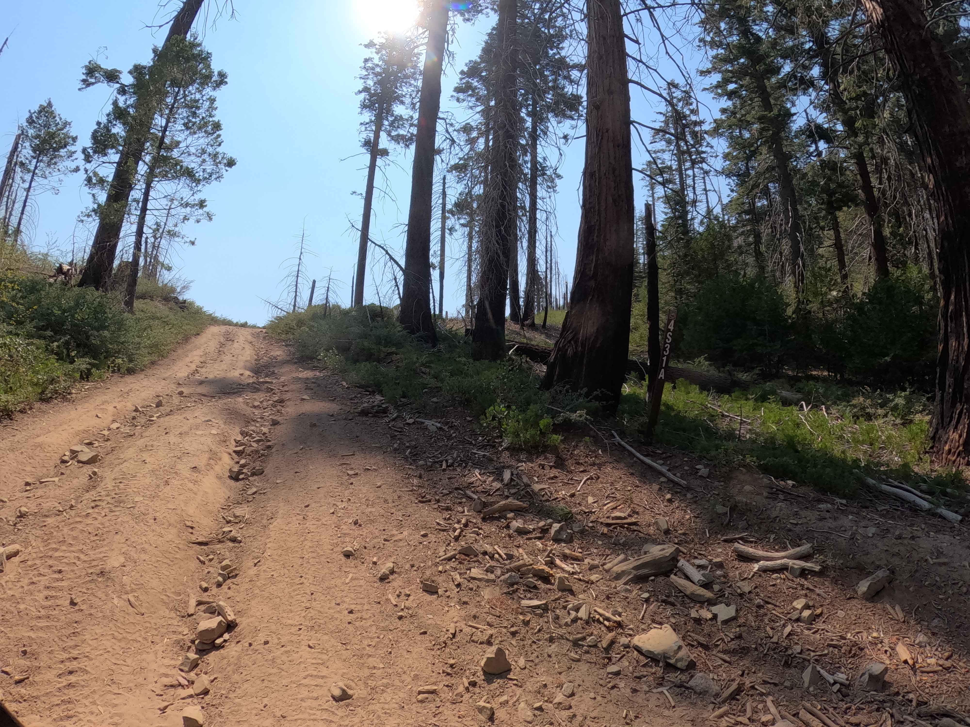
Trail Overview
This 1.2-mile spur is a short, intense climb that dramatically departs from the easier roads below to reach a great viewpoint of the surrounding Sierra and the valley below. Branching off Dobler Meadow, the trail immediately tilts upward, becoming a steep, loose, and rocky two-track that winds through a forest recovering from the 2018 Ferguson Wildfire. The defining characteristic of this route is the serious exposure near the summit. The trail transitions into a narrow shelf road cut into the steep mountainside, where drivers are treated to vertigo-inducing drop-offs and massive panoramic views. The surface here is chunky and loose, demanding focus. The reward at the end is the historic Signal Peak Fire Lookout, perched on a rocky summit with 360-degree vistas. This is not a trail for those with a fear of heights!
Photos of Signal Peak - FS 4S031A

Difficulty
While the obstacles themselves aren't car-breaking, the combination of steep grades, loose traction, and significant shelf-road exposure pushes this trail to a solid 3. Drivers must be comfortable managing vehicle width on a narrow track with severe drop-offs. The surface is consistently rocky and loose, meaning 4 Low is strongly recommended to maintain control without spinning tires on the climb or riding the brakes on the descent. It requires a confident hand at the wheel.
Status Reports
Signal Peak - FS 4S031A can be accessed by the following ride types:
- High-Clearance 4x4
- SUV
Signal Peak - FS 4S031A Map
Popular Trails
Midway Well Road
JT Sand Hole

Gooseneck - FS 8s09g
The onX Offroad Difference
onX Offroad combines trail photos, descriptions, difficulty ratings, width restrictions, seasonality, and more in a user-friendly interface. Available on all devices, with offline access and full compatibility with CarPlay and Android Auto. Discover what you’re missing today!