Coyote Flats FS7S10
Total Miles
7.7
Technical Rating
Best Time
Summer, Fall
Trail Type
Full-Width Road
Accessible By
Trail Overview
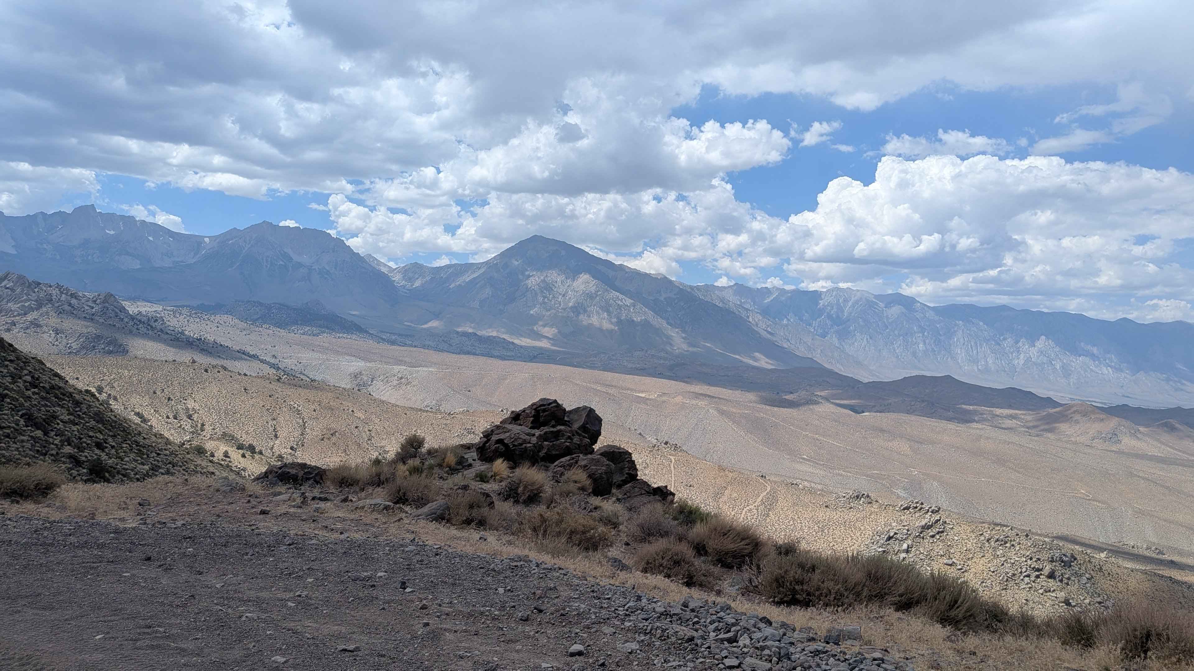
This dramatic ascent climbs almost 4,000 feet in just under 8 miles, utilizing shelf roads and switchbacks to navigate the steep terrain. The route offers stunning views of the valley below and dramatic vistas of the Eastern Sierra mountain peaks throughout the climb. After the first mile, the road becomes more rocky with very dramatic views of the Eastern Sierras and White Mountains. After 2 miles, it starts to level off with a slow, gradual climb. Around mile 4, the trail passes through a section with interesting granite rock formations in a sparse pine forest filled with lots of brush and wildflowers. By mile 5.5, it opens up into a big meadow surrounded by mountains, eventually ending in the middle of a large valley with views of mountains in all directions.
Photos of Coyote Flats FS7S10

Difficulty
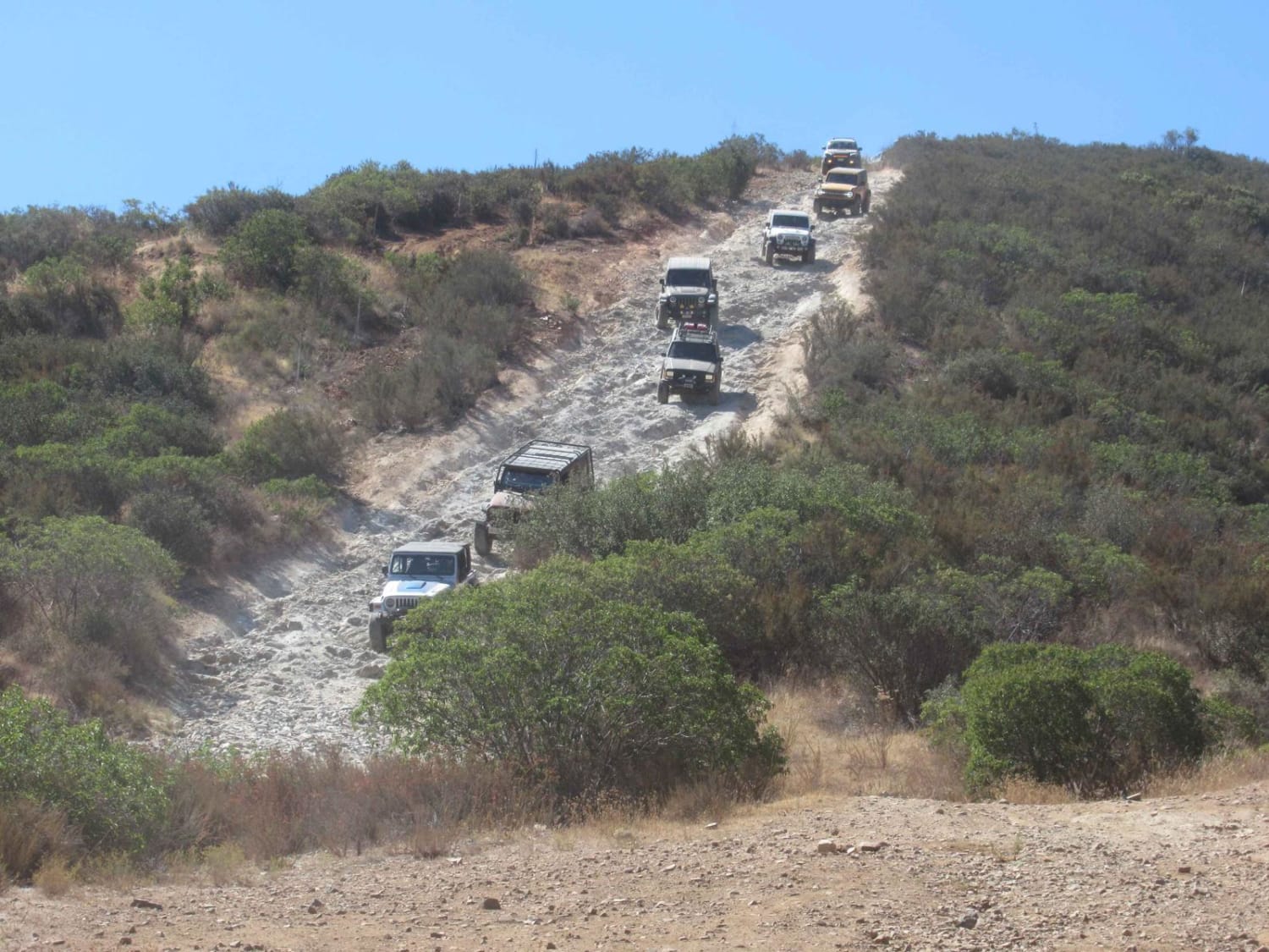
This trail earns a moderate difficulty rating due to its challenging terrain features. The route includes lots of big holes with articulating off-camber sections that are mostly sandy, with some rocks in the first mile and after the third mile. The shelf roads and switchbacks require careful navigation, and there are a couple of small water crossings along the way.
History
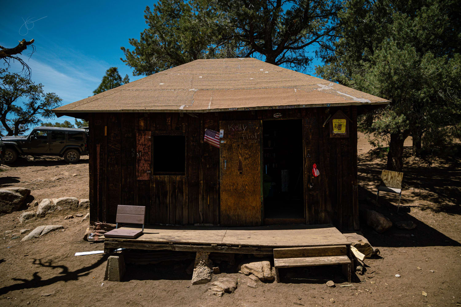
Coyote Flats, near Bishop, California, has a history rooted in mining and military use. Originally known as Coyote Plateau, the area features a high-altitude airstrip, once the highest in the country, that was used for military testing. Mining activity, particularly for tungsten during WWII, also shaped the area.
Status Reports
Coyote Flats FS7S10 can be accessed by the following ride types:
- High-Clearance 4x4
- SUV
- SxS (60")
- ATV (50")
- Dirt Bike
Coyote Flats FS7S10 Map
Popular Trails

Spur Roads - BLM C2319 - C2352

The Sand Highway
The Trek to McIver's Cabin
Donohoe Loop-Mocogo Ranch Trail
The onX Offroad Difference
onX Offroad combines trail photos, descriptions, difficulty ratings, width restrictions, seasonality, and more in a user-friendly interface. Available on all devices, with offline access and full compatibility with CarPlay and Android Auto. Discover what you’re missing today!