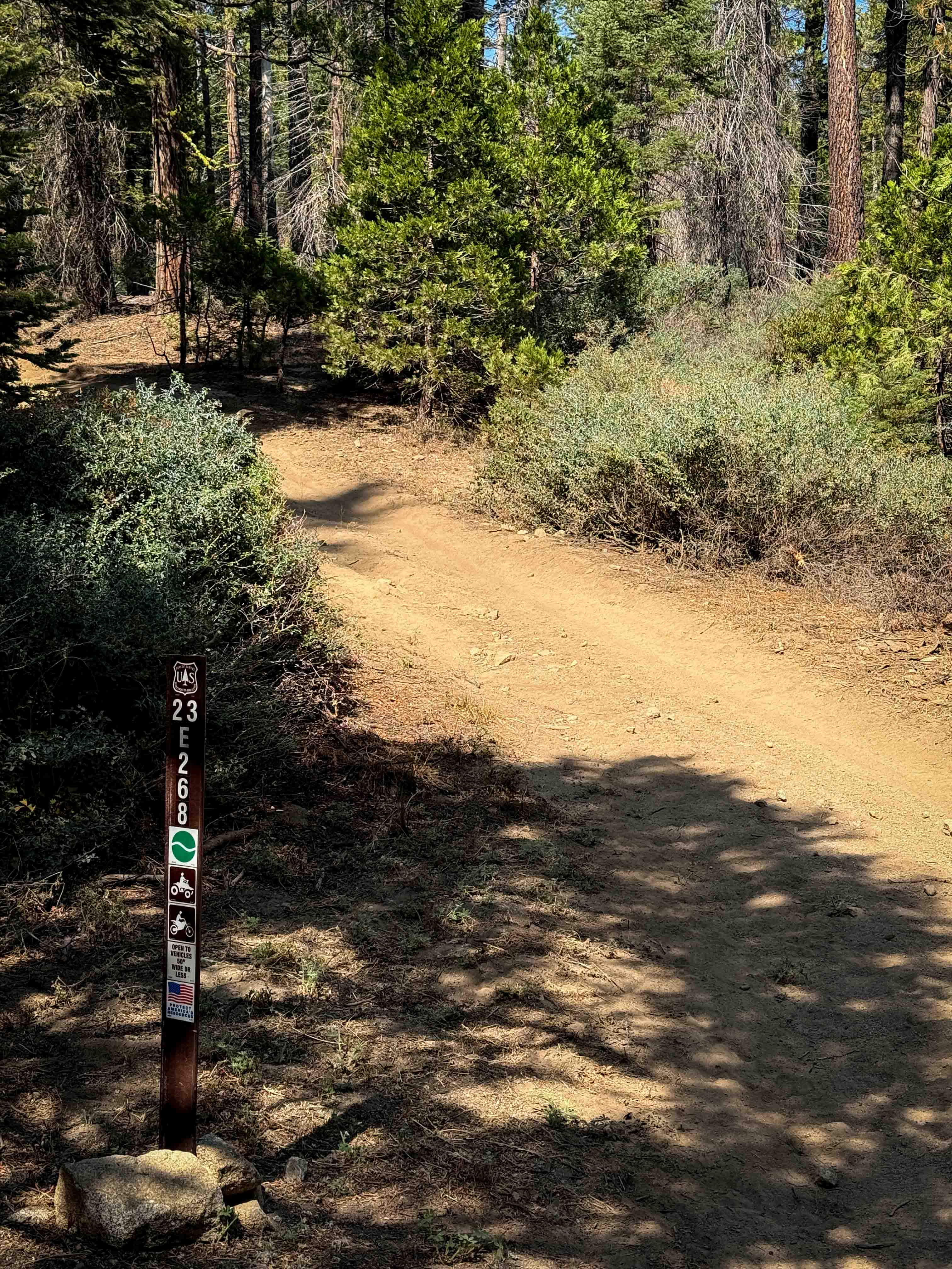
23E268
Total Miles
0.4
Technical Rating
Best Time
Spring, Fall
Trail Type
50" Trail
Accessible By
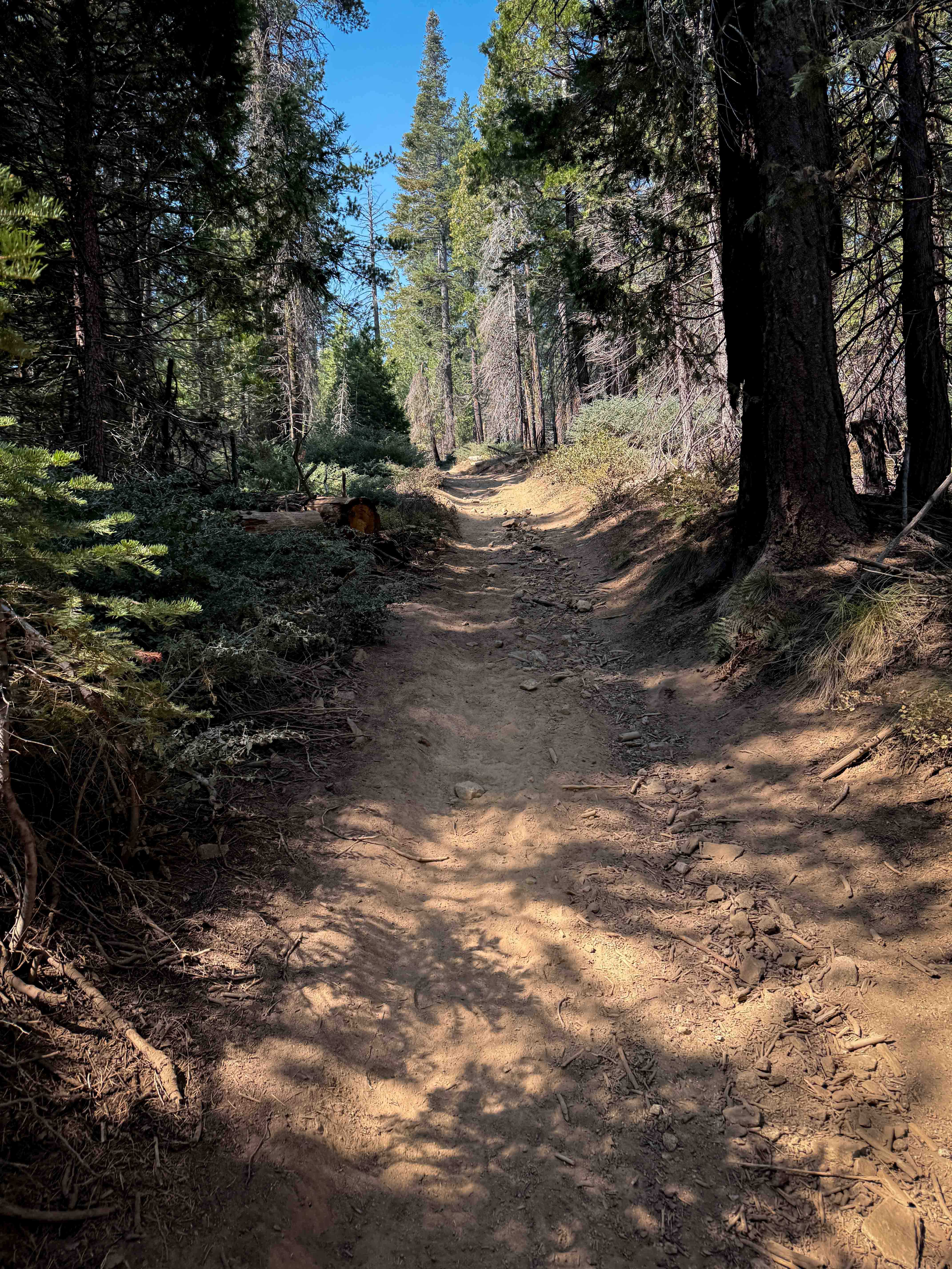
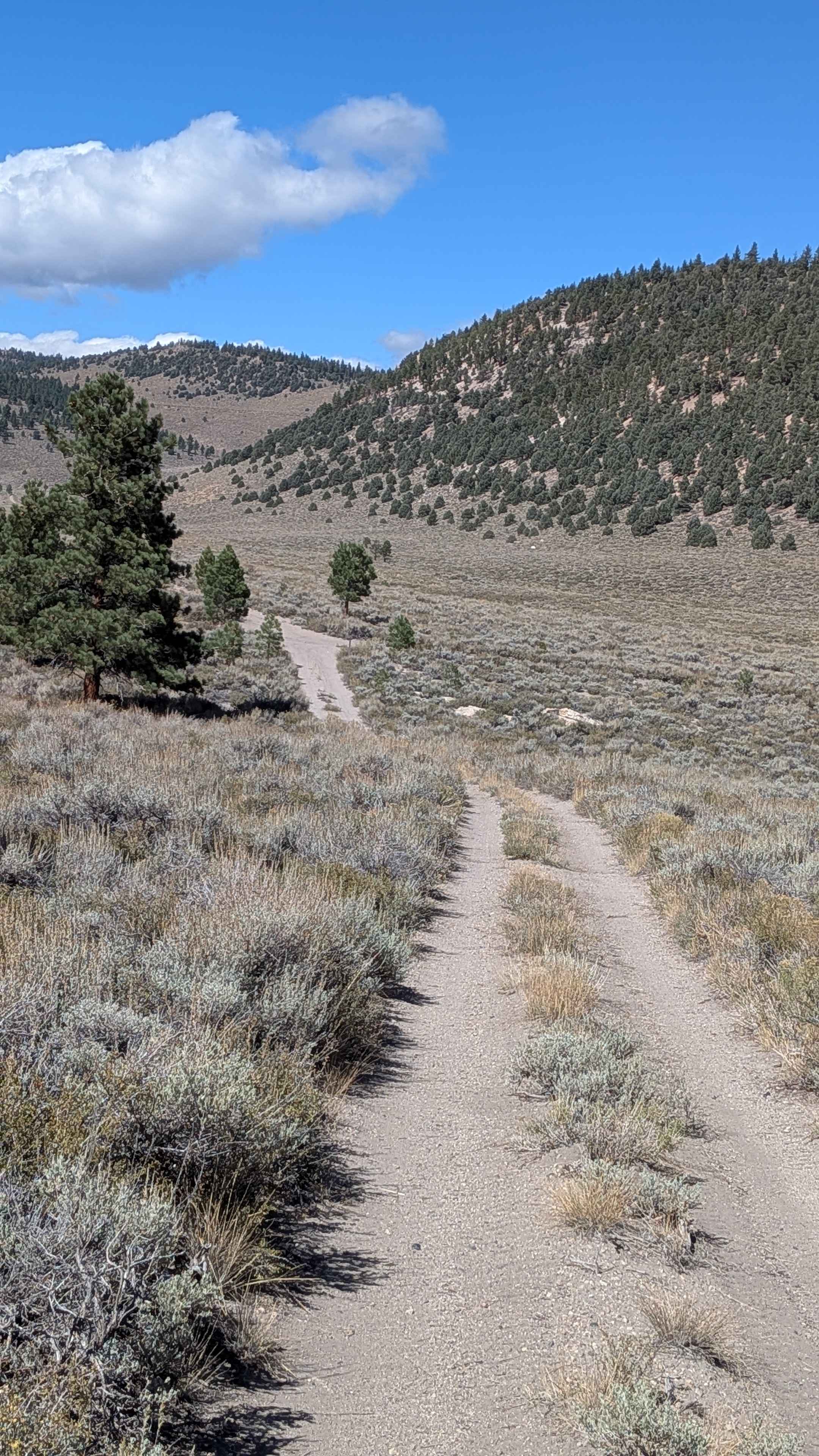
Trail Overview
This is a short ATV trail that connects from the Forest Service road FS 8S065A up to 23E291. It starts off with a semi-steep climb from the southeast end, with loose rocks and shallow ruts, for the first hundred yards. Then it mellows out in grade, continuing with a steady, gradual climb for the rest of the trail. Expect some bigger bumps and dips, but no major obstacles. It goes through a dry and dusty forest of big sugar pine trees, with lots of loose sticks and pine needles, but not many rocks. The trees are tighter in a couple spots, but it's mostly a wide forested corridor, ideal for riders of all skill levels.
Photos of 23E268
Difficulty
This is overall an easy ATV trail with no major obstacles and not many rocks. It will be easy in either direction that you ride it.
Status Reports
23E268 can be accessed by the following ride types:
- ATV (50")
- Dirt Bike
23E268 Map
Popular Trails
Horse Mountain - FS 27S11
Parker Lake Road - NF1S25
The onX Offroad Difference
onX Offroad combines trail photos, descriptions, difficulty ratings, width restrictions, seasonality, and more in a user-friendly interface. Available on all devices, with offline access and full compatibility with CarPlay and Android Auto. Discover what you’re missing today!