17EV118
Total Miles
1.3
Technical Rating
Best Time
Spring, Fall
Trail Type
Single Track
Accessible By
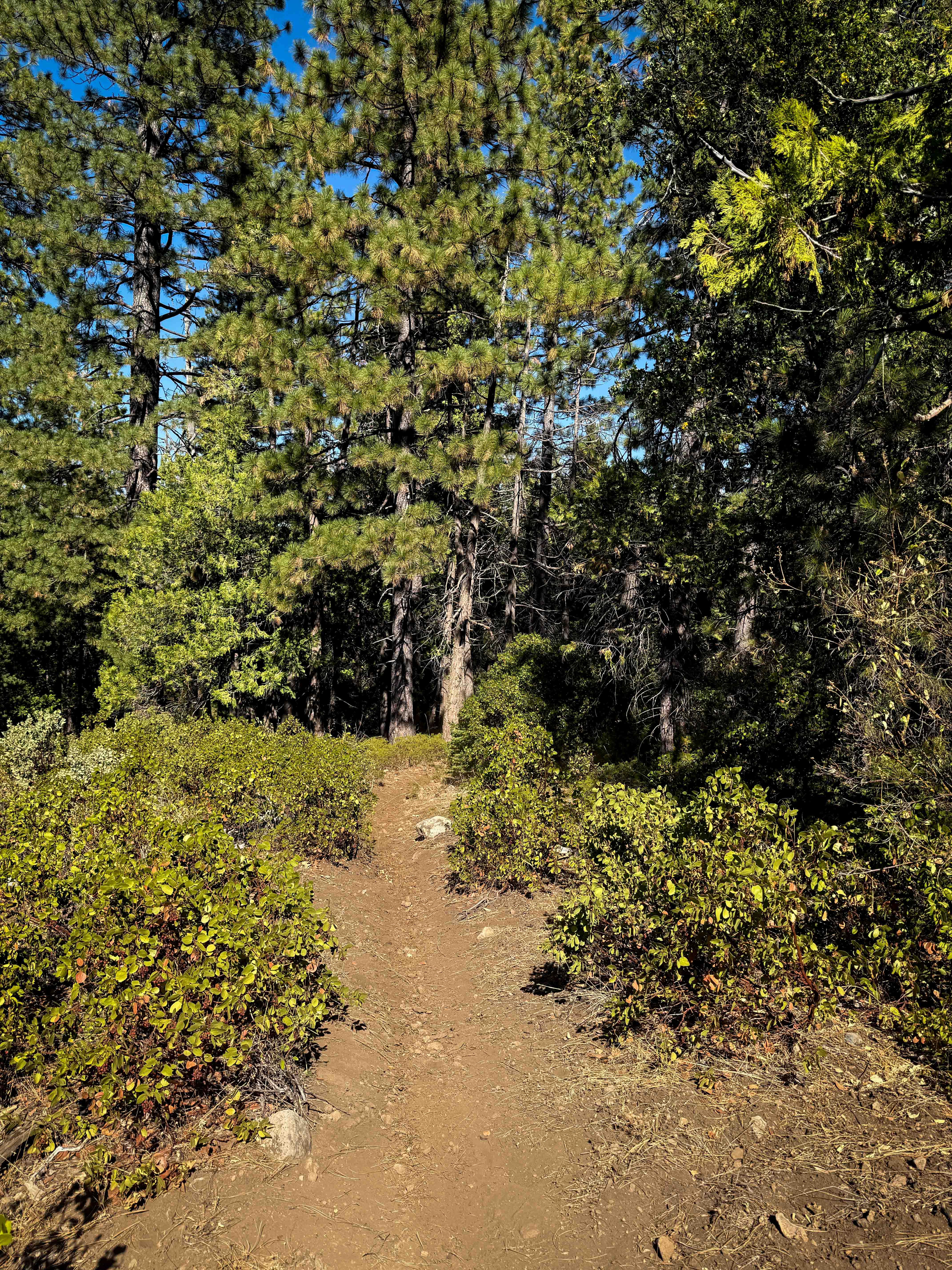
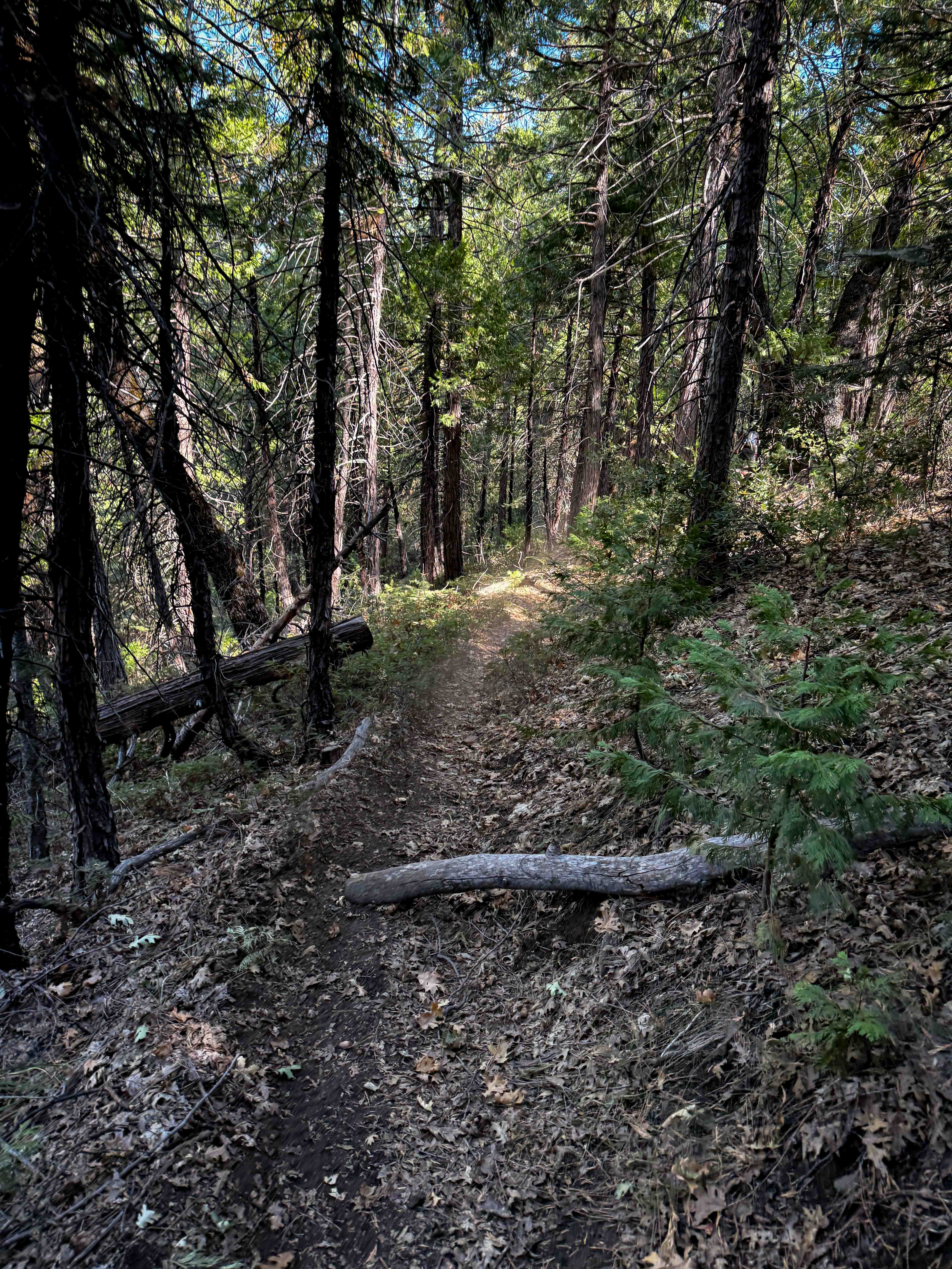
Trail Overview
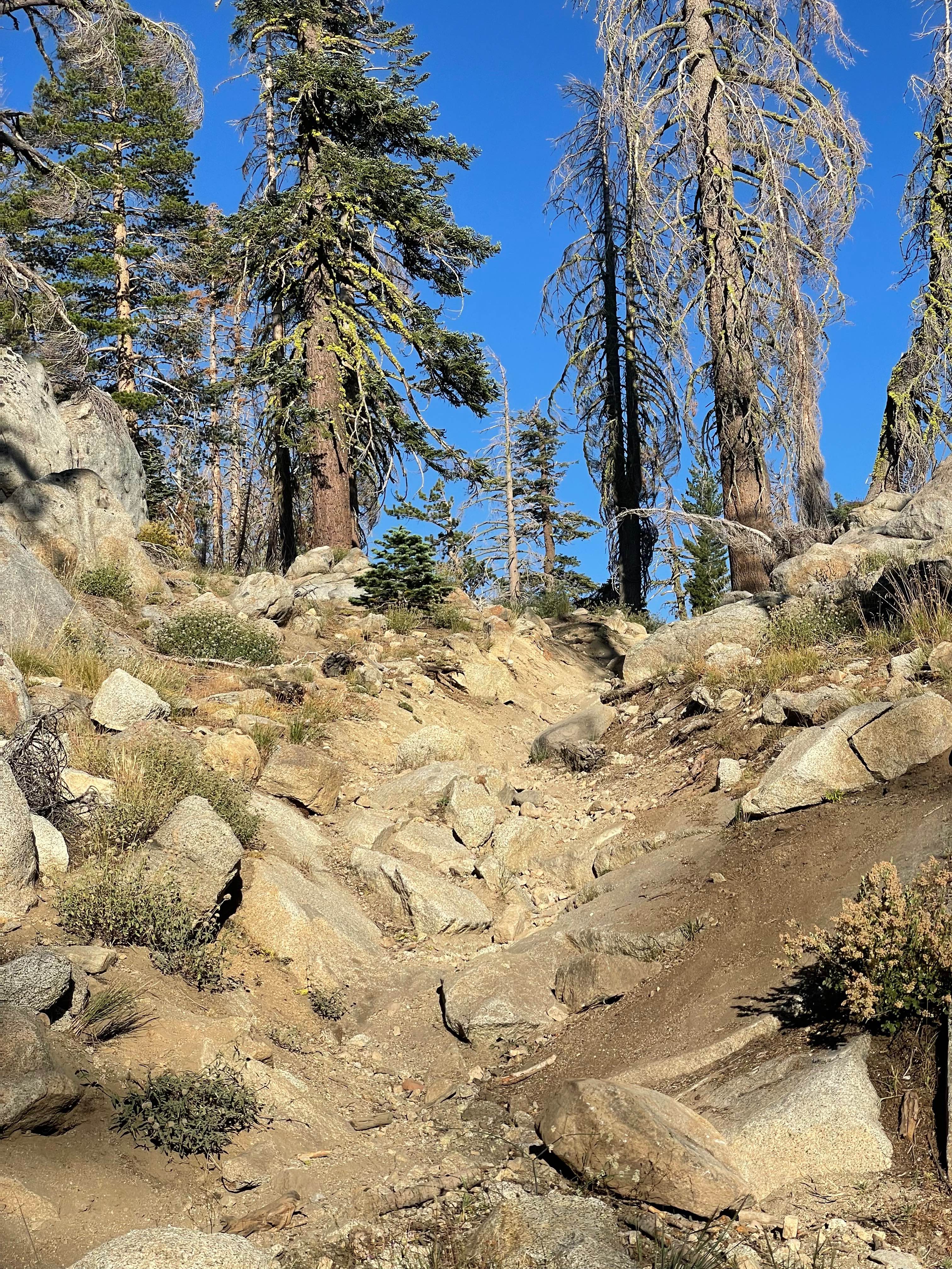
This is a 1.4 mile long single track through the Stanislaus National Forest that goes through a mix of shaded forest and sun-exposed hillsides. It's a narrow trail that weaves tightly through the tall pine trees, and has a bit of loose rock in the dryer sections that are more sun-exposed and grassy. It goes up and down with a few steep spots, but is mostly a manageable grade. Expect a few ruts, loose logs and sticks and roots. The tight trees are the hardest part of this trail, with spiky low branches sticking out. However, the access to this trail was a bit more challenging, as you had to go down a steep loose rocky hill to get to the west end, and one of the forest roads to access it was also blocked by downed logs. This trail is seasonally closed 12/16 - 4/14 to motorized use.
Photos of 17EV118
Difficulty
This is an easy trail overall as it just winds very tightly through the trees. Watch for low-hanging branches. There aren't any major obstacles though.
Status Reports
17EV118 can be accessed by the following ride types:
- Dirt Bike
17EV118 Map
Popular Trails
Buck Pasture Trail (East)
The Rocky Narrows
The onX Offroad Difference
onX Offroad combines trail photos, descriptions, difficulty ratings, width restrictions, seasonality, and more in a user-friendly interface. Available on all devices, with offline access and full compatibility with CarPlay and Android Auto. Discover what you’re missing today!