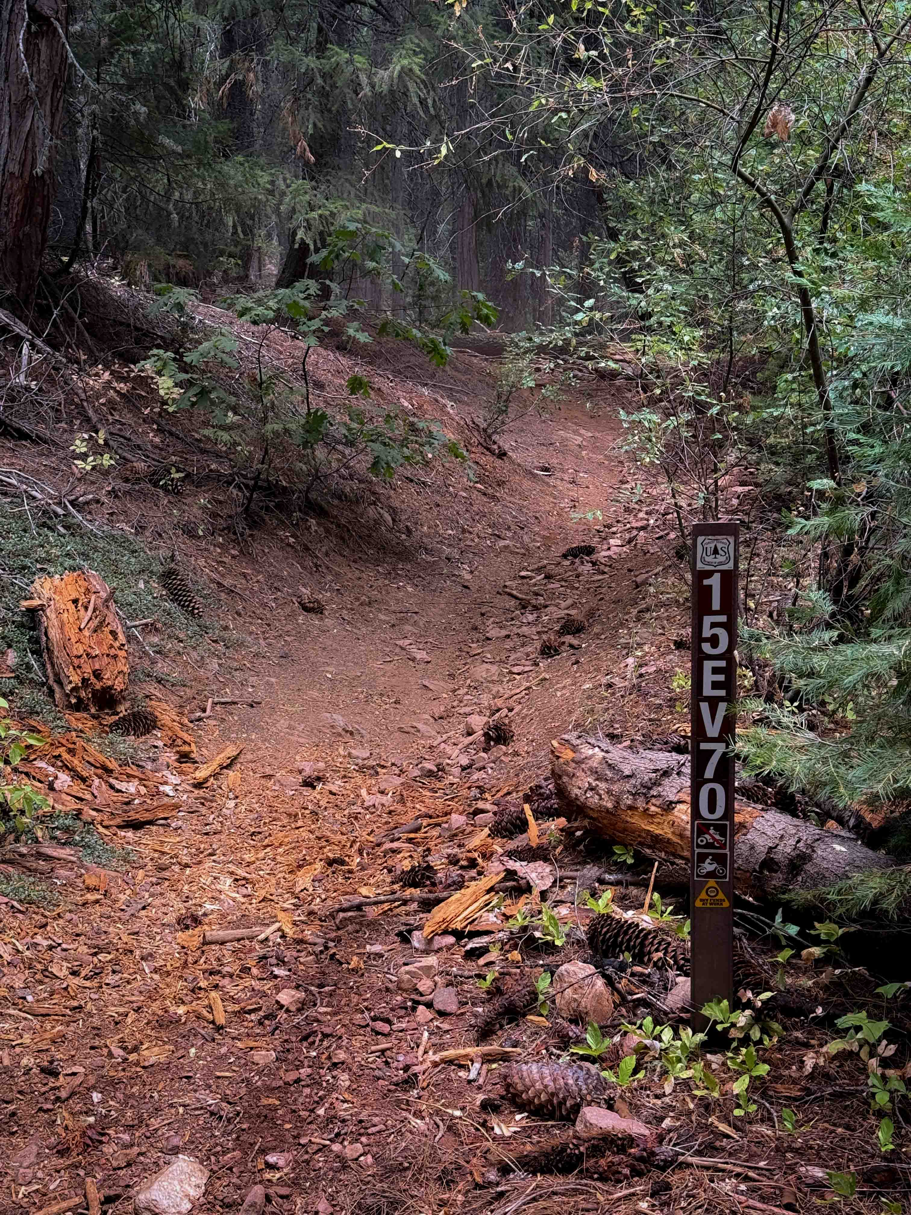
15EV70
Total Miles
0.2
Technical Rating
Best Time
Spring, Fall
Trail Type
Single Track
Accessible By
Trail Overview
This is a quarter-mile-long singletrack connector trail between the 4 way intersection of 15EV69, 15EV109, and 15EV68 on the south end, and the ATV trail 15EV105 on the north end. From south to north, it leaves the O'Neil Creek bottom, and climbs straight up a steep hill with lots of roots and loose rocks, making it somewhat more technical. It gains a couple hundred feet of elevation in just a quarter mile. The trail is littered with pinecones and stick debris and has a lot of roots across it. There was a big log down at the top of the climb that riders will have to go over.
Photos of 15EV70

Difficulty
This trail is somewhat more technical because it has lots of roots and loose rocks on a very steep slope. The entirety of the trail is a steep grade as it connects from the forest floor to the ATV trail on the hillside. This is rated Most Difficult by the Forest Service.
Status Reports
15EV70 can be accessed by the following ride types:
- Dirt Bike
15EV70 Map
Popular Trails

Red Mountain OHV Trail
Mojave Road, East
Portuguese Meadow - FS 24S15
The onX Offroad Difference
onX Offroad combines trail photos, descriptions, difficulty ratings, width restrictions, seasonality, and more in a user-friendly interface. Available on all devices, with offline access and full compatibility with CarPlay and Android Auto. Discover what you’re missing today!