Nella Winfield 12
Total Miles
4.9
Technical Rating
Best Time
Spring, Fall, Winter
Trail Type
Full-Width Road
Accessible By
Trail Overview
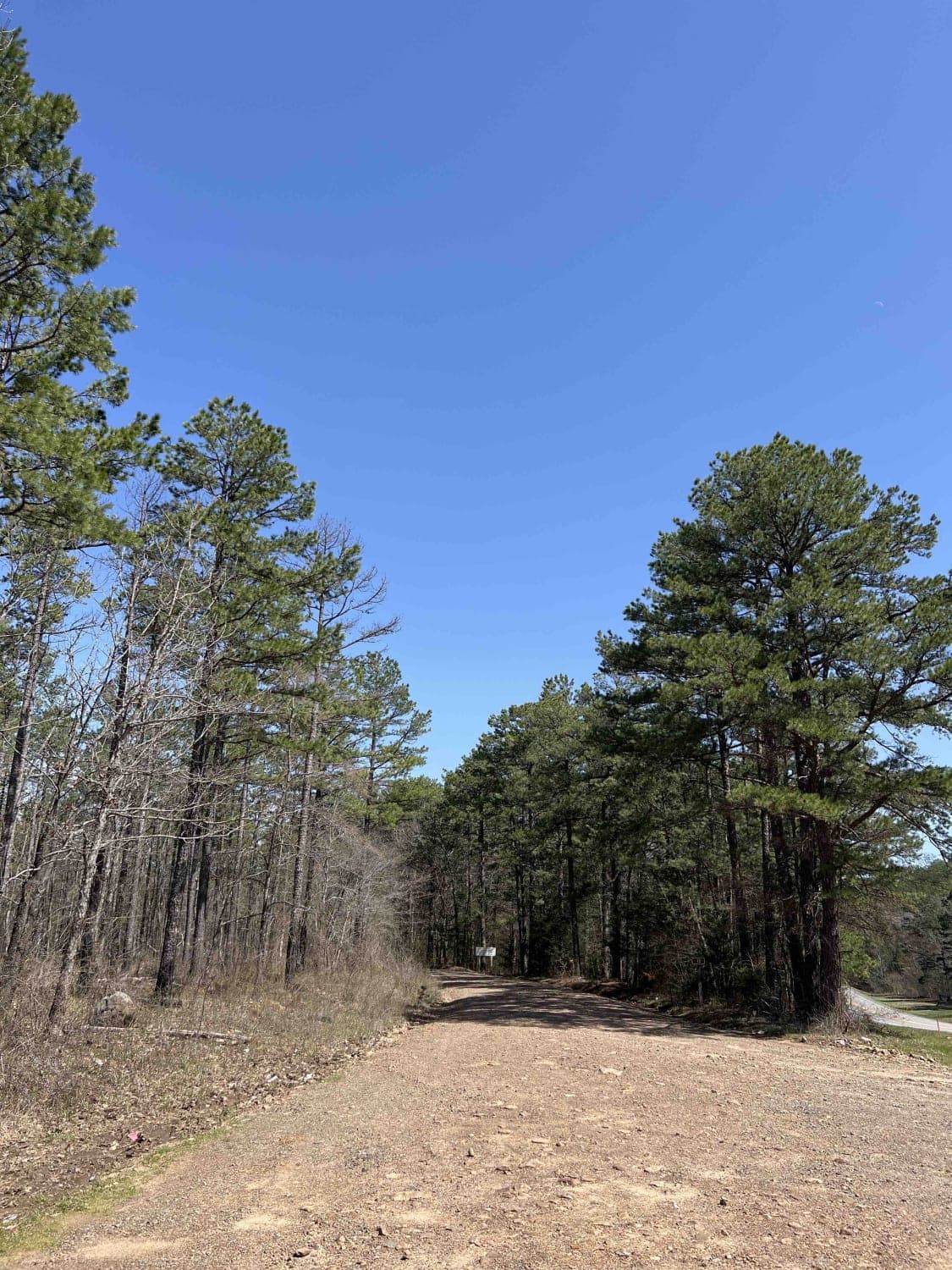
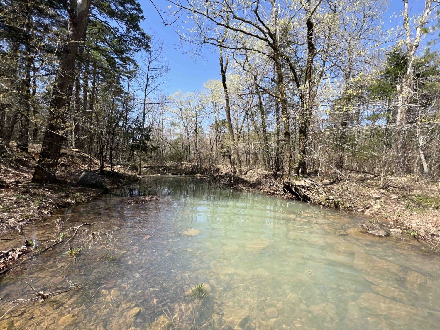
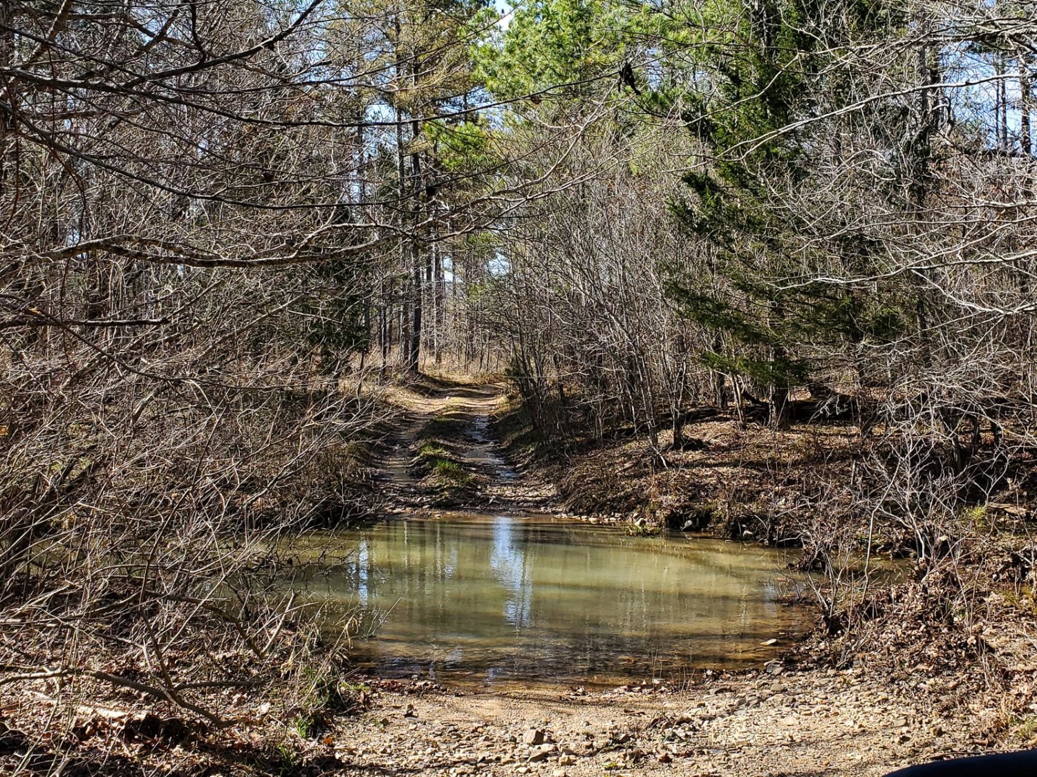
Nella Winfield 12 is the gateway to some really cool off-road trails. With several technical water crossings, narrow roads, and 4WD only areas, I had a lot of fun tracking through this area. It's washed out in several areas that require high clearance. There are camp spots but there weren't fire rings that I was able to find. Cell service is very sparse at a maximum elevation of about 1200 feet which might be the only area to get cell service. Cedar Creek is absolutely beautiful and is a fast-flowing creek. There might be some good fishing in there. Johnson Creek also crosses this area as well. Lots of areas to pull off and have some lunch as you ebb and flow through the forest.
Photos of Nella Winfield 12
Difficulty
There are several washed-out areas with water crossings that require 4WD.
History
https://www.fs.usda.gov/Internet/FSE_DOCUMENTS/stelprdb5143491.pdf
Status Reports
Nella Winfield 12 can be accessed by the following ride types:
- High-Clearance 4x4
- SUV
- SxS (60")
- ATV (50")
Nella Winfield 12 Map
Popular Trails

Ritter Road

G2 Four Fingers

Bois D'Ark WMA from HWY 67
The onX Offroad Difference
onX Offroad combines trail photos, descriptions, difficulty ratings, width restrictions, seasonality, and more in a user-friendly interface. Available on all devices, with offline access and full compatibility with CarPlay and Android Auto. Discover what you’re missing today!