Saguaro Ridge
Total Miles
0.9
Technical Rating
Best Time
Spring, Fall, Winter
Trail Type
Single Track
Accessible By
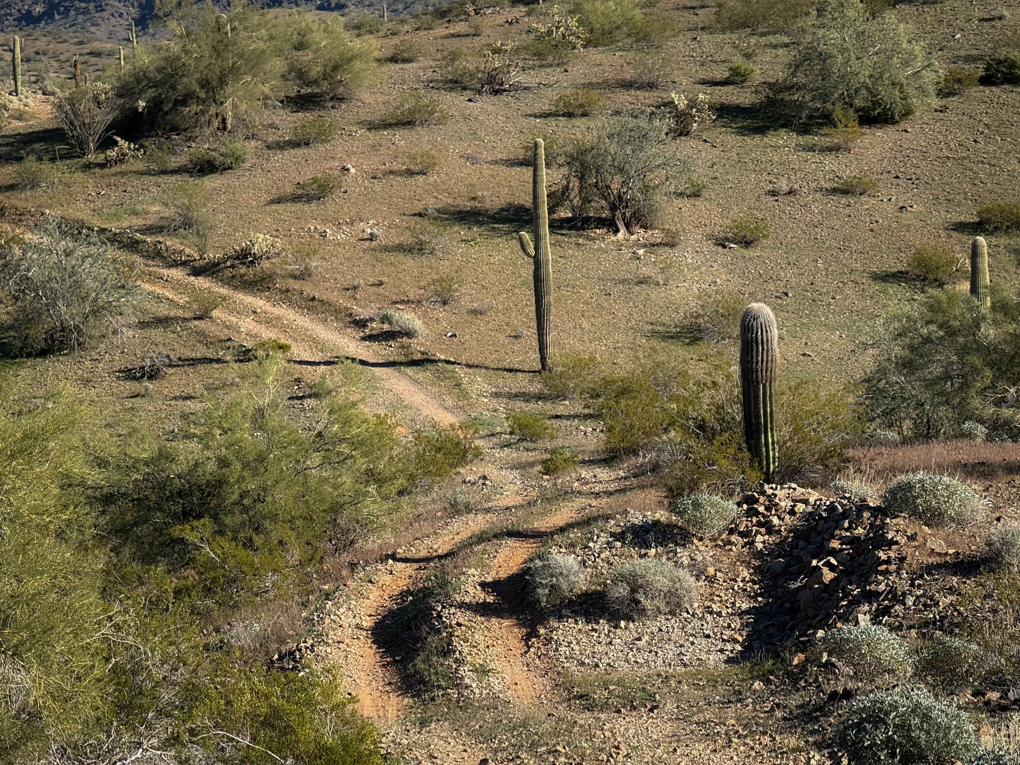
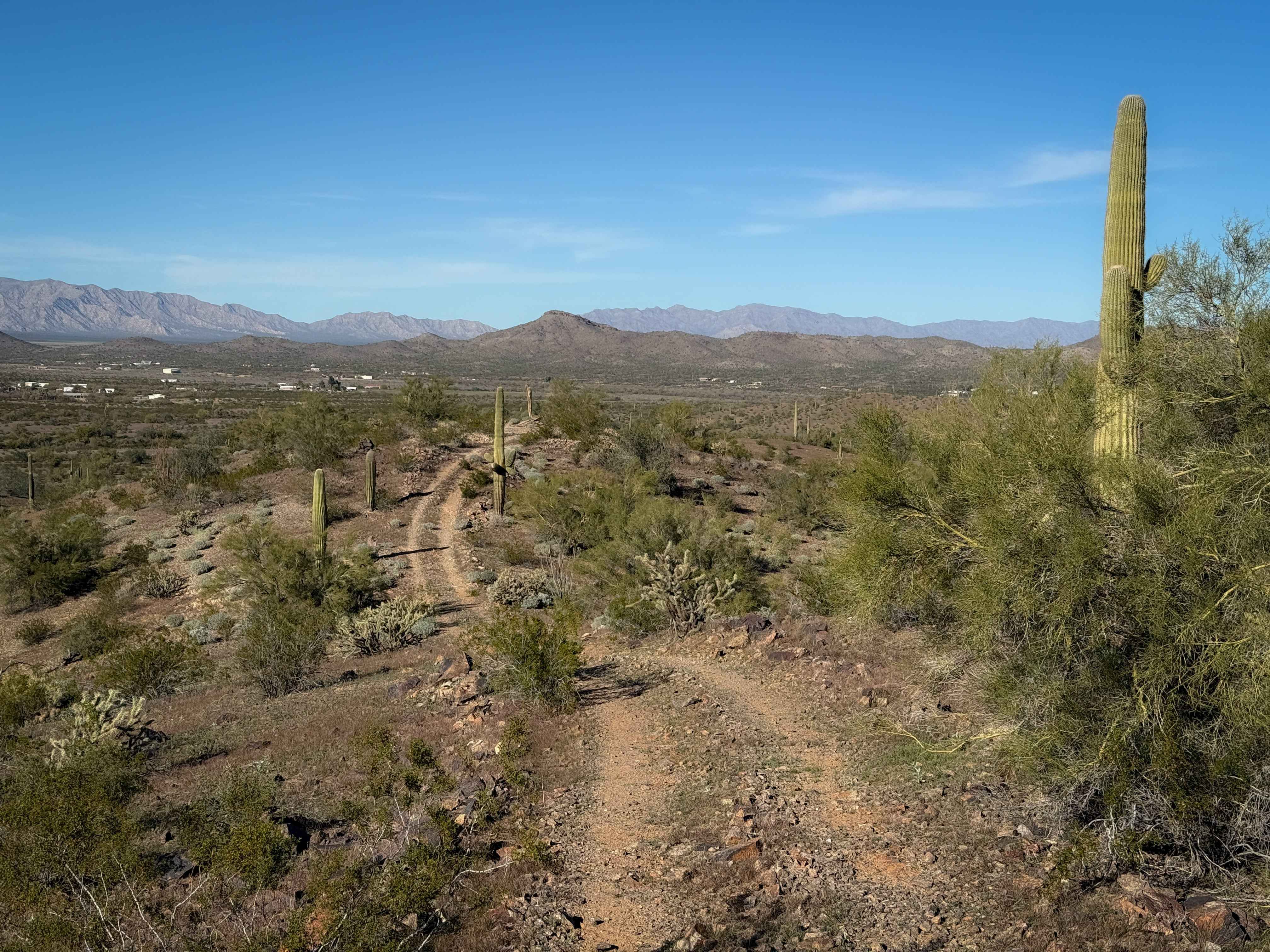
Trail Overview
The west end of this trail starts in a sand wash and climbs up from the wash onto the nearby hill. It ascends a steep climb full of loose rock on a wide trail like a two-track. In spring time, these hills are very green, and it brings you up to a scenic ridge line looking down on the desert hills full of saguaros, creosote bushes, and cholla. You get really nice views from the ridge of the distant mountains. It curves along the tops of the mountains on an easy path, with no major obstacles, and a few more gradual climbs and descents. The trail is generally pretty easy to follow, with lots of tracks on a well-defined path. It drops back off of the ridgeline back to the valley floor on the east end. This trail is entirely unmarked and lacks signage for width designations.
Photos of Saguaro Ridge
Difficulty
This trail is easy because it has no major obstacles, and the climbs and descents are overall very gradual. It is ideal for riders with basic experience.
Status Reports
Saguaro Ridge can be accessed by the following ride types:
- Dirt Bike
Saguaro Ridge Map
Popular Trails

Straight Line Down
Buffalo Ranch to Grand Canyon North Rim

Beer Bottle Wash
The onX Offroad Difference
onX Offroad combines trail photos, descriptions, difficulty ratings, width restrictions, seasonality, and more in a user-friendly interface. Available on all devices, with offline access and full compatibility with CarPlay and Android Auto. Discover what you’re missing today!