FS 660
Total Miles
1.8
Technical Rating
Best Time
Spring, Fall
Trail Type
Full-Width Road
Accessible By
Trail Overview
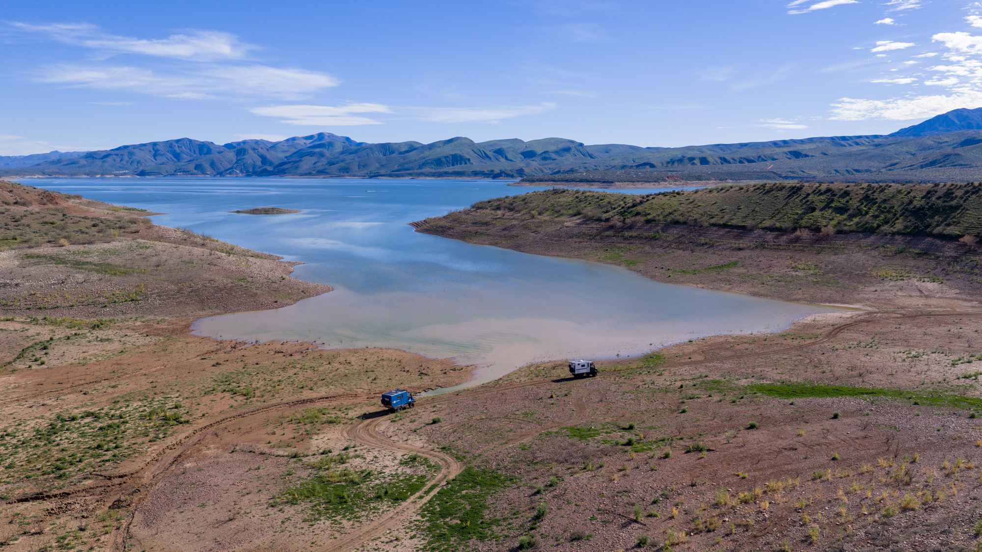
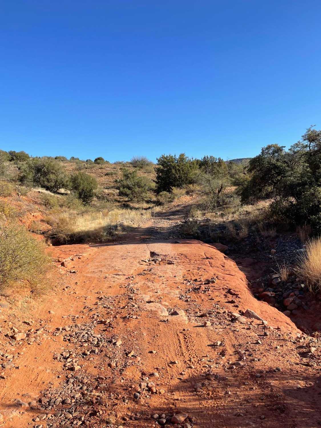
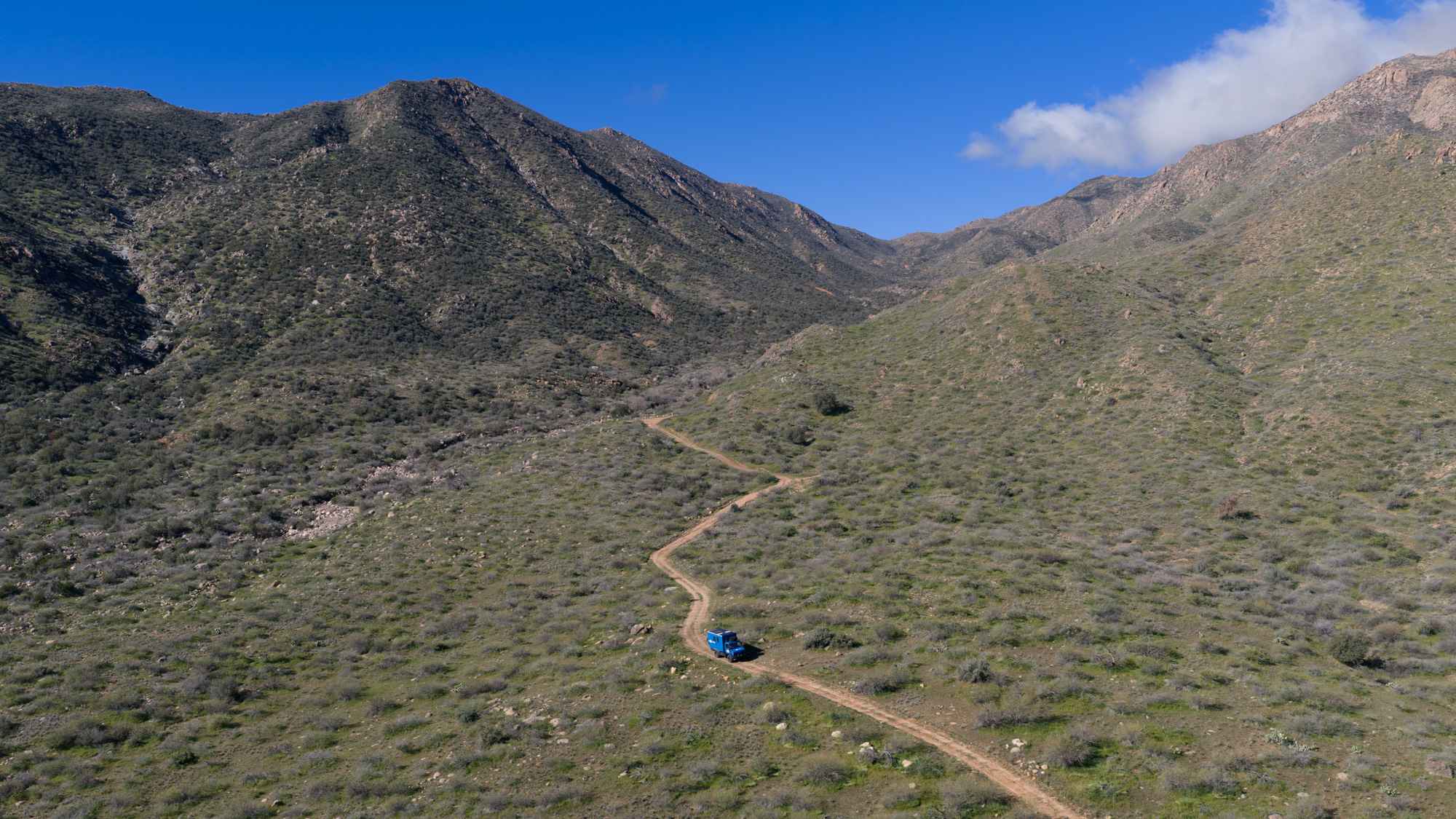
The trail begins with a winding climb along the side of a hill, featuring frequent dips, curves, and short but steep ditches formed by washouts. Vehicles with longer wheelbases may find the frequent dips and short, steep washouts more challenging. The route eventually weaves its way down to a cracked dry lakebed where the shoreline has receded, requiring a longer drive across the exposed lakebed to reach the water's edge. The road is marked by large posts in the ground and ends at two separate beach areas with a few established fire rings suitable for camping. This area is seasonally closed from November 15 through February 15 to provide wintering waterfowl with an environment free of human disturbance. Please do not drive this trail during that time.
Photos of FS 660

Difficulty
This trail earns its moderate rating due to the repeated steep dips, washout ditches, and uneven transitions that can challenge breakover angles, especially for longer wheelbase vehicles. While not extreme, drivers should be comfortable navigating erosion features and soft lakebed terrain, depending on conditions.
Status Reports
FS 660 can be accessed by the following ride types:
- High-Clearance 4x4
- SUV
- SxS (60")
- ATV (50")
- Dirt Bike
FS 660 Map
Popular Trails

Stud Horse Point Loop

West Swift Trail 366
Reno Pass - FS 524
The onX Offroad Difference
onX Offroad combines trail photos, descriptions, difficulty ratings, width restrictions, seasonality, and more in a user-friendly interface. Available on all devices, with offline access and full compatibility with CarPlay and Android Auto. Discover what you’re missing today!