Flynnagain
Total Miles
1.3
Technical Rating
Best Time
Spring, Winter, Fall
Trail Type
Single Track
Accessible By
Trail Overview
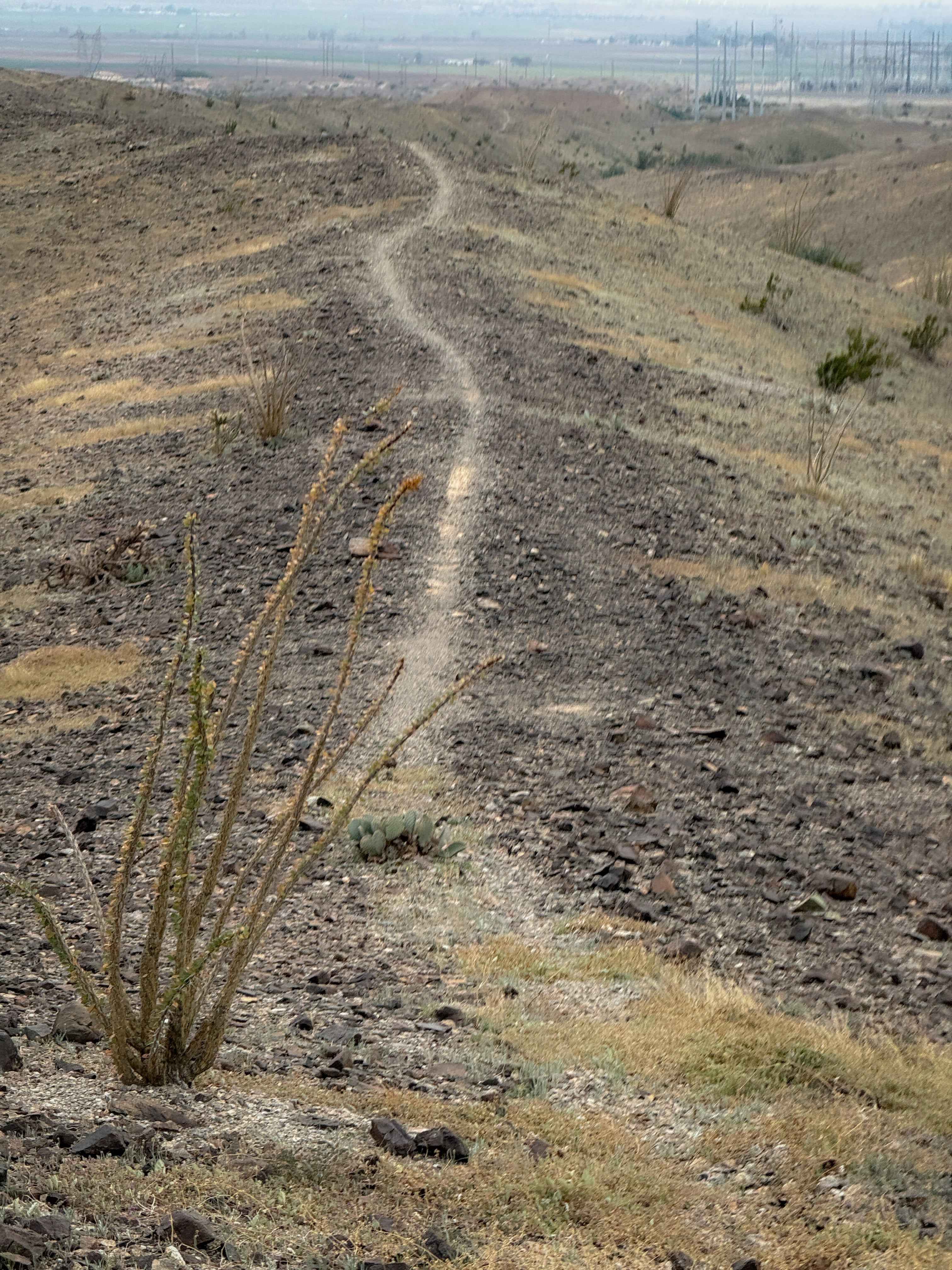
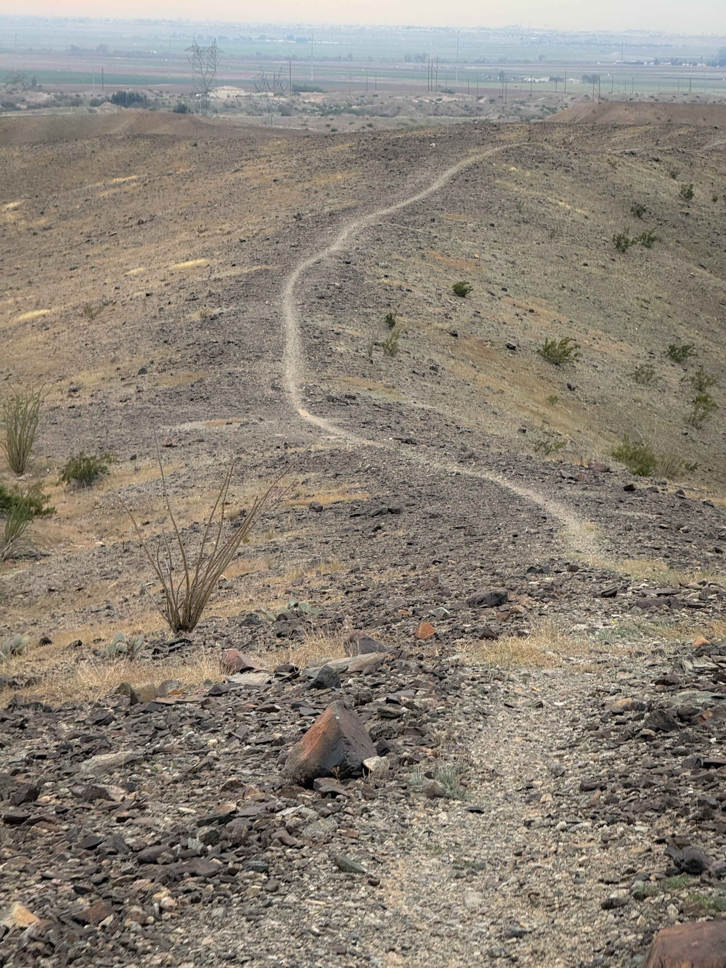
Flynnagain is a fun 1.5-mile-long singletrack on the southern portion of the Laguna Hills trail system. The north entrance is marked with the name of the trail, and it rides across a barren hilltop full of dark colored, packed loose rocks. The trail is worn into the rocks, but there are also rock stacks on either side of the trail, like goalposts, to help you follow the trail through this terrain. It drops down from the hilltops on a rutted out descent that is loose and rocky, and drops down into a wash. There are more rock cairns in the wash to help mark the route, as it is less obvious here. The trail ends on the south end at a dirt road on the north side of the canal.
Photos of Flynnagain
Difficulty
This is a fun and easy route that only has a couple steep and loose spots, but is mostly gradual and doesn't have any major rock obstacles. It is ideal for riders of all skill levels.
Status Reports
Flynnagain can be accessed by the following ride types:
- Dirt Bike
Flynnagain Map
Popular Trails
East Rim Ridge Trail

Tanks Scenic Bypass
The onX Offroad Difference
onX Offroad combines trail photos, descriptions, difficulty ratings, width restrictions, seasonality, and more in a user-friendly interface. Available on all devices, with offline access and full compatibility with CarPlay and Android Auto. Discover what you’re missing today!