Fir Point View
Total Miles
3.1
Technical Rating
Best Time
Spring, Summer, Fall
Trail Type
60" Trail
Accessible By
Trail Overview
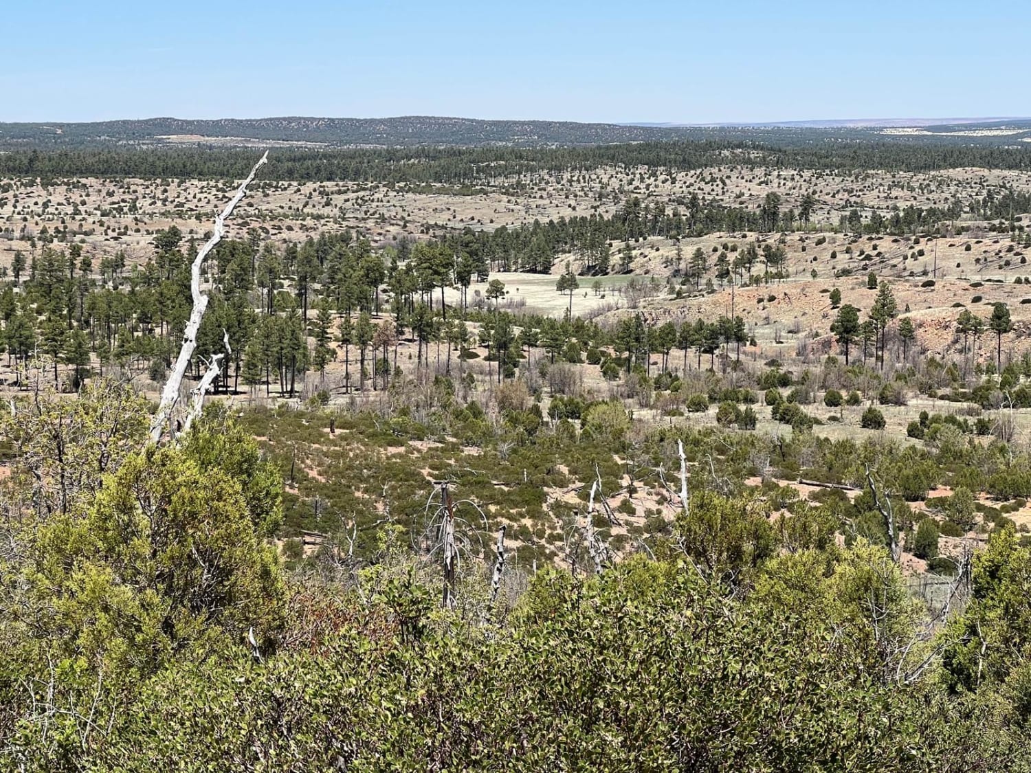
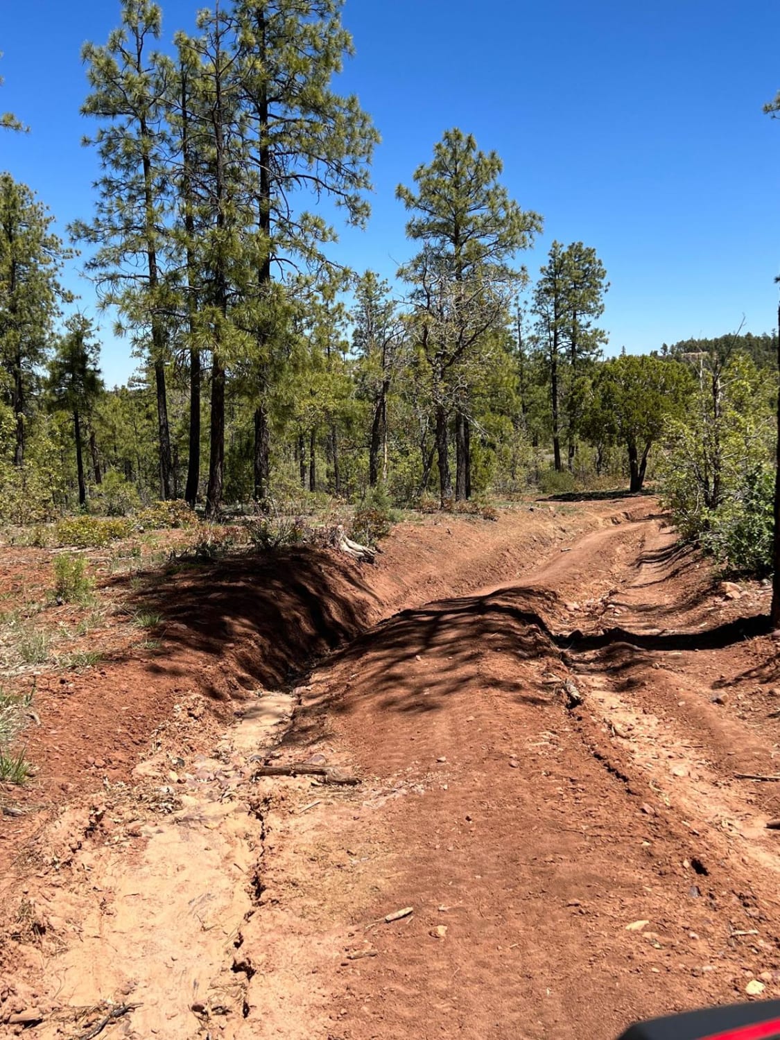
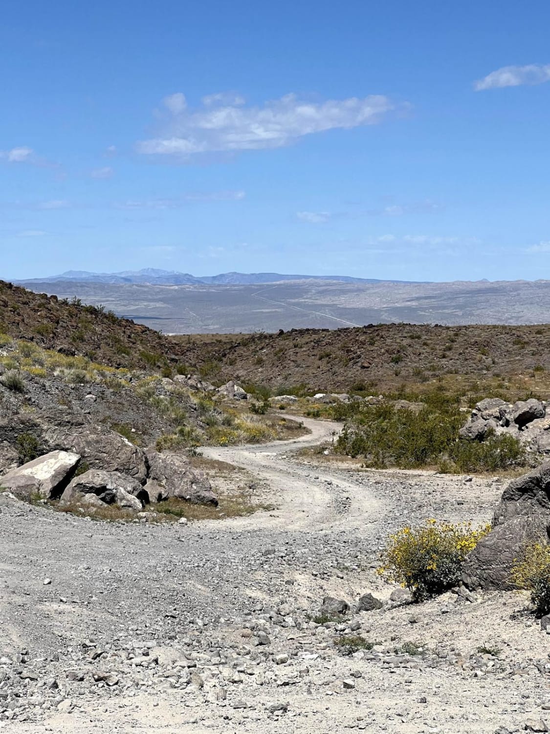
This is an unmarked ATV/UTV, dirt bike only route due to the trees and bushes making it very narrow. Larger vehicles may be able to avoid some of the trees but some will prevent further travel and there are not many places to turn around. The route starts gradually climbing on both ends before a steep, rocky, eroded trail finally reaches Fir Point at 6,755 ft elevation. There are panoramic views to the north, from Fir Point, looking at Bryant and Wood Canyon.
Photos of Fir Point View
Difficulty
This steep route has loose, large rocks and numerous washouts. Erosion has caused deep ruts.
Status Reports
Fir Point View can be accessed by the following ride types:
- SxS (60")
- ATV (50")
- Dirt Bike
Fir Point View Map
Popular Trails

Foothills Boulevard

Picacho Wash

Davidson Wash
Joy Lane to Rock Quarry Part 1
The onX Offroad Difference
onX Offroad combines trail photos, descriptions, difficulty ratings, width restrictions, seasonality, and more in a user-friendly interface. Available on all devices, with offline access and full compatibility with CarPlay and Android Auto. Discover what you’re missing today!