Coyote Peak West
Total Miles
1.3
Technical Rating
Best Time
Spring, Fall, Winter
Trail Type
Full-Width Road
Accessible By
Trail Overview
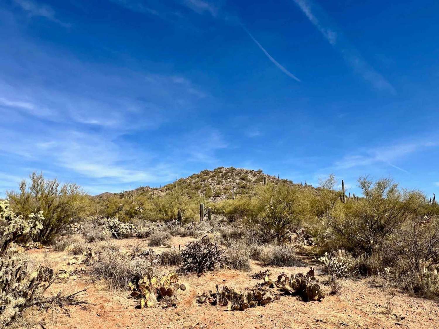
Coyote Peak West is a short out-and-back trail that promises an engaging, albeit narrow, adventure. Rated as a 2, this trail is designed primarily for single-vehicle passage, so larger vehicles may find themselves dealing with the occasional desert pinstriping and minor scratches as they navigate the route through the dense vegetation. At the end of the trail, you'll discover a small, secluded campsite that comfortably accommodates two vehicles, offering a perfect spot to unwind and enjoy the serenity of the landscape tucked into the foothills of Coyote Peak. Situated on BLM land adjacent to State Trust Land, it's essential to note that there is a gate at the trailhead--be sure to leave it as you found it to retain access. As you traverse this path, keep an eye out for signs of free-range cattle, as these local inhabitants typically make an appearance when you return to camp for the night. You'll also find a small campsite toward the trail's beginning, just past the gate. As you venture further along, the trail narrows significantly, transitioning into a field filled with jumping cacti, so proceed with caution to avoid any unwanted contact. Interspersed throughout the area, you'll also notice impressive larger saguaros standing tall, contributing to the dramatic desert scenery. Important Note: Before setting out on Coyote Peak West, always ensure you are prepared for desert conditions by bringing enough water and supplies to support your adventure. Download your offline maps for navigation, and remember that connectivity could be limited, as you may find only a bar or two of LTE service.
Photos of Coyote Peak West

Difficulty
This trail is rated as a 2, indicating manageable conditions overall. However, the narrowness and dense vegetation can present challenges for larger vehicles and require careful navigation to avoid paint damage.
Status Reports
Coyote Peak West can be accessed by the following ride types:
- High-Clearance 4x4
- SUV
- SxS (60")
- ATV (50")
- Dirt Bike
Coyote Peak West Map
Popular Trails
Bowie to Nowhere

Clark Airport Connector
The onX Offroad Difference
onX Offroad combines trail photos, descriptions, difficulty ratings, width restrictions, seasonality, and more in a user-friendly interface. Available on all devices, with offline access and full compatibility with CarPlay and Android Auto. Discover what you’re missing today!