4 trails found in Arizona
Which "airport" are you looking for?
We found 4 off-road trails in Arizona matching your search. Pick the one you're looking for below.
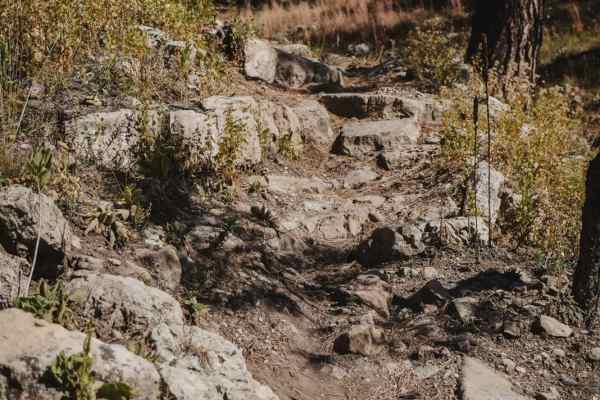
Airport Connector
Airport Connector is a 0.7-mile short connector trail in the middle of the Airport Trail loop that connects the north and south halves of the loop. It's an easy trail that is a good way to shortcut your ride if you don't want to ride all 17 miles of the Airport Trail. Taking the Airport Connector cu...
Learn more about Airport Connector
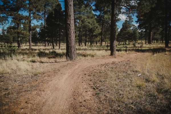
Airport
Airport Trail is a long single-track trail in the Coconino National Forest south of Flagstaff, Arizona, in the Kelly Motorized Trail System. This one is about a 17-mile loop, with lots of tight twisty turns, and full of rocks. There is a trailhead on the north end at the start of Mary's Dinner, and ...
Learn more about Airport

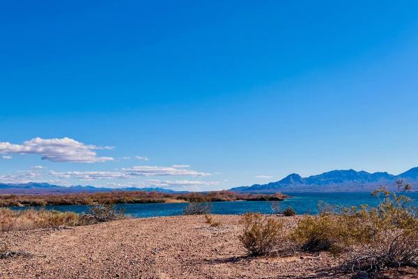
Cottonwood Valley Overlook to Airport Coves
This trail begins or ends at the Cottonwood Valley overlook, where you can see Lake Mojave in multiple directions. There is no water access from this overlook. It is a series of canyons with the lake far below. The trail is dirt mostly with some loose gravel. Watch for small washouts. The view from ...
Learn more about Cottonwood Valley Overlook to Airport Coves
Airport Cove Loop
This short out-and-back trail picks up off the end of Willow Cove Trail. This trail leads to several dispersed campsites and access to Lake Mojave. This trail is a one-lane road specified by a sign on the way in. It is rated a two because the trail is only one car wide. Oncoming vehicles would have ...
Learn more about Airport Cove Loop