Little River Canyon
Total Miles
15.4
Technical Rating
Best Time
Summer, Spring, Fall
Trail Type
Full-Width Road
Accessible By
Trail Overview
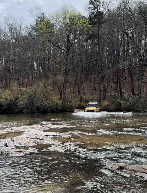
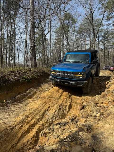
Little River Canyon is a Wildlife Management Area with several interconnected trails. The trails are a mixture of maintained gravel, dirt, heavy ruts, and water crossings. A paper map with trail markings can be picked up at the ranger station (County Road 103 just off of State Road 35). The trail entrance is on County Road 295 (off of State Road 35). This 15.1-mile loop typically is run counterclockwise. From the trail entrance to Trail 7 (2.6 miles), it is tame and mostly gravel, with 2 small creek crossings. Trail 7 is moderately rutted, meandering through a wooded area. Trail 9 starts as maintained gravel, but the east end is deeply rutted and a spotter is recommended. Going south on Trail 5, you cross another small creek and can then immediately choose to do a deeper crossing of Little River on Trail 3 or continue back to the entrance. The river crossing is not too deep (in early spring) if you keep a direct line, but it's fairly bumpy. Trail 3 spits you back on County 103, but you very quickly turn right to get back on Trail 2. There are some muddy spots and puddles along Trail 2 leading up to a right turn on Trail 4 and the second crossing of Little River. This crossing is a bit deeper (~24 inches deep in early spring), especially at the entrance. The exit of the river isn't clearly visible at the start, but head toward the slightly exposed flat rocks in the middle and veer slightly right. Shortly after emerging from the river, a left turn puts you back on Trail 5 and back to the trail entrance. A quick stop at the Little River Falls Bridge overlook (on State Road 35) or other overlooks off of paved road 176 are nice photo ops.
Photos of Little River Canyon
Difficulty
Expect deep ruts in sections and water crossings of ~24 inches in spots (depending on rainfall).
Status Reports
Little River Canyon can be accessed by the following ride types:
- High-Clearance 4x4
- SUV
Little River Canyon Map
Popular Trails

Rock Creek

#7 Diamondback - Beginning Section


Mountain Dew
The onX Offroad Difference
onX Offroad combines trail photos, descriptions, difficulty ratings, width restrictions, seasonality, and more in a user-friendly interface. Available on all devices, with offline access and full compatibility with CarPlay and Android Auto. Discover what you’re missing today!