OV350843
Total Miles
1.0
Technical Rating
Best Time
Summer, Spring, Fall
Trail Type
50" Trail
Accessible By
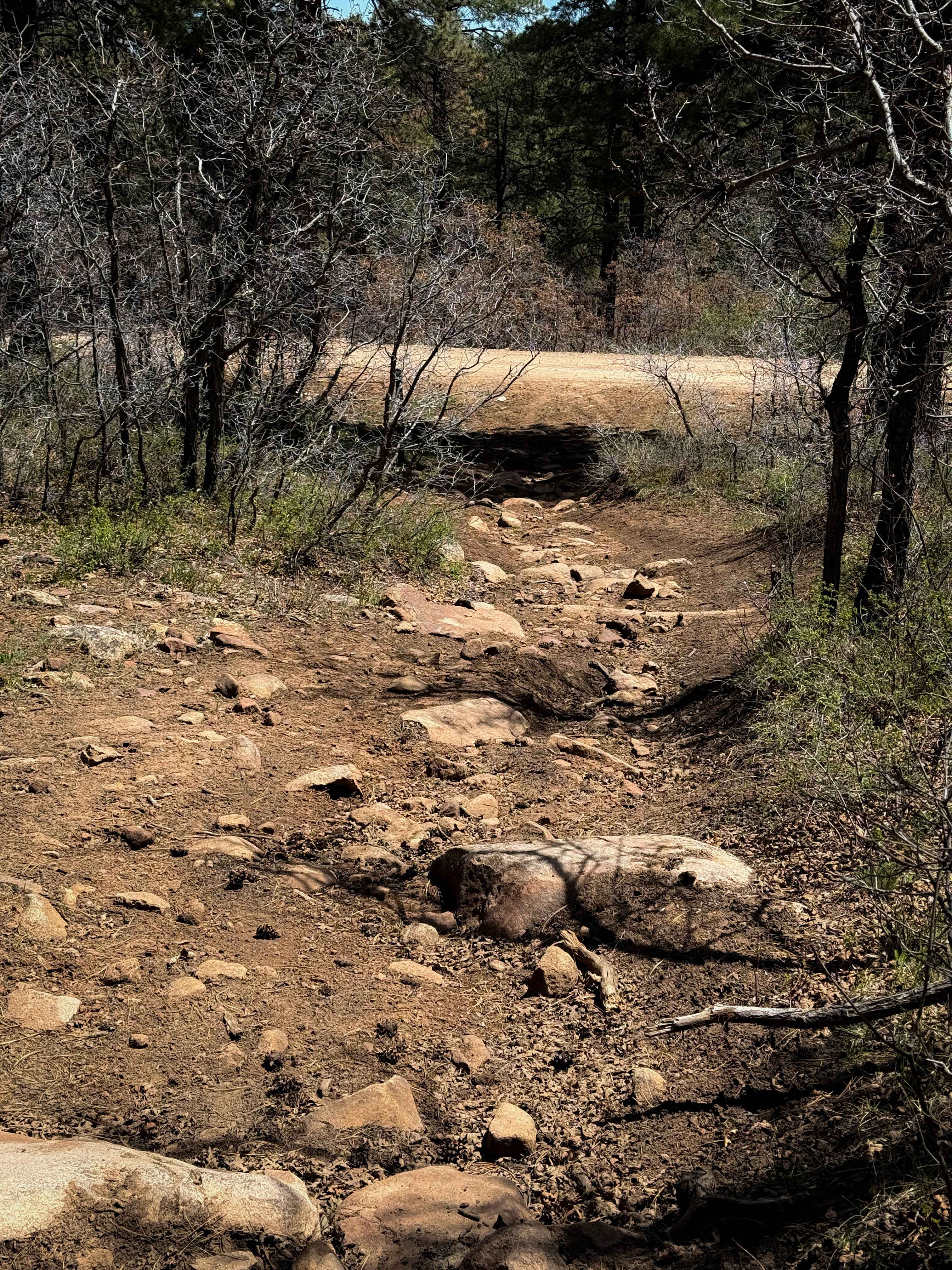
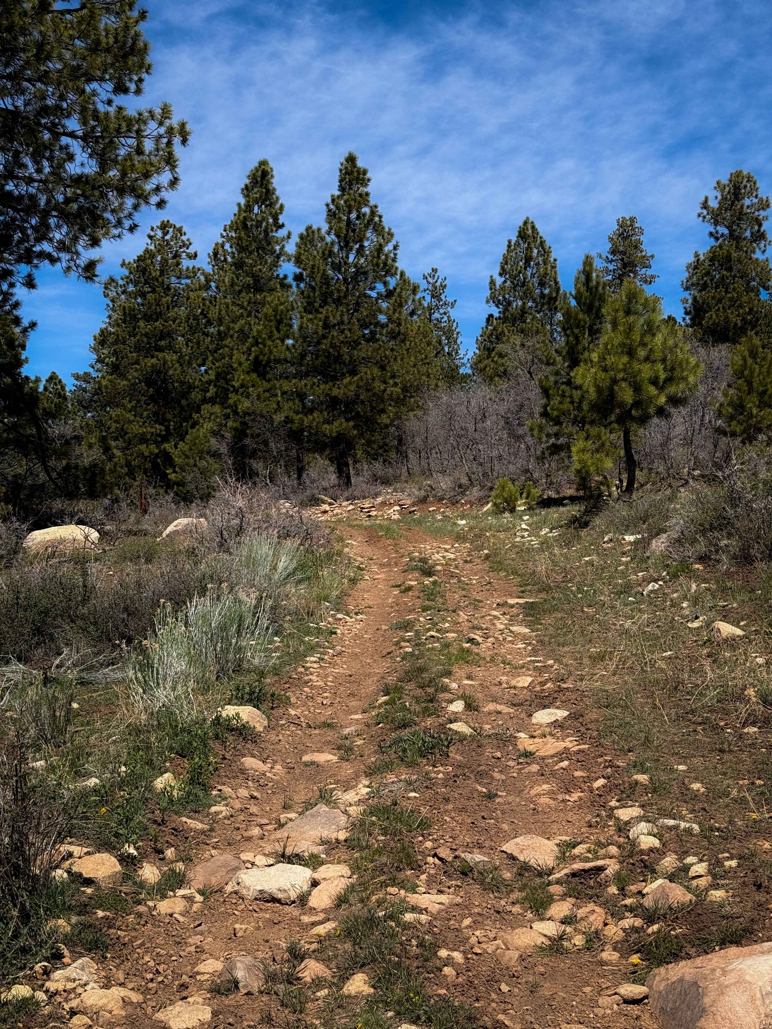
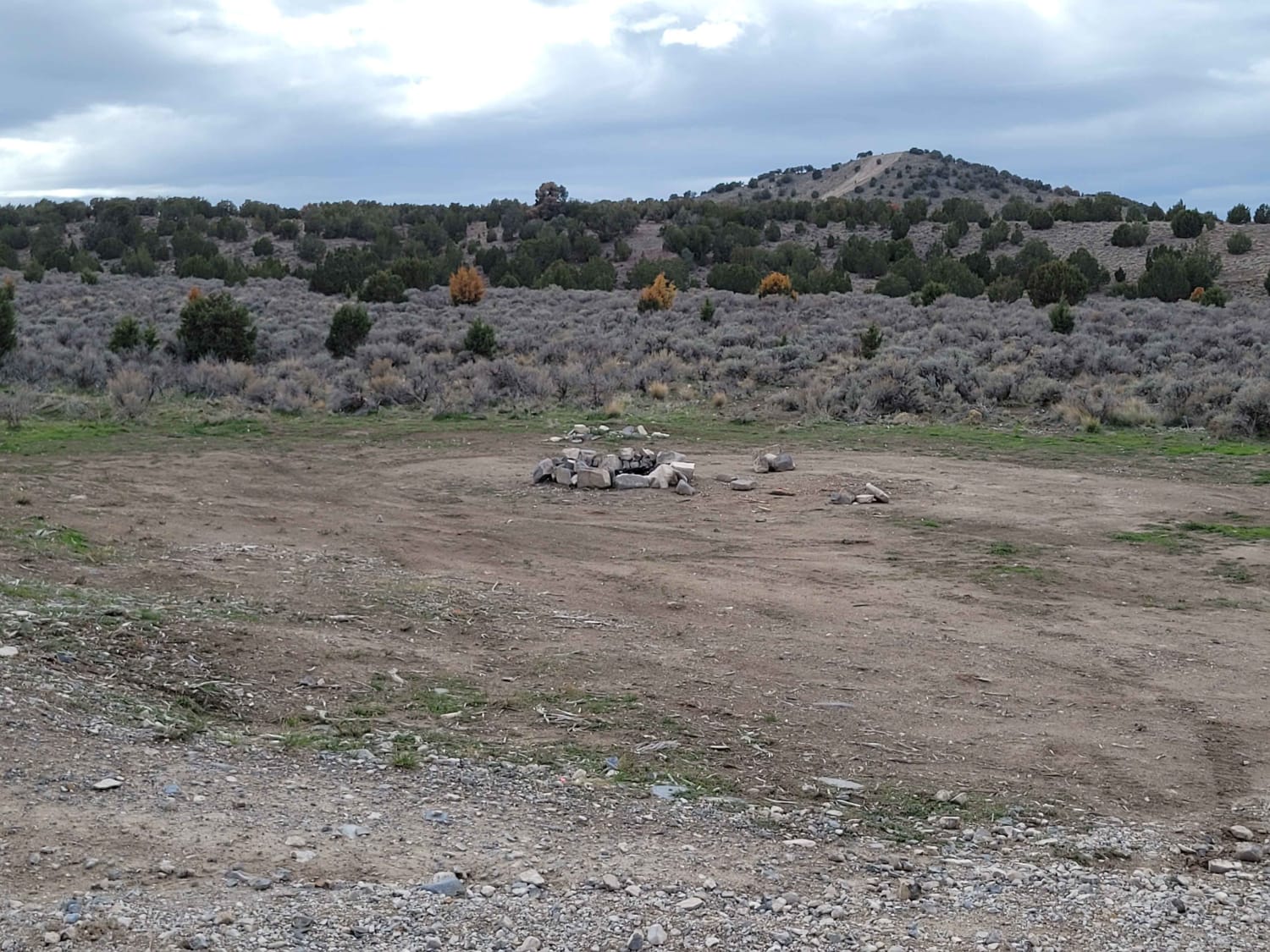
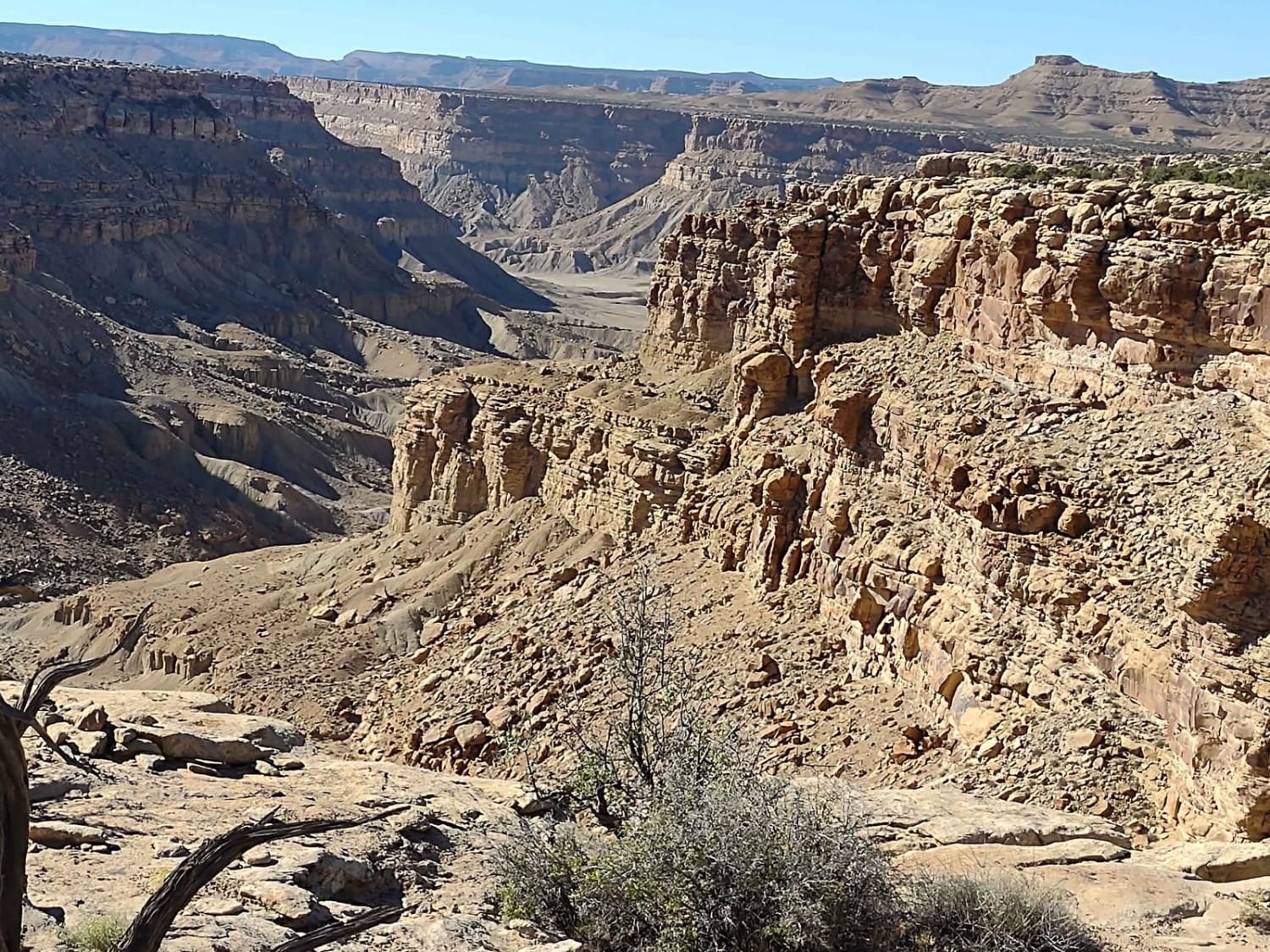
Trail Overview
This is a short and moderately easy segment of ATV trail that rides along the boundary of Utah State Trust Land and the Manti La Sal National Forest. The west end starts at the bottom of a hill climb overlooking a small pond on the Chicken Creek. You may see deer or wild turkeys here. It climbs a wide two-track that has frequent embedded and loose chunky rocks in the surface, but remains pretty gradual and easy. It meanders through ponderosa pine on small rolling hills, with shallow ruts, along a fence line. There is a 50" pinch point at the intersection with the Upper 2 Mile Loop. The trail becomes rockier as it goes east, with several small embedded boulders in the trail. The last quarter mile on the east end gets steeper as it descends down towards the Rim Rocker trail, with several small rock ledges from the embedded rocks. The trail was clear of any logs in early spring, but there is always potential for new log hazards, as this is a typical forest environment at 8,600 feet elevation.
Photos of OV350843
Difficulty
This is a moderately easy trail as it has several small rock ledges and short, steep climbs, but it is mostly gradual, and was free of any log obstacles at the time. It is best suited to riders with a basic experience level.
Status Reports
OV350843 can be accessed by the following ride types:
- ATV (50")
- Dirt Bike
OV350843 Map
Popular Trails
Devil's Playground and Dodge Truck Mines
Tantalus Flat - NF30168
Horseshoe Way
Horse Canyon Road
The onX Offroad Difference
onX Offroad combines trail photos, descriptions, difficulty ratings, width restrictions, seasonality, and more in a user-friendly interface. Available on all devices, with offline access and full compatibility with CarPlay and Android Auto. Discover what you’re missing today!