Tote Road
Total Kilometers
3.0
Technical Rating
Best Time
Spring, Summer, Fall
Trail Type
High-Clearance 4x4 Trail
Accessible By
Trail Overview
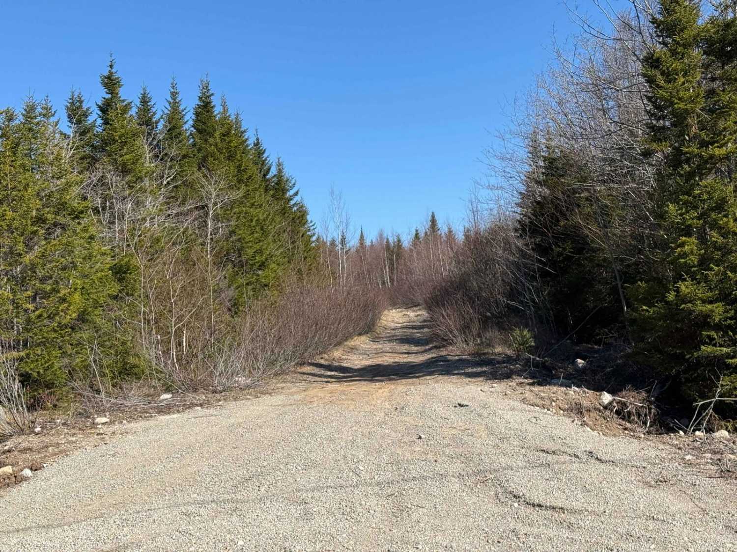
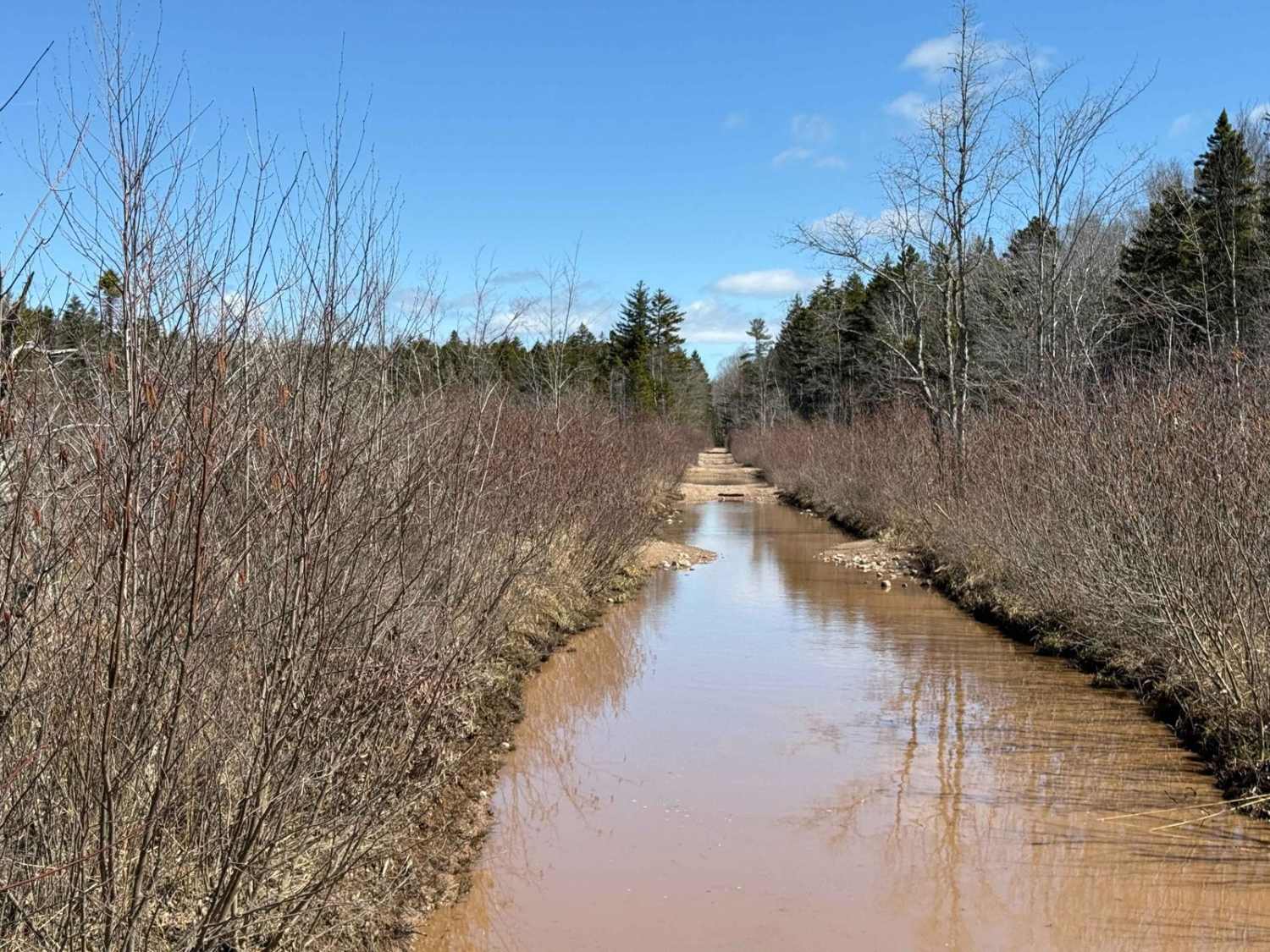
Starting from the southern end, Tote Road is a narrow, hard-packed dirt trail formerly used as a logging road. The trail is unmaintained and well-worn, with heavy brush guaranteeing pinstriping for most vehicles. While the road occasionally opens up, it remains tight, with some sections featuring large, exposed rocks that create natural ledges. Expect to encounter exposed culverts that require careful navigation and several large water holes that may conceal rocks and logs beneath the surface. The final 500 meters near the northern end is the most technical, especially for wider vehicles. This section narrows significantly and includes tight passages around large boulders, requiring precise manoeuvring.
Photos of Tote Road

Difficulty
Narrow trail, small rock ledges, exposed culverts, large water holes
History
The Tote Road in Upper Tantallon, Nova Scotia, is a route rich in history, blending its origins with the historic Portage Road and connections to key settlement and transportation networks. A section of the Tote Road aligns with the Portage Road, a late 19th- or early 20th-century route that connected the St. Margaret's Bay Road to the Old Annapolis Road. This network supported logging operations and early settlement activities in the region.The Old Annapolis Road, surveyed in the late 18th century, aimed to provide a direct transportation link across the province, facilitating settlement in areas like Wellington, a military settlement north of the Tote Road area. Although Wellington was largely abandoned by the 1860s, its remnants, including named lakes and cellar sites, reflect its historical significance. The Portage Road likely served as a logistical link, supporting resource exploitation and settlement in this region.Today, the Tote Road offers explorers a glimpse into Nova Scotia's past, connecting users with the legacy of Indigenous pathways, early European settlement, and the province's logging heritage. As you travel this trail, you are walking through layers of history, from ancient transportation corridors to the industrious efforts of early settlers and loggers.
Status Reports
Tote Road can be accessed by the following ride types:
- High-Clearance 4x4
- SxS (60")
- ATV (50")
- Dirt Bike
Tote Road Map
Popular Trails

Old Liverpool Road

Butler Road
South River Lake Trail

Quarry Road
The onX Offroad Difference
onX Offroad combines trail photos, descriptions, difficulty ratings, width restrictions, seasonality, and more in a user-friendly interface. Available on all devices, with offline access and full compatibility with CarPlay and Android Auto. Discover what you’re missing today!