Stanley Airport Road
Total Kilometers
7.7
Technical Rating
Best Time
Spring, Summer, Fall
Trail Type
Full-Width Road
Accessible By
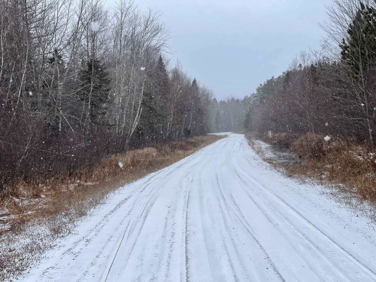
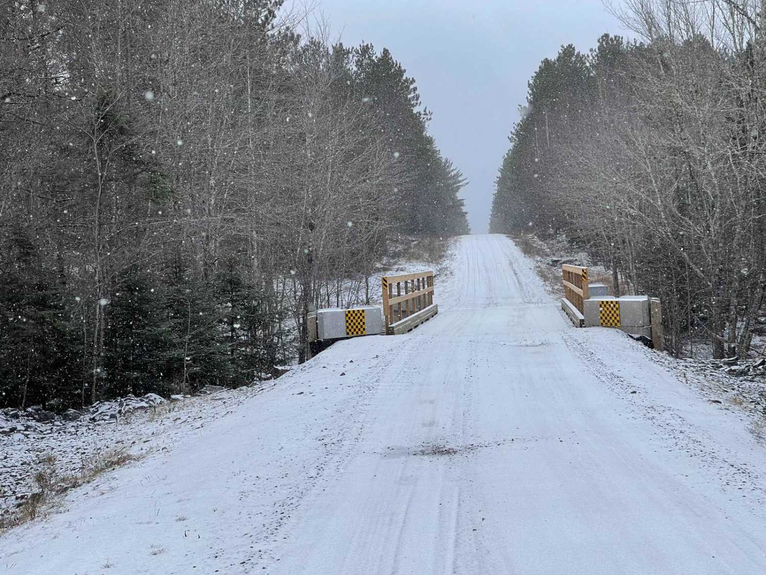
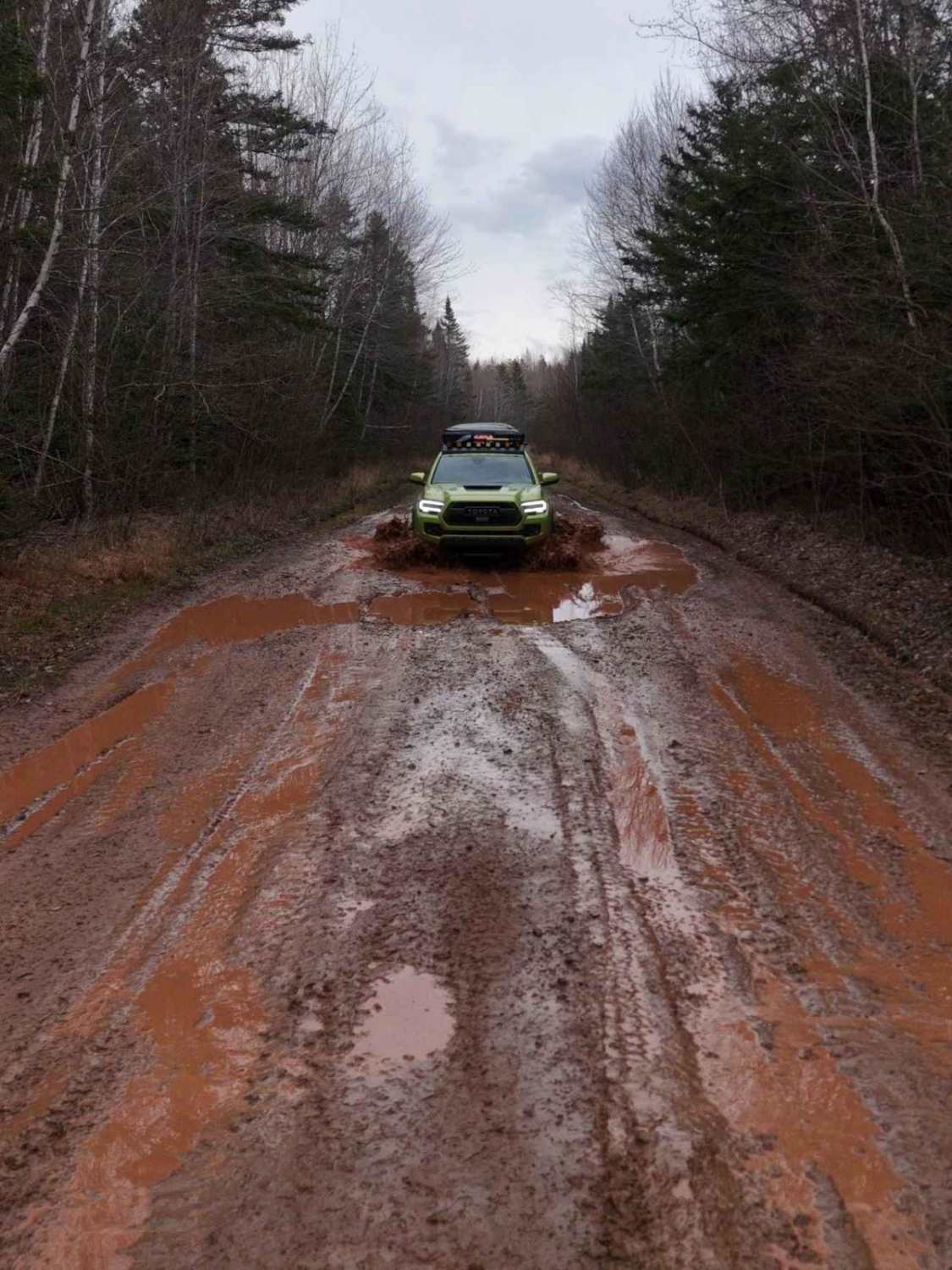
Trail Overview
Stanley Airport Road is an easy dirt road that serves as the main entrance to a large section of crown land in East Hants. This road is home to Stanley Airport and the Stanley Public Shooting Range, making it a notable route for various activities. It provides access to numerous roads leading into crown land, offering plenty of exploration opportunities. However, be cautious of active logging in the area. Additionally, the road may become rutted and muddy during the spring thaw or heavy rain, so plan accordingly. This road is perfect for those looking to explore the vast crown lands while enjoying the amenities nearby. Stanley Airport, located in Hants County, Nova Scotia, has a rich history dating back to World War II. It was established in March 1941 as RCAF Station Stanley, part of the British Commonwealth Air Training Plan. The airport served as the base for the Royal Canadian Air Force's Number 17 Elementary Flying School, which trained thousands of pilots using Fleet Finch II and de Havilland Tiger Moth aircraft. The school operated until January 1944, when it was closed as the war drew to a close. Today, Stanley Airport is home to the Stanley Sport Aviation Association, continuing its legacy in aviation.
Photos of Stanley Airport Road
Difficulty
This is an easy dirt and gravel road. There are some ruts during spring thaw/heavy rain.
Status Reports
Stanley Airport Road can be accessed by the following ride types:
- High-Clearance 4x4
- SUV
- SxS (60")
- ATV (50")
- Dirt Bike
Stanley Airport Road Map
Popular Trails

Browns Mountain Road

Ingramport Connector
Mosher Road

Quarry Road
The onX Offroad Difference
onX Offroad combines trail photos, descriptions, difficulty ratings, width restrictions, seasonality, and more in a user-friendly interface. Available on all devices, with offline access and full compatibility with CarPlay and Android Auto. Discover what you’re missing today!