Pabineau Falls Trail
Total Kilometers
8.7
Technical Rating
Best Time
Spring, Fall, Summer
Trail Type
Full-Width Road
Accessible By
Trail Overview
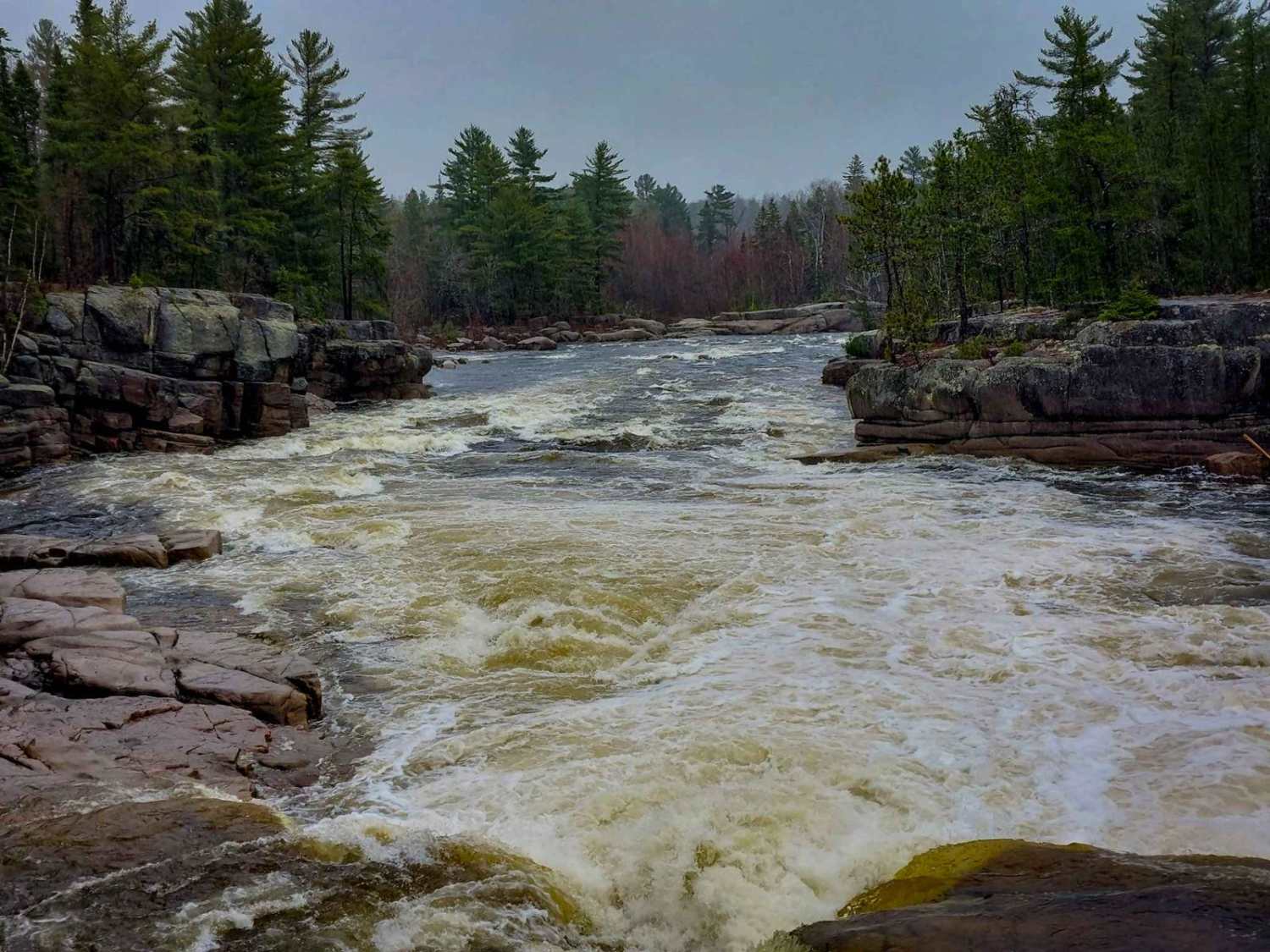
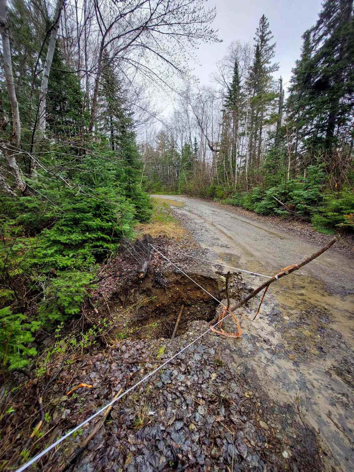
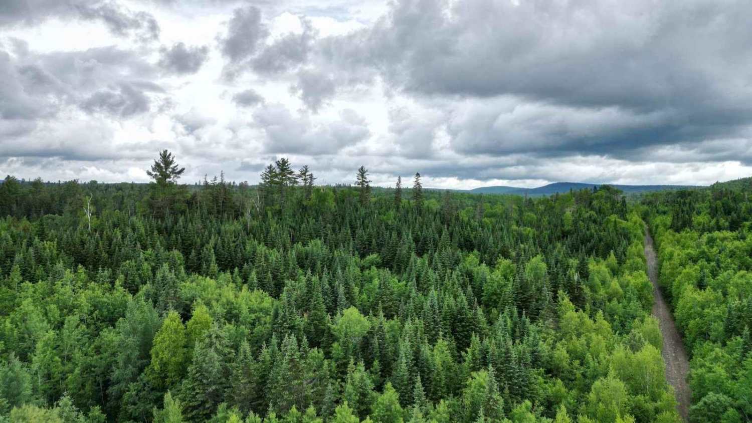
The Pabineau Falls Trail offers a pleasant route along the Nepisiguit River, from Middle Landing (Route 316) to the scenic Pabineau Falls in New Brunswick. Located within the Pabineau First Nation, the falls are a notable feature on the Nepisiguit River. For the 5km from Middle Landing, the trail is a dirt path with potential mud puddles and ruts (generally less than 12 inches deep). It's typically wide enough for one vehicle with limited passing areas, and more suitable for vehicles with higher clearance. Please note that this section is not regularly maintained, and there is one washout area to be mindful of. Pin stripes may also occur on this section. Beyond the 5km mark, the trail widens to accommodate two vehicles and becomes a maintained dirt road leading to Pabineau Falls. The waterfalls themselves are a worthwhile destination. The Pabineau Seafood Restaurant, an XTR gas station, and the Pabineau Pow Wow store are conveniently located within a short distance of the falls.
Photos of Pabineau Falls Trail
Difficulty
This trail has mud and ruts less than 12 inches deep. The trail is single vehicle wide with minimal passing opportunities in sections of the trail.
Status Reports
Pabineau Falls Trail can be accessed by the following ride types:
- High-Clearance 4x4
- SUV
- SxS (60")
- ATV (50")
- Dirt Bike
Pabineau Falls Trail Map
Popular Trails

Firewood Lane Gully
Upper Stone Ridge Winter Run

Penniac Tower Road

Old Springhill Loop
The onX Offroad Difference
onX Offroad combines trail photos, descriptions, difficulty ratings, width restrictions, seasonality, and more in a user-friendly interface. Available on all devices, with offline access and full compatibility with CarPlay and Android Auto. Discover what you’re missing today!