Tri-State Line Road
Total Miles
25.4
Technical Rating
Best Time
Spring, Summer, Fall, Winter
Trail Type
Full-Width Road
Accessible By
Trail Overview
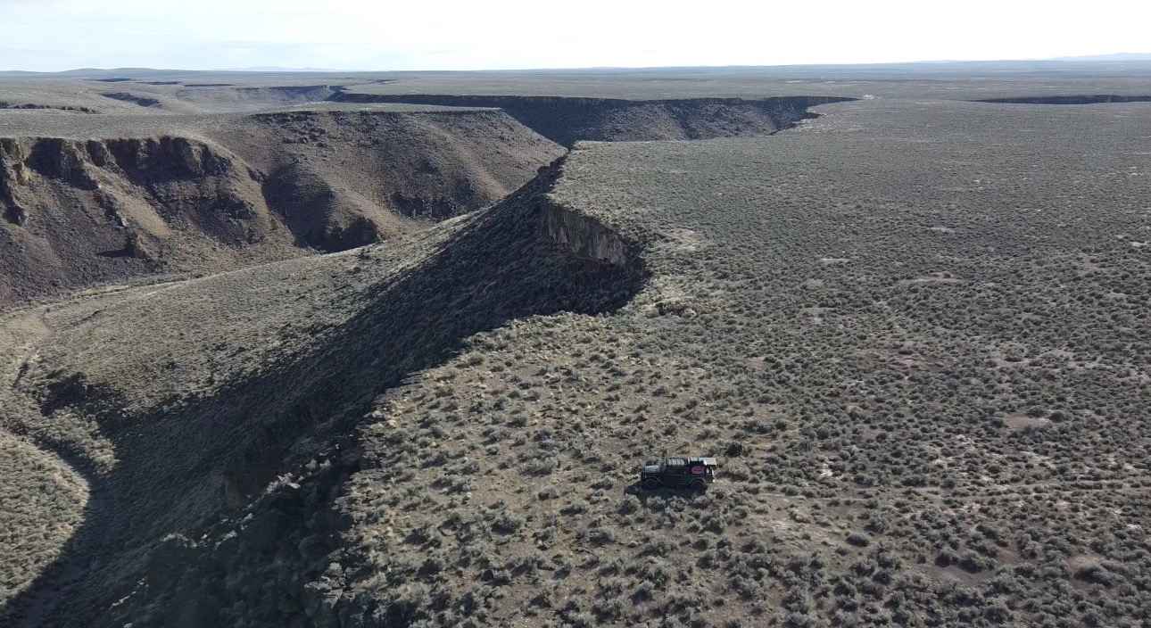
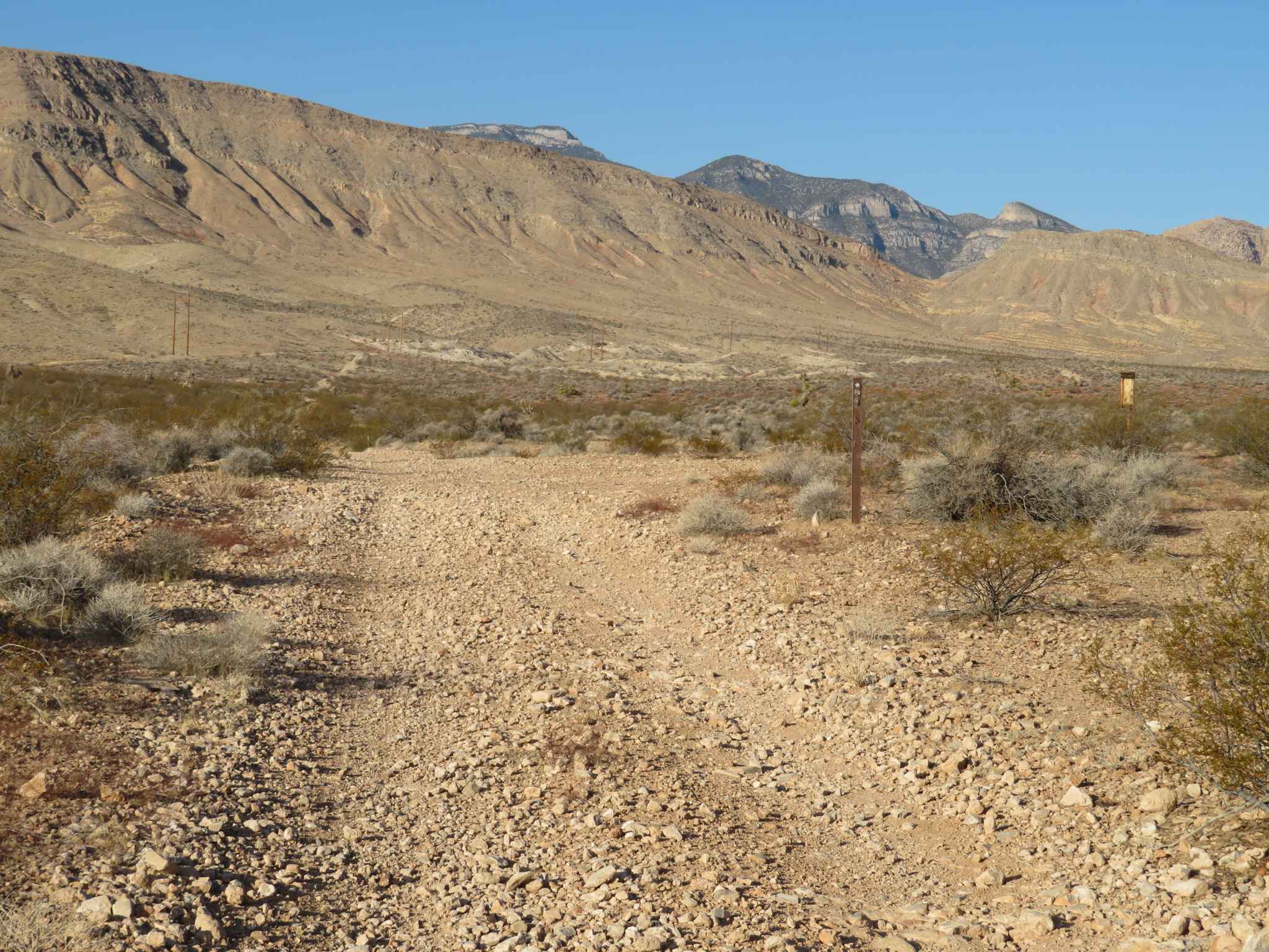
This trail runs from Long Canyon in the Humboldt National Forest to the monument at the tri-state line of Oregon, Idaho, and Nevada, then continues to an overlook of the Owyhee River canyon. The trail starts as an easy dirt/gravel road with a few ruts and wash areas, and gets rocky and bumpy near the monument. From the monument to the canyon, the trail is extremely overgrown with sagebrush, and is a bumpy, rock garden the entire 2 to 3 miles to the overlook. As you approach, use caution, or you will drive right off the cliff, as it gives no warning that you are approaching it. There is room at the end to camp overlooking the canyon. There are no amenities, no cellphone service, and you are extremely remote here. The closest services are approximately 3 hours and over 100 miles away. Any vehicle should be able to navigate this trail; terrain tires and airing down are highly recommended.
Photos of Tri-State Line Road
Difficulty
This is a rough and rocky road that should be manageable by any vehicle type. Airing down your tires will make this a much more pleasant ride.
History
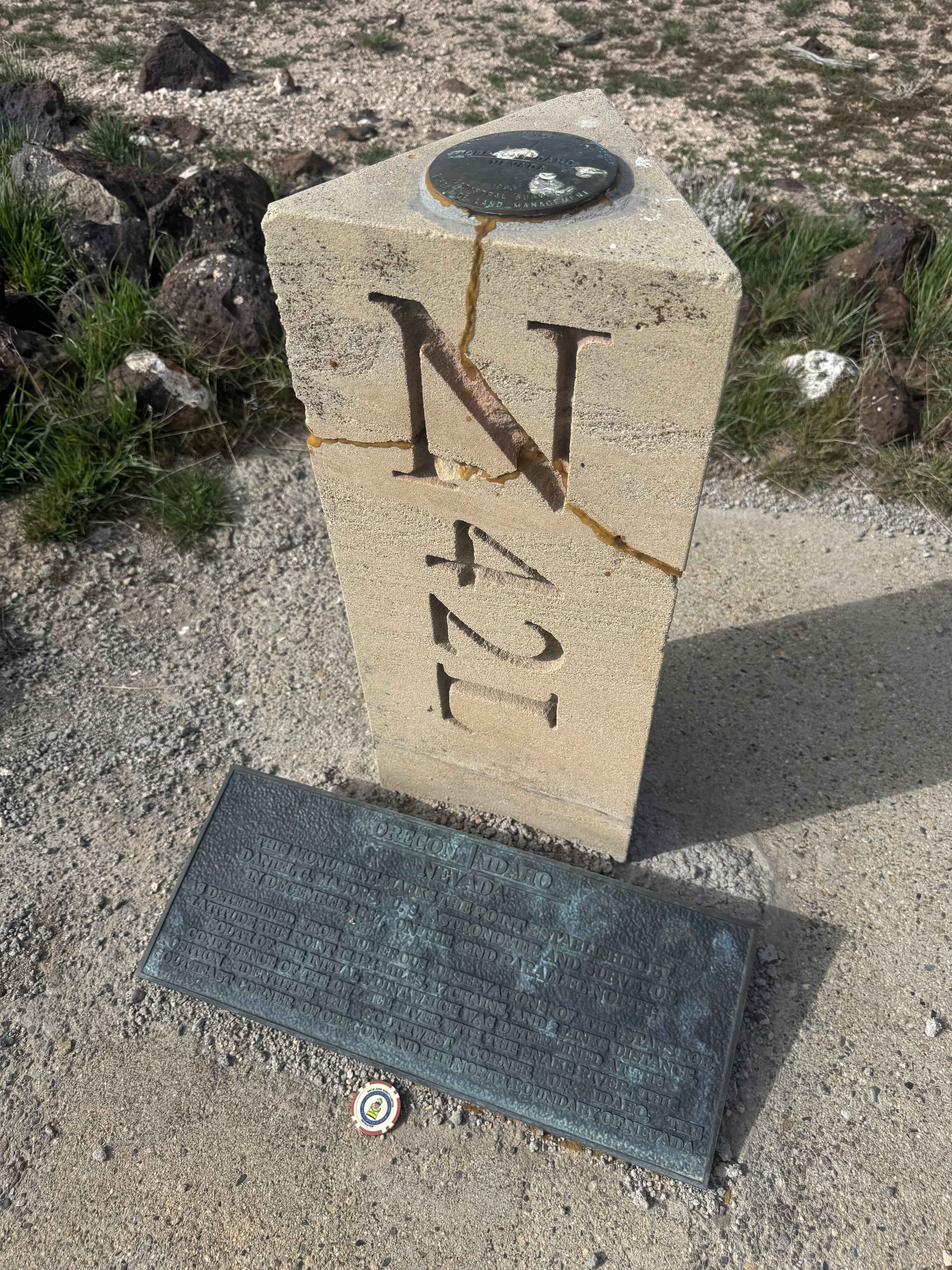
There is a geological marker and monument placed on the state line of Idaho, Oregon, and Nevada. This point was established by Daniel Majors (US Astronomer) in December 1867 on the 42nd parallel north. This point is 124 miles, 17 chains, and 2 links distance south from the initial point of the confluence of the Owyhee and Snake Rivers. It marks the southwest point of Oregon, the southeast point of Idaho, and the north boundary of Nevada.
Status Reports
Tri-State Line Road can be accessed by the following ride types:
- High-Clearance 4x4
- SUV
- SxS (60")
- ATV (50")
- Dirt Bike
Tri-State Line Road Map
Popular Trails

Clifton Flat Trail

Hacketts Ranch Road

CC East Primitive Road North - 36
Blue Diamond Cut-off
The onX Offroad Difference
onX Offroad combines trail photos, descriptions, difficulty ratings, width restrictions, seasonality, and more in a user-friendly interface. Available on all devices, with offline access and full compatibility with CarPlay and Android Auto. Discover what you’re missing today!